
| Area | North Fork |
| Topic | Temperature: FWA, NF and SF Rose Creek (Site 85-20, 85-21) 2001 |
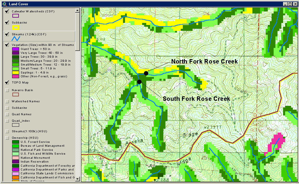
The above image is a screen capture from the KRIS Navarro Map Project, which shows 90 meter riparian zones derived from 1994 Landsat imagery from the USFS Spatial Analysis Lab in Sacramento, CA. It compares the riparian conditions in the South Fork Rose Creek and the North Fork Rose Creek. The South Fork has larger trees in its riparian zone, and its floating weekly average water temperatures are approximately one degree cooler than those in the North Fork. The difference in temperature could also be due to topographic shading caused by differences in the orientation of the drainages, or monitoring device error.
 Click on image to enlarge (148K).
To learn more about this topic click Info Links
To view additional information (data source, aquisition date etc.) about this page, click Metadata
| www.krisweb.com |