
|
Area/Topic | Bibliography | Background | Hypotheses | Home |
|
Map Page.
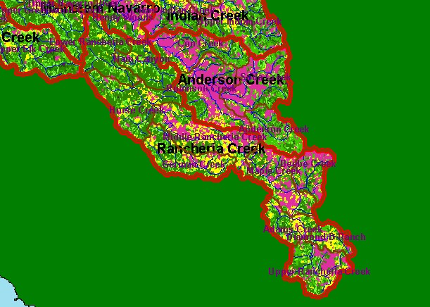
You selected the area Rancheria Creek and the topic Land Cover: USFS Veg Size for Middle Rancheria Creek 1994 |
| This is a map of 1994 USFS Landsat vegetation in the Rancheria Creek sub-basin, displayed with KRIS sub-basins, Calwater Planning Watersheds, and 1:100,000 scale streams. The vegetation classification is accurate at a one-hectare scale (approximately 11 pixels) and is suitable for stand classification. Data provided by the U.S. Forest Service Spatial Analysis Lab in Sacramento, CA. | |||
|
|
||
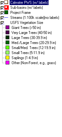
To view metadata about a map layer, click on a link in the table below.
| Name of Layer in Map Legend | Metadata File Name |
|---|---|
| Calwater PWS (w/ labels) | calw22.shp.txt |
| Sub-basins (w/ labels) | subbasins.shp.txt |
| Project Frame | Unavailable |
| Streams (1:100k scale)(no labels) | streams100.shp.txt |
| USFS Riparian Veg Size | vegsizebuf.tif.txt |
| USFS Vegetation Size | vegsize.tif.txt |
| Topo Map (1:24k scale) | Unavailable |
| Graycale Hillshade (TIFF) | grayscale_xnv_light.tif.txt |
| www.krisweb.com |