| Area |
Rancheria Creek |
| Topic |
Tour: Upper Rancheria Creek and Tributary Shearing Creek 2001 |
 Click on image to enlarge (45K). Click here to display a larger version (701K).
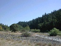
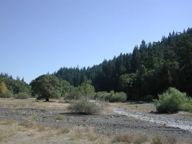
View of Rancheria Creek at the mouth of Shearing Creek which comes in from the left. Notice the aggraded, exposed streambed and lack of riparian vegetation. Photo by Pat Higgins, 9/21/01.
 Click on image to enlarge (69K). Click here to display a larger version (712K).
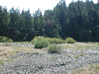
Looking down the channel of Shearing Creek from Highway 128 at its convergence with Rancheria Creek. Photo by Pat Higgins, 9/21/01.
 Click on image to enlarge (91K). Click here to display a larger version (747K).
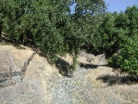
View of Shearing Creek looking upstream. Notice highly aggraded stream bed, cut banks and agricultural fencing near active channel. The stream bed contains angular material mixed with fine sediment. To see a photo of the same location taken during the high winter flows, see "Tour: Shearing Creek High Winter Flows 2002." Photo by Pat Higgins, 9/21/01.
 Click on image to enlarge (101K).
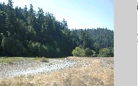
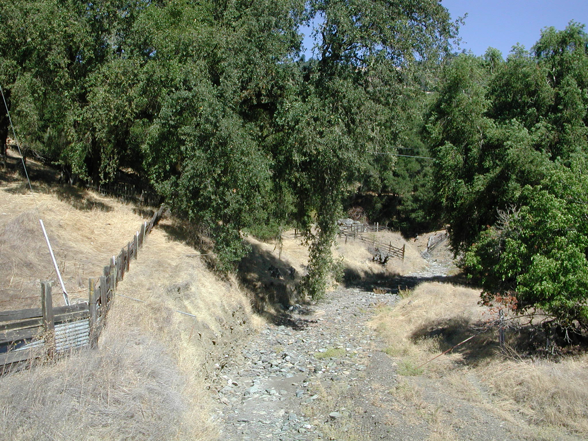
View looking downstream on Rancheria Creek just below Shearing Creek. Notice riprap on right side of bank and agricultural activity adjacent to channel. Channel bed is highly aggraded and unconfined, lacking riparian vegetation. To see a photo of the same location taken during the high winter flows, see photo numbers 3 and 4 in the topic "Tour: Shearing Creek High Winter Flows 2002." Photo by Pat Higgins, 9/21/01.
To learn more about this topic click Info Links
To view additional information (data source, aquisition date etc.) about this page, click Metadata

 Click on image to enlarge (45K). Click here to display a larger version (701K).
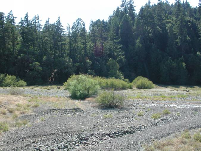 Click on image to enlarge (69K). Click here to display a larger version (712K).
 Click on image to enlarge (91K). Click here to display a larger version (747K).
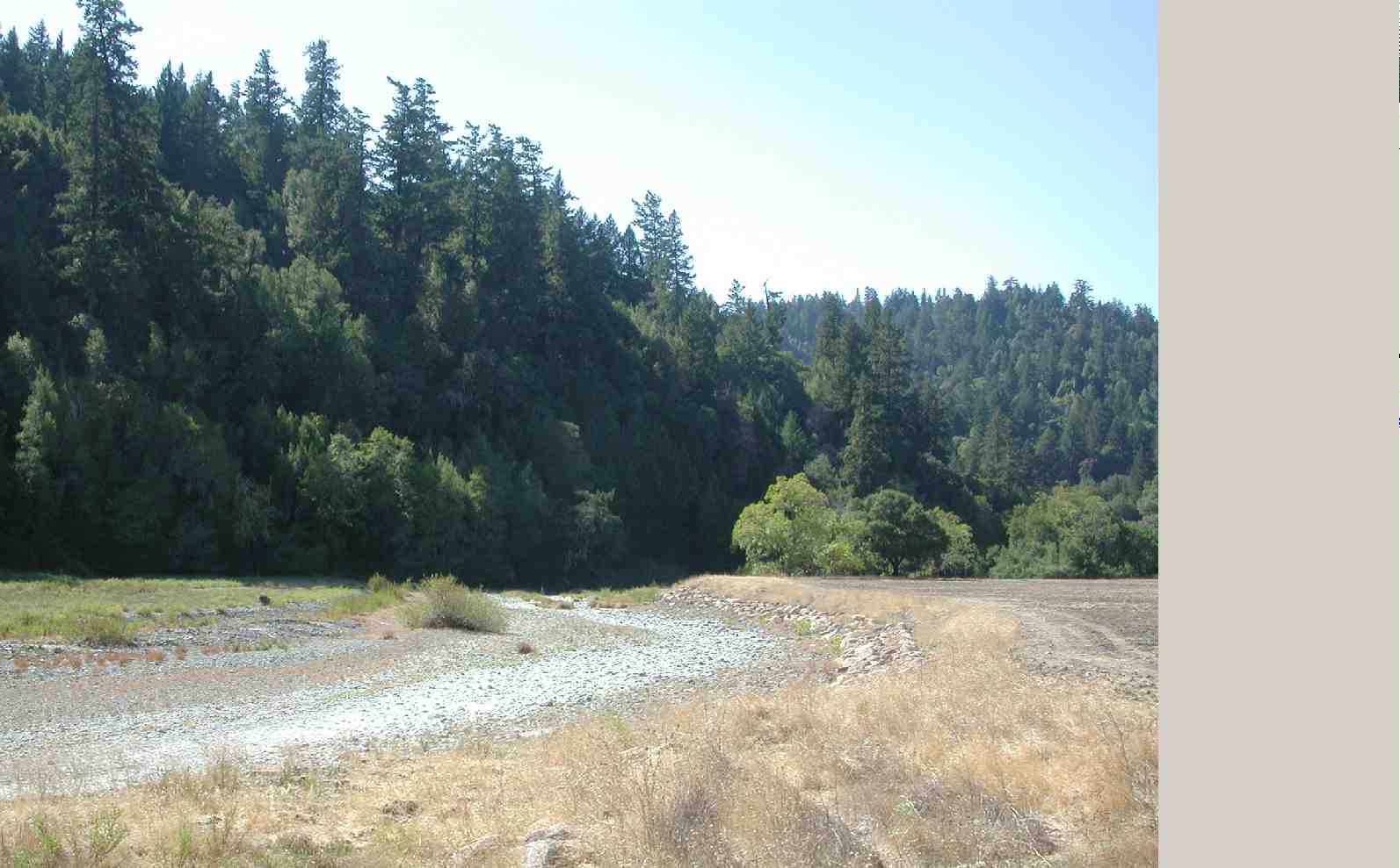 Click on image to enlarge (101K).