| Area |
Rancheria Creek |
| Topic |
Tour: Shearing Creek High Winter Flows 2002 |
 Click on image to enlarge (43K). Click here to display a larger version (312K).
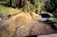
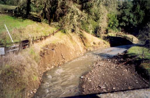
This photo shows Shearing Creek upstream of the Highway 128 bridge, during high winter flows at 3 P.M. on December 31, 2002, when the Navarro River was flowing at approximately 9,000 cubic feet per second. This photograph looks upstream, and shows a vertical bare eroding bank. To see a photo of the same location taken during the dry season, see photo number 3 in the topic "Tour: Upper Rancheria Creek and Tributaries Channel Photos 2001 Part 4." Photo was taken by Eli Asarian.
 Click on image to enlarge (34K). Click here to display a larger version (269K).
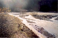
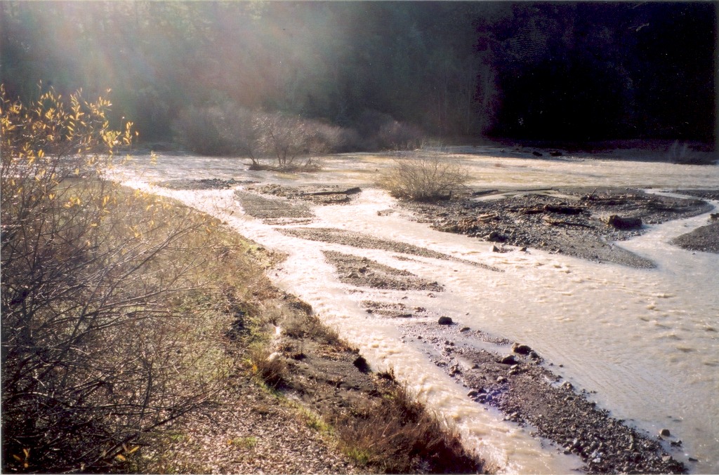
This photo shows Shearing Creek from of the Highway 128 bridge, during high winter flows at 3 P.M. on December 31, 2002, when the Navarro River was flowing at approximately 9,000 cubic feet per second. This photograph looks downstream (just to the left of the next photograph), and the confluence with Rancheria Creek is visible at the center of the photograph. The channel is unconfined, wide and braided. Photo was taken by Eli Asarian.
 Click on image to enlarge (29K). Click here to display a larger version (224K).
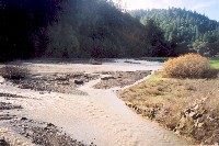
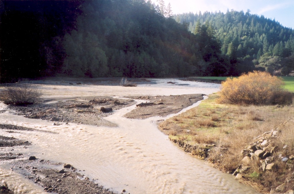
This photo shows Shearing Creek from of the Highway 128 bridge, during high winter flows at 3 P.M. on December 31, 2002, when the Navarro River was flowing at approximately 9,000 cubic feet per second. This photograph looks downstream (between the previous and next photographs), and the confluence with Rancheria Creek is visible at the center of the photograph. The channel is unconfined, wide and braided. To see a photo of the same location taken during the dry season, see photo number 8 in the topic "Tour: Upper Rancheria Creek and Tributaries Channel Photos 2001 Part 3." Photo was taken by Eli Asarian.
 Click on image to enlarge (23K). Click here to display a larger version (186K).
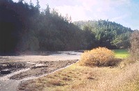
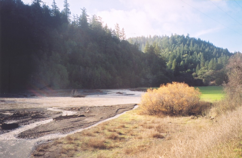
This photo shows Shearing Creek from of the Highway 128 bridge, during high winter flows at 3 P.M. on December 31, 2002, when the Navarro River was flowing at approximately 9,000 cubic feet per second. This photograph looks downstream (just to the right of the previous photograph), and the confluence with Rancheria Creek is visible at the center of the photograph. The channel is unconfined, wide and braided. To see a photo of the same location taken during the dry season, see photo number 8 in the topic "Tour: Upper Rancheria Creek and Tributaries Channel Photos 2001 Part 3." Photo was taken by Eli Asarian.
To learn more about this topic click Info Links
To view additional information (data source, aquisition date etc.) about this page, click Metadata

 Click on image to enlarge (43K). Click here to display a larger version (312K).
 Click on image to enlarge (34K). Click here to display a larger version (269K).
 Click on image to enlarge (29K). Click here to display a larger version (224K).
 Click on image to enlarge (23K). Click here to display a larger version (186K).