
|
Area/Topic | Bibliography | Background | Hypotheses | Home |
|
Map Page.
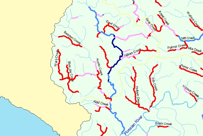
You selected the area Austin Creek and the topic Habitat: Maximum Pool Depths in Austin Cr and Small Tribs 1995-2001 |
| The map shows the stream reaches surveyed during the California Department of Fish and Game habitat typing surveys in Austin Creek and its Austin Creek and its tributaries tributaries. Reaches are color-coded by the percent (by number) of pools with a maximum depth greater than 3 feet. | |||
|
|
||
| www.krisweb.com |