
| Area | Austin Creek |
| Topic | Tour: Austin Creek State Parks Road Erosion Control #1 (PWA) |
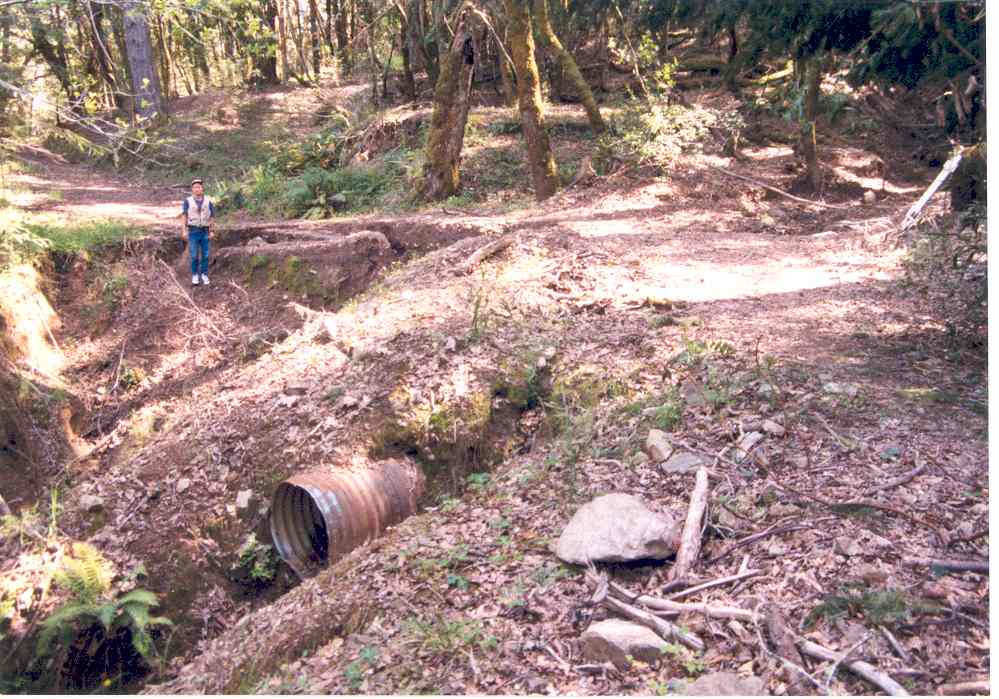
This photo shows typical erosion problems related to roads in the Austin Creek State Recreation Area, which prompted State Parks and Pacific Watershed Associates to seek grant funding to protect aquatic habitat downstream in East Austin Creek. The surveyor is standing where road fill has been eroded as a result of past diversion of a stream out of view at right. The water was likely diverted from the culvert pictured at the bottom of the photo. It is also possible that sheet flow and gully erosion related to the road prism at left may have contributed to the problem. This is Figure 1A from Pacific Watershed Associates (2002) East Austin Creek Watershed Erosion Control and Prevention Project Final Report. Photo taken in 1998.
This photo shows a small tributary of East Austin Creek which has been diverted onto the road and is causing gully erosion. This is Figure 1B from Pacific Watershed Associates (2002) East Austin Creek Watershed Erosion Control and Prevention Project Final Report. Photo taken in 1998.
This large gully has been formed because of long road segments are being drained with too few culverts. The erosive force of the water during large storms creates a "shotgun" effect and large gullies can form in a short period of time. This is Figure 2A from Pacific Watershed Associates (2002) East Austin Creek Watershed Erosion Control and Prevention Project Final Report. Photo taken in 1998.
This photo shows road drainage problems in the Austin Creek State Recreation Area and east Austin Creek watershed. The culvert for ditch relief is what is known as a "hanging culvert", which often creates high erosion potential on slopes down hill. This culvert is actually getting little drainage, however, because a gully on the road just upslope has diverted the flow from the road into a gully on the side hill. This problem can be as a result of insufficient water bars. This is Figure 2B from Pacific Watershed Associates (2002) East Austin Creek Watershed Erosion Control and Prevention Project Final Report. Photo taken in 1998.
This is a before photo of an ephemeral tributary of East Austin Creek where a stream crossing has restricted channel width and poses the risk of failure in a major storm event. The photo is taken looking downstream and the sediment in the foreground has actually built up over the original channel grade because the road prism was acting as impediment to sediment transport. This is Figure 3A from Pacific Watershed Associates (2002) East Austin Creek Watershed Erosion Control and Prevention Project Final Report. Photo taken in 1998.
This is photo taken during a road crossing removal on a tributary of East Austin Creek in the the Austin Creek State Recreation Area (see previous Picture for before shot if this location). The excavator is removing sediment stored behind a stream crossing that has been removed, attempting to restore the stream to its former grade and prevent the sediment from cycling downstream and harming aquatic resources. This is Figure 3B from Pacific Watershed Associates (2002) East Austin Creek Watershed Erosion Control and Prevention Project Final Report. Photo taken in 2001.
This photo shows one of 31 stream crossings replaced in the Austin Creek State Recreation Area as part of project co-sponsored by California State Parks and Pacific Watershed Associates. Preventing crossing failures in major storms helps protect streams from catastrophic storm damage. This is Figure 4A from Pacific Watershed Associates (2002) East Austin Creek Watershed Erosion Control and Prevention Project Final Report. Photo taken in 2001.
This photo shows a typical culvert installation during the Pacific Watershed Associates/State Parks cooperative erosion control project in the Austin Creek State Recreation Area. The culverts were installed at the base of the fill and in line with the natural grade of the stream channel. "Each culvert had sufficient length to construct stable fill slopes and were fitted with critical dips to prevent future stream diversions" (PWA, 2002). This is Figure 4B from Pacific Watershed Associates (2002) East Austin Creek Watershed Erosion Control and Prevention Project Final Report. Photo taken in 2001.
 Click on image to enlarge (102K).
 Click on image to enlarge (95K).
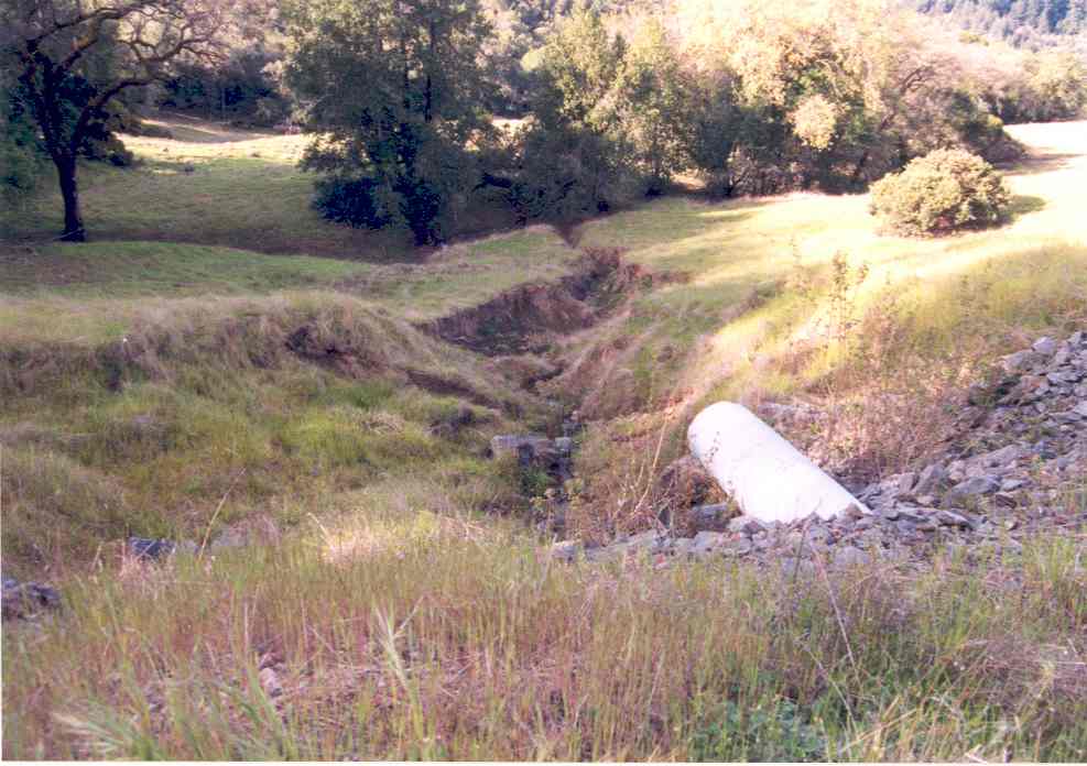 Click on image to enlarge (73K).
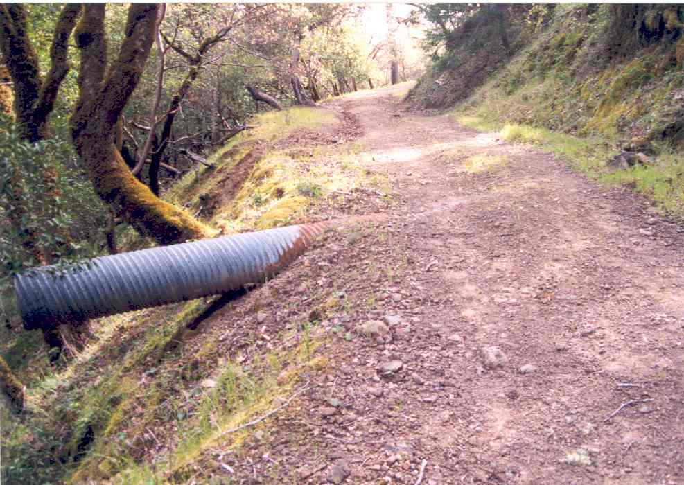 Click on image to enlarge (93K).
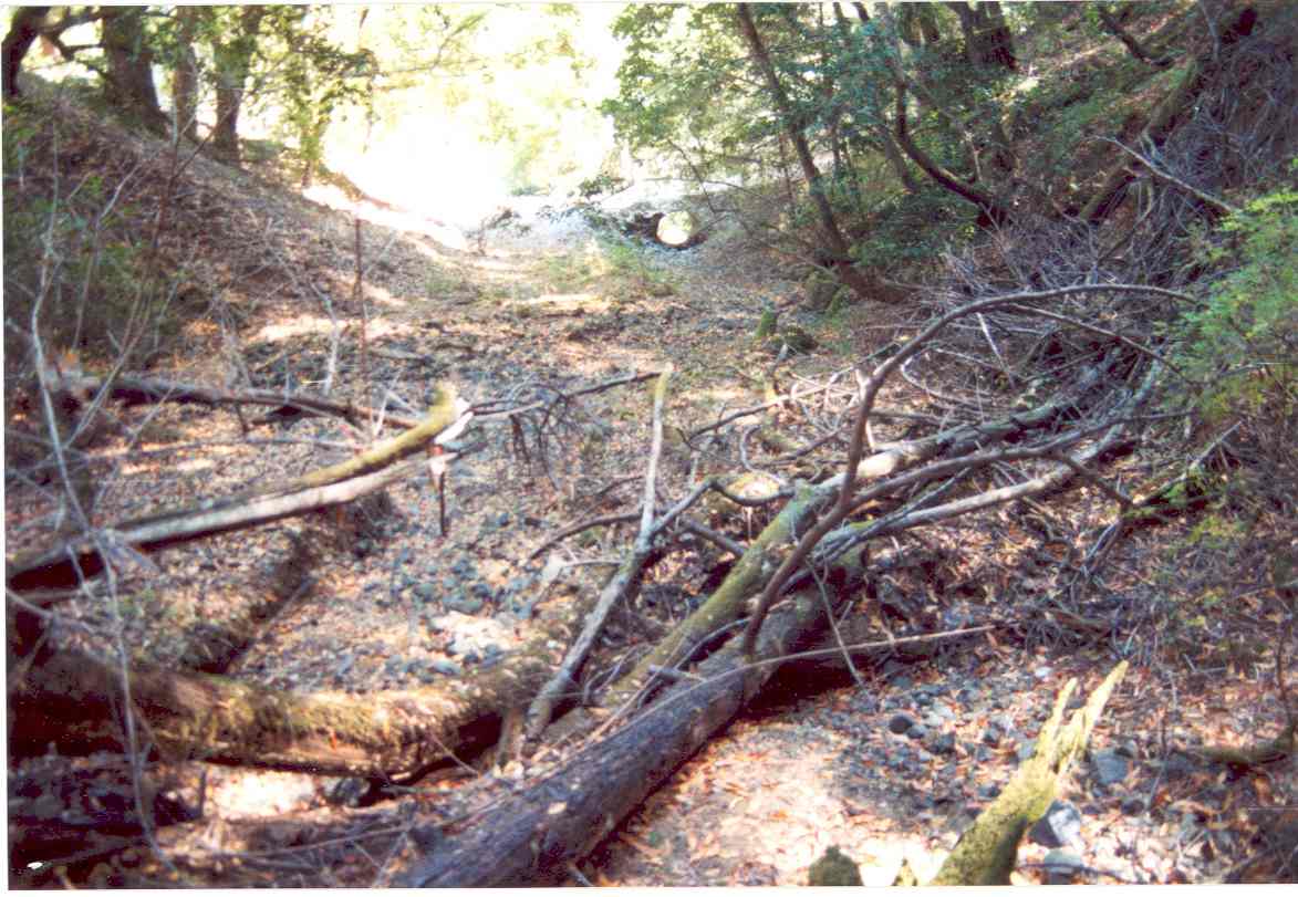 Click on image to enlarge (112K).
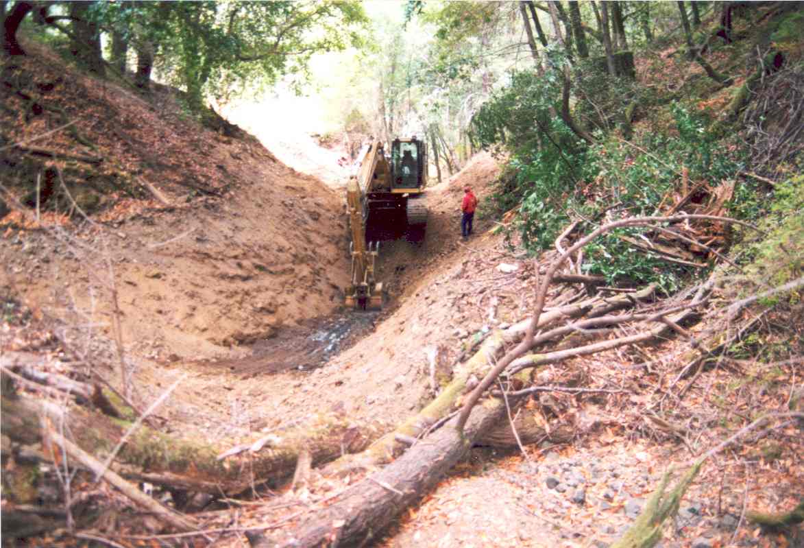 Click on image to enlarge (108K).
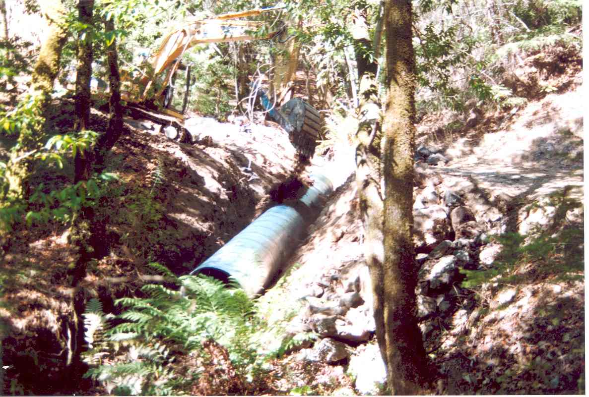 Click on image to enlarge (125K).
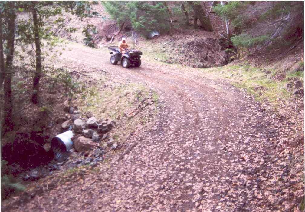 Click on image to enlarge (87K).
To learn more about this topic click Info Links
To view additional information (data source, aquisition date etc.) about this page, click Metadata
| www.krisweb.com |