
| Area | Austin Creek |
| Topic | Tour: Austin Creek State Parks Road Erosion Control #2 (PWA) |
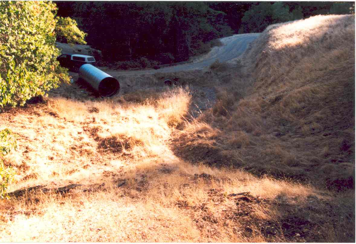
This is a photo of a stream crossing with high potential for failure before an appropriately sized culvert was installed. Note the difference in size of the new pipe versus the old one, which is about to be replaced (see next photo). The larger culvert is sized to accommodate a 100 year storm event. This is Figure 5A from Pacific Watershed Associates (2002) East Austin Creek Watershed Erosion Control and Prevention Project Final Report. Photo taken in 2001.
This photo shows the same location as Picture #1 immediately after culvert installation in Fall 2001. Note that the inlet to the culvert is flared to lower the likelihood of the culvert plugging during a large storm and also the "use of the low berm at outside edge of the road to protect the newly constructed fill slope and the excavation of the channel stored sediment above the culvert inlet" (PWA, 2002). This is Figure 5B from Pacific Watershed Associates (2002) East Austin Creek Watershed Erosion Control and Prevention Project Final Report. Photo taken in 2002.
This is Figure 6 from Pacific Watershed Associates (2002) East Austin Creek Watershed Erosion Control and Prevention Project Final Report and it shows the same location as Pictures #1 & #2. The channel of this small tributary has downcut to bedrock "with minor channel adjustments in cross sectional area and the site has stable side slopes" (PWA, 2002). Photo taken in 2002.
This is one of 23 armored fill crossings in the Austin Creek State Recreation Area fixed under a joint project carried out by California State Parks and Pacific Watershed Associates. "Armored fill crossings are appropriate along low roads, and where properly sized culverts are difficult to install or where the inlet would still have a high potential of plugging" (PWA, 2002). This is Figure 7 from Pacific Watershed Associates (2002) East Austin Creek Watershed Erosion Control and Prevention Project Final Report. Photo taken in 2001.
This photo shows Site #44 of the Austin Creek State Recreation Area erosion control project before the old culvert was extracted and replaced with an armored fill crossing. This project was a joint effort of PWA and State Parks. This is Figure 8A from Pacific Watershed Associates (2002) East Austin Creek Watershed Erosion Control and Prevention Project Final Report (see Picture #6 & #7 for after). Photo taken in 1998.
This dump truck places large rock for armoring the road fill where an undersized, old culvert has been removed (see Picture #1). "During installation the road is lowered several feet vertically with a broad rolling dip, a keyway is dug from the base of the fill to the mid-point of the road bed, filter fabric is placed over the keyway, and mix of rock armor is applied which is coarser then the stream is capable of carrying at high flows" (PWA, 2002). See Picture #7 for after the project shot. This is Figure 8B from Pacific Watershed Associates (2002) East Austin Creek Watershed Erosion Control and Prevention Project Final Report. Photo taken in 2001.
This armored fill crossing on Austin Creek State Recreation Area poses no risk of failure because very little road fill remains. "The stream must flow over the armored apron at all stream flows to function properly and prevent future sediment delivery to stream channels" (PWA, 2002). This is Figure 8C from Pacific Watershed Associates (2002) East Austin Creek Watershed Erosion Control and Prevention Project Final Report. Photo taken in 2002.
At total of 136 rolling dips were installed to promote improved road drainage in the Austin Creek State Recreation Area carried out jointly by California State Parks and Pacific Watershed Associated. The low spot in the road where the truck is has been contoured to drain at the low point. PWA (2002) described the procedure as follows: "the road bed was outsloped, berms were removed and used to fill the inboard ditch, and broad, very drivable rolling dips were installed in order to disperse road runoff to the maximum degree possible." This is Figure 9 from Pacific Watershed Associates (2002) East Austin Creek Watershed Erosion Control and Prevention Project Final Report. Photo taken in 2001.
 Click on image to enlarge (104K).
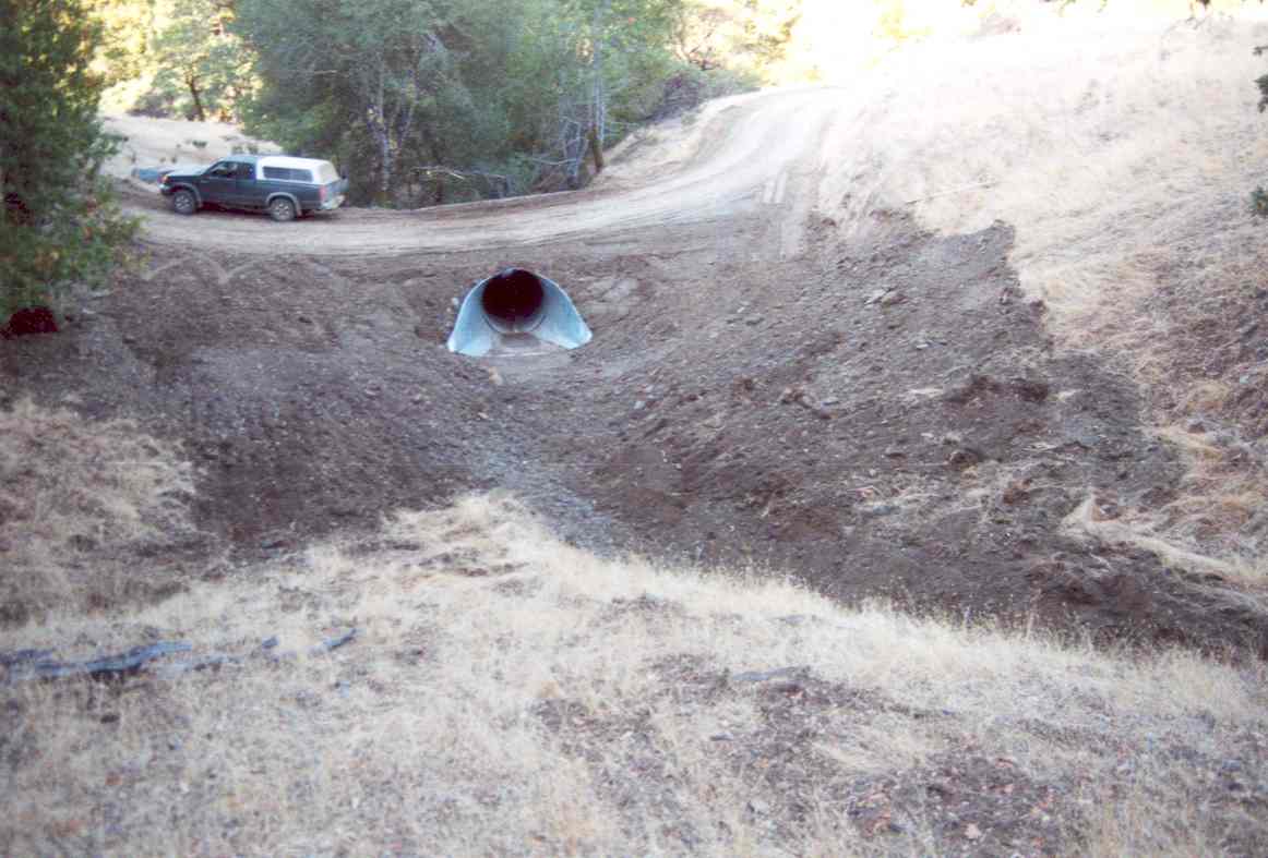 Click on image to enlarge (79K).
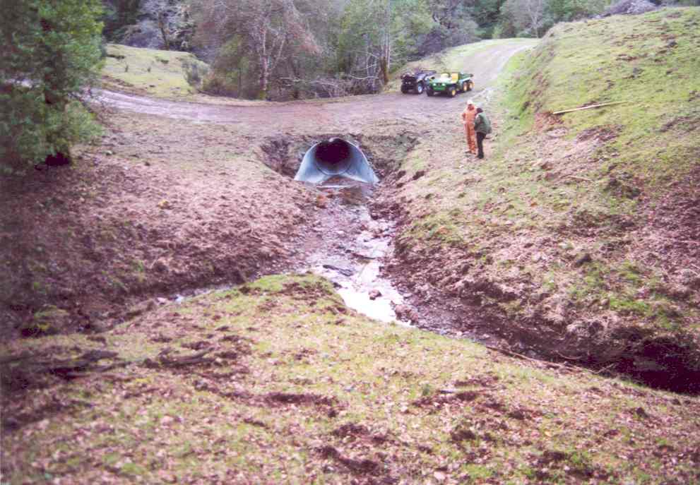 Click on image to enlarge (80K).
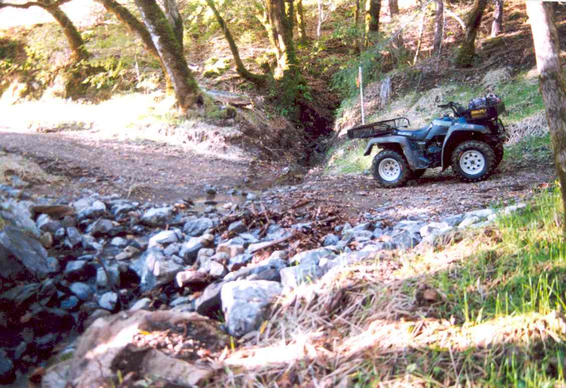 Click on image to enlarge (101K).
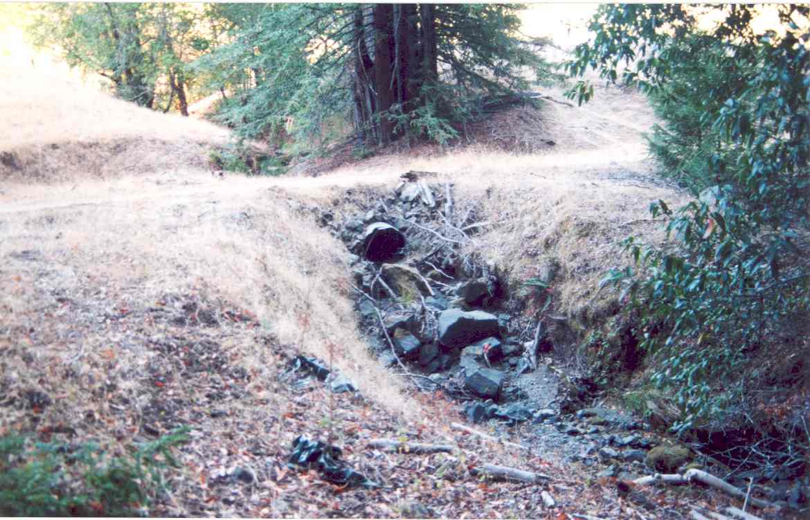 Click on image to enlarge (103K).
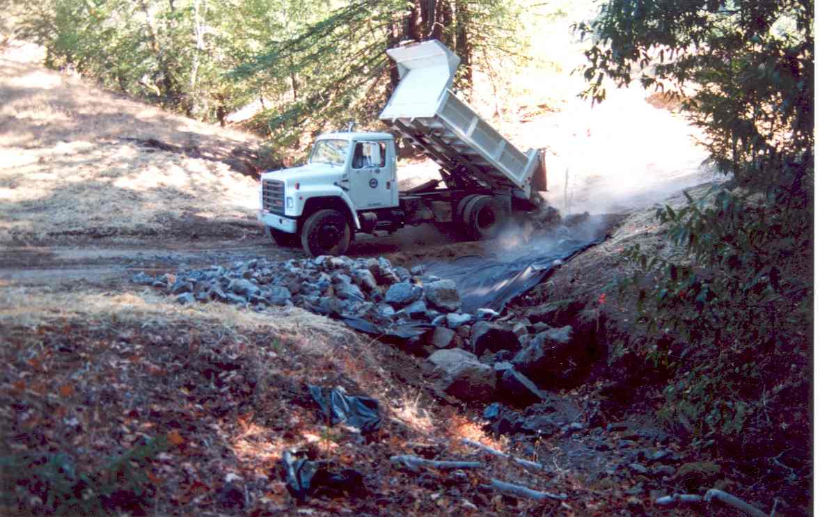 Click on image to enlarge (96K).
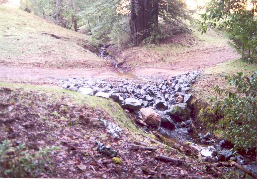 Click on image to enlarge (82K).
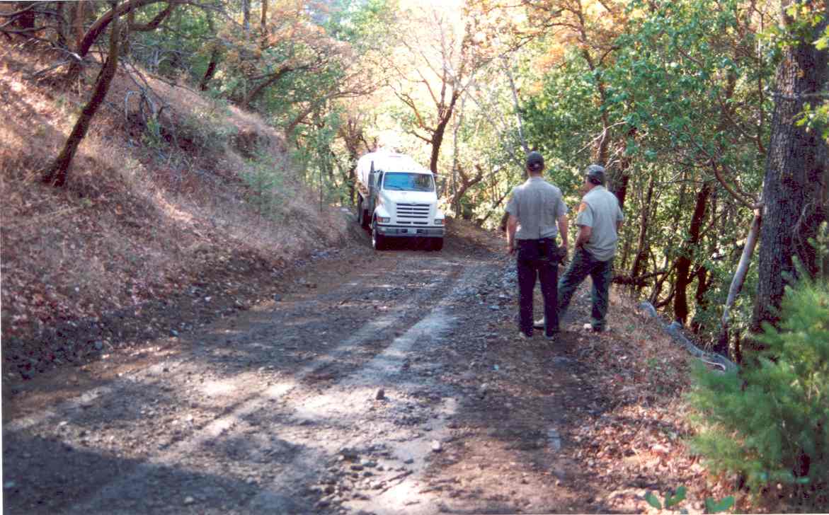 Click on image to enlarge (102K).
To learn more about this topic click Info Links
To view additional information (data source, aquisition date etc.) about this page, click Metadata
| www.krisweb.com |