
| Area | Basin-wide/Regional |
| Topic | Habitat: Alexander Valley Russian River Pool Depth & Cover 1998 |
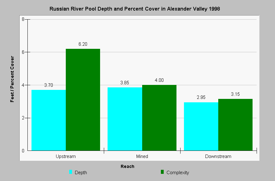
| Caption: This chart shows the average pool depth (feet) and pool complexity (percent area) for three reaches of the mainstem Russian River in the Alexander Valley above, within, and below two areas subject to gravel skimming operations. Both pool depth and complexity measured less downstream of gravel skimming. Data published by the Sonoma County Water Agency. | |
 |
To learn more about this topic click Info Links .
To view additional information (data source, aquisition date etc.) about this page, click Metadata .
To view the table with the chart's data, click Chart Table web page.
To download the table with the chart's data, click rrarm_pools98_sum.db (size 4,096 bytes) .
To view the table with the chart's source data, click Source Table web page.
To download the table with the chart's source data, click rrarm_hab98.xls.db (size 4,096 bytes)
| www.krisweb.com |