
| Area | Basin-wide/Regional |
| Topic | Stream Channel: Cross-Section - Russian River rm23.5 |
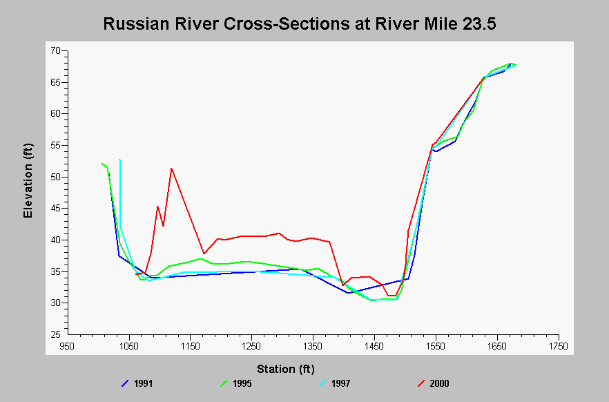
| Caption: This chart shows cross-section surveys on the Russian River at river mile 23.5, located in the Middle Reach on the MacMurray Property. The thalweg scoured between 1991 and 1995, and deposition occurred on the point bar between 1997 and 2000. Data come from the Sonoma County Water Agency and were collected as part of the Russian River Aggregate Resource Management monitoring. See InfoLinks for more information. | |
 |
To learn more about this topic click Info Links .
To view additional information (data source, aquisition date etc.) about this page, click Metadata .
To view the table with the chart's data, click Chart Table web page.
To download the table with the chart's data, click xs_rm235_rr_arm_1991_2000.dbf (size 6,070 bytes) .
| www.krisweb.com |