
| Area | Basin-wide/Regional |
| Topic | Stream Channel: Cross-Section - Russian River rm52.0 |
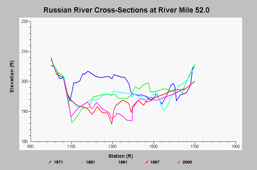
| Caption: This chart shows cross-section surveys on the Russian River at river mile 52.0, located in Alexander Valley at the Geyserville Bridge. Since 1971 there has been a large amount of degradation to the channel. The 1971 gravel bar was scoured and the thalweg has moved to this area. Data come from the Sonoma County Water Agency and were collected as part of Russian River Aggregate Resource Management monitoring. Cross-section data pre-1991 were digitized from digitized from SCWA cross-sectional blue prints by NW Hydraulics. See InfoLinks for more information. | |
 |
To learn more about this topic click Info Links .
To view additional information (data source, aquisition date etc.) about this page, click Metadata .
To view the table with the chart's data, click Chart Table web page.
To download the table with the chart's data, click xs_rm520_rr_arm_1971_2000.dbf (size 27,517 bytes) .
| www.krisweb.com |