
|
Area/Topic | Bibliography | Background | Hypotheses | Home |
|
Map Page.
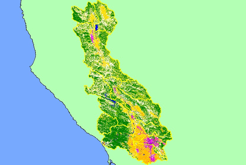
You selected the area Basin-wide/Regional and the topic Map: 1E. EPA Landcover/Landuse, Russian River Basin |
| This is a map of the EPA Landcover/Landuse in the Russian River basin, based on a 1992 Landsat TM satellite image. The southern portion of the project area is heavily urbanized (shown in hot pink). Flat areas in the northern portion are mostly agriculture (orange). Patches of coniferous forest (blue) and mixed forest (dark green) dominate the slopes above Sonoma Creek and also the southern end of the project area. | |||
|
|
||
| www.krisweb.com |