|
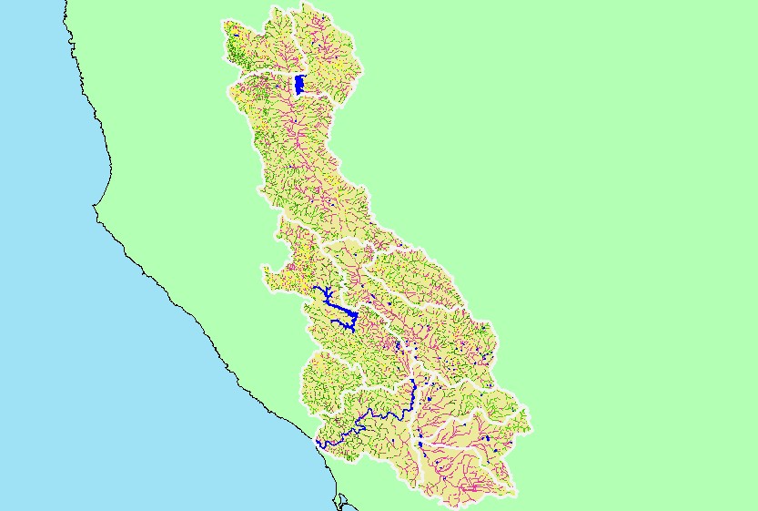
This is a map of 1999 USFS Landsat vegetation size data within 90-meter riparian buffer zones in the Russian River basin. Not surprisingly, reaches of streams flowing
through grasslands often have Non-Forest riparian zones. This may be partially due to grazing and agricultural management practices, as well as urbanization. Data
provided by the U.S. Forest Service Spatial Analysis Lab in Sacramento, CA. The vegetation classification is accurate at a one-hectare scale (approximately 11 pixels)
and is suitable for stand classification.
|
|