
| Area | Basin-wide/Regional |
| Topic | Tour: Flooding and Gravel Mining, Mainstem Russian Middle Reach |
This aerial photo by Martin Griffin shows the Russian River flooding gravel pits which are adjacent to the river. Griffins annotations on the photo show where the levee has broken and the river is flowing into the pits. Photo taken in January 1995.
This aerial photo was taken by Martin Griffin on 1/3/1997 and shows flooding of gravel ponds by the Russian River. Annotation on the photo points out that the levee at this site had failed in 1995. The long arrow at right shows the potential for waste water from the City of Healdsburg to also be enjoined in a larger flood event.
A collapsed levee separating two gravel pits. Photo by Martin Griffin, 1/3/1997
The stream running from the Benoist Pit to the Russian River, March 1993. Photo by Martin Griffin
The outlet of the Benoist Pit, March 1993. Photo by Martin Griffin
This aerial photo also shows the Middle Reach of the mainstem Russian River flooding gravel pits adjacent to the river in January 1997. Photo by Martin Griffin.
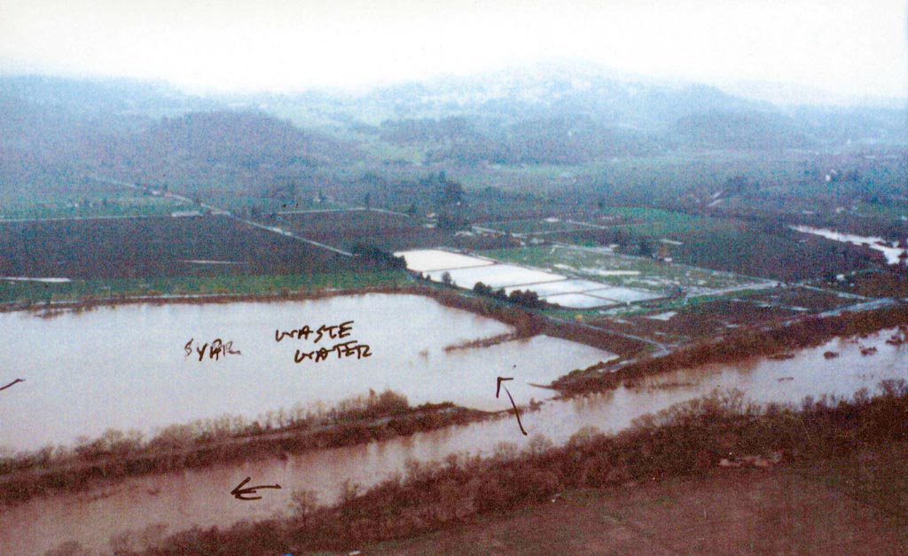
This January 3, 1997 aerial photo by Martin Griffin shows a gravel operation in the riparian zone of the Russian River inundated by flood flows. Arrows point to the path of flood waters from the river as they flow from left to right. The main channel of the Russian River is in the lower part of the photo.
The breaches shown at center and bottom connect the flow of the Russian River to the Kaiser plant and on to other pits. The area of riparian forest to the background was mined for gravel in the 60's and filled with sediment in just 30 years giving some hope that natural processes can recover other pits in the floodplain. Photo by Martin Griffin, 1/3/1997
 Click on image to enlarge (128K).
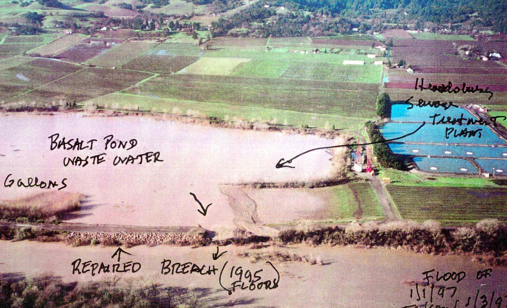 Click on image to enlarge (197K).
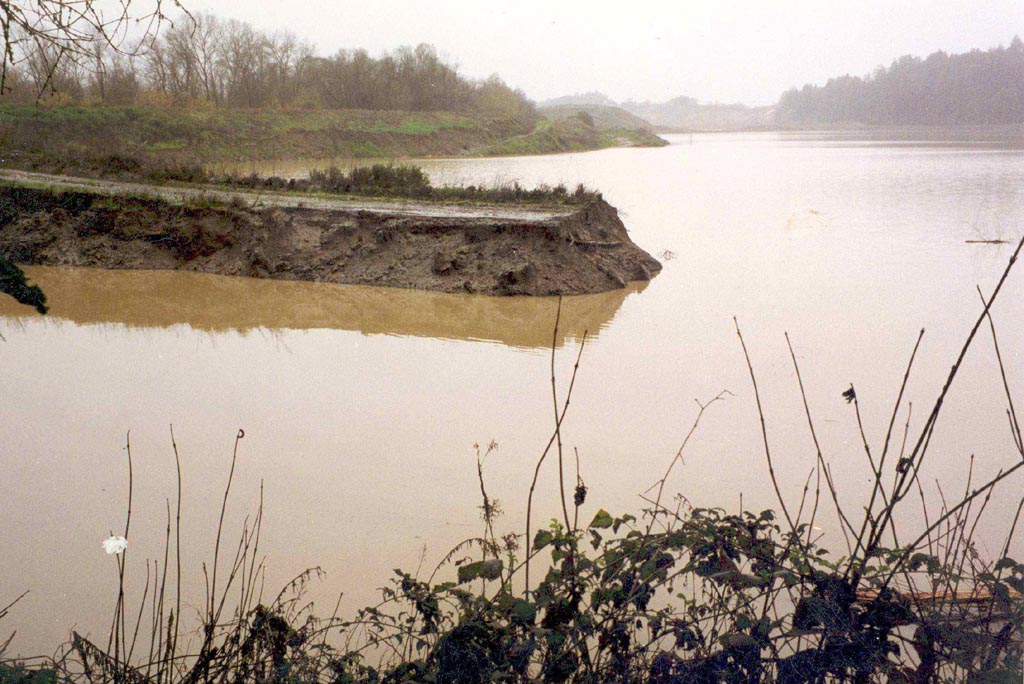 Click on image to enlarge (151K).
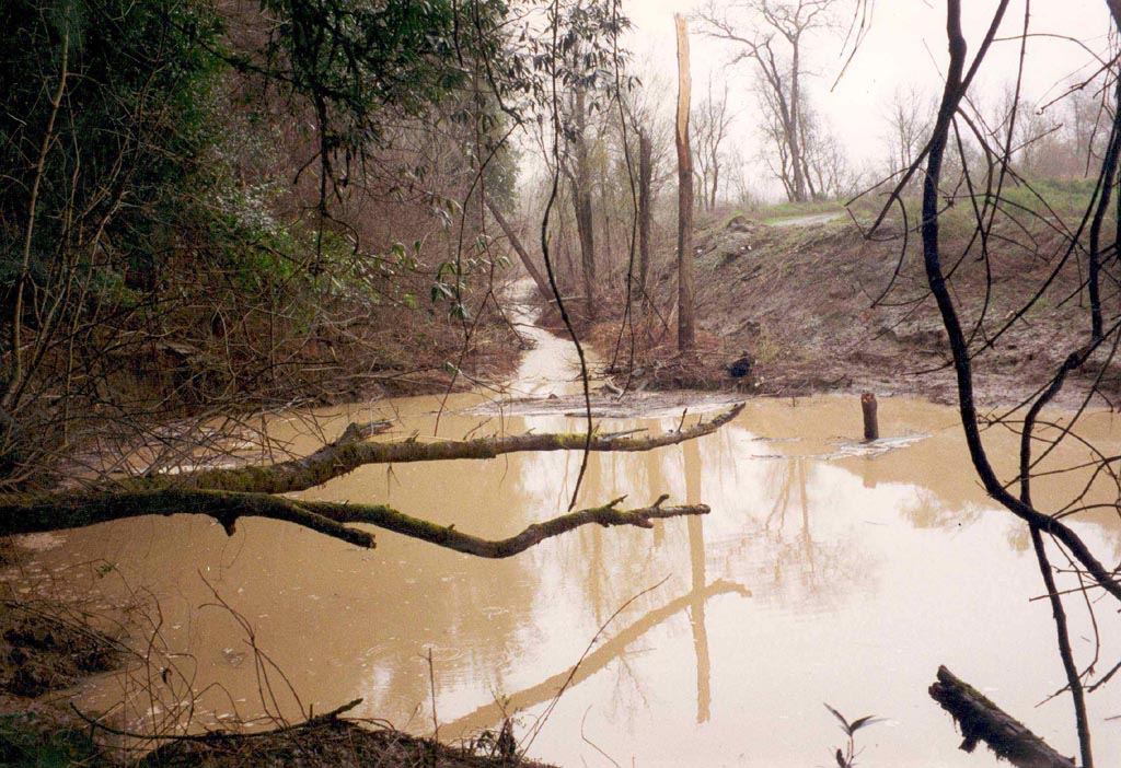 Click on image to enlarge (193K).
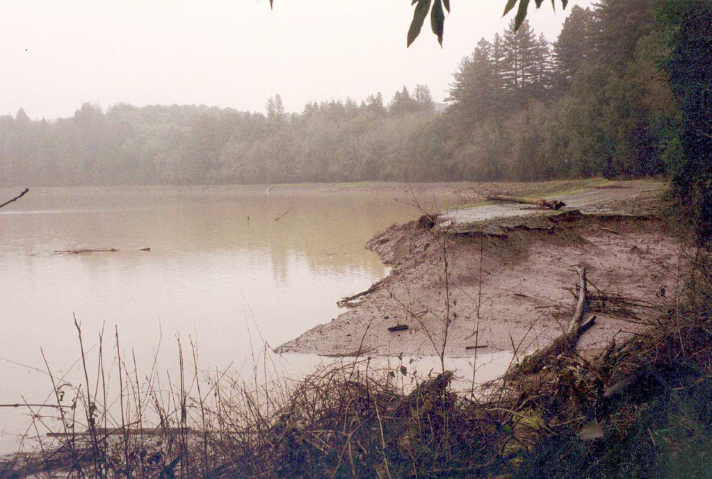 Click on image to enlarge (164K).
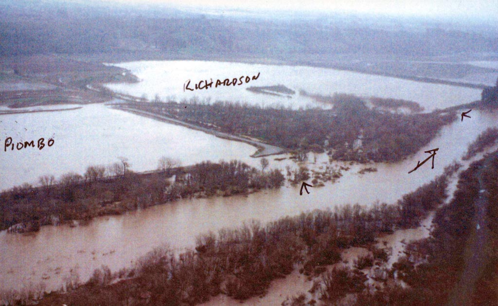 Click on image to enlarge (131K).
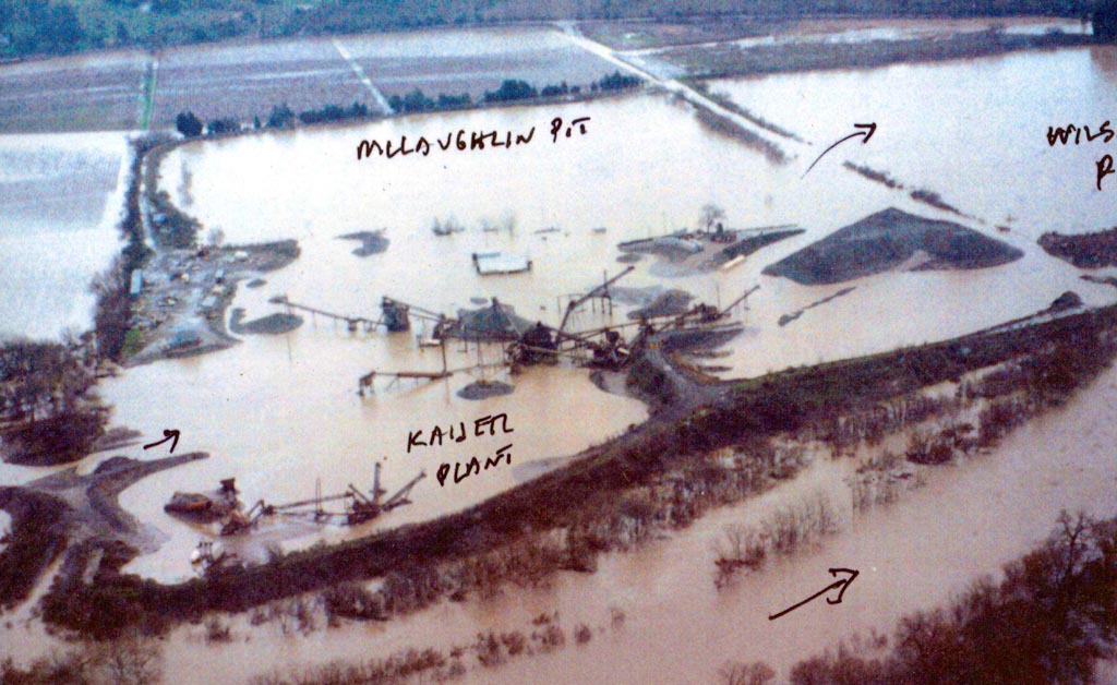 Click on image to enlarge (140K).
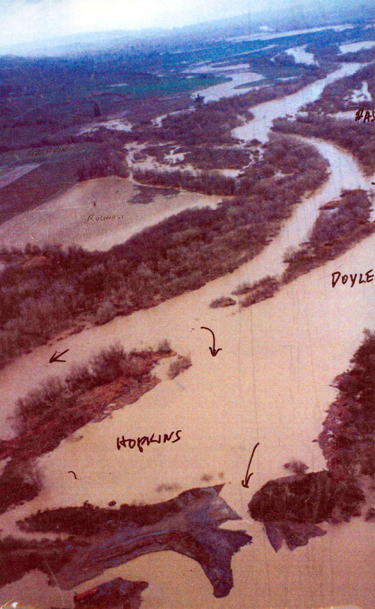 Click on image to enlarge (198K).
To learn more about this topic click Info Links
To view additional information (data source, aquisition date etc.) about this page, click Metadata
| www.krisweb.com |