
| Area | Basin-wide/Regional |
| Topic | Tour: Gravel Mining, Mainstem Russian Middle Reach |
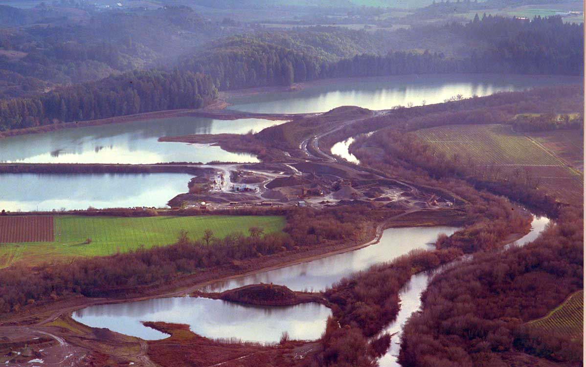
The Middle Reach of the Russian River has been subject to extensive gravel mining which leaves inundated pits separated from the river channel by narrow levees of aggregate of riparian. This photo shows the Benoist pit in the background and also the Kaiser Sand and Gravel plant. This photo by Martin Griffin is discussed in his book, Saving the Marin Sonoma Coast (Sweetwater Springs Press, Healdsburg, CA 1998).
Gravel mining in the Middle Reach commonly occurs in former vineyards. This pit has apparently reached the depth of groundwater as indicated by the lake forming where the dredge is operating. Photo by Scott Hess, September 2000.
This photo shows a temporary crossing built of 18 culverts and gravel used by Syar Inc. to move trucks and gravel across the Russian River. Photo by Martin Griffin.
This anonymous photo shows the remnants of a stream crossing at the mouth of Dry Creek. The Healdsburg wastewater plant is in the background.
The large Basalt pit stores secondary wastewater from the Healdsburg treatment plant (blue water in background). The Syar phase 5 pit is being dug in this photo. Photo by Scott Hess, September 2000.
This is the Syar phase 5 pit, dug very deep and intended to store additional secondary wastewater. Photo by Scott Hess, September 2000.
The Syar processing plant is located adjacent to downtown Healdsburg and the popular summer reservoir. The gravel bar in the background has been subject to further mining since 2000. Photo by Scott Hess, September 2000.
The Hanson Pit and gravel plant adjacent to the wells from which Windsor draws municipal water. This is approximately 1 mile downstream from the Basalt Pit. Photo by Scott Hess, September 2000.
 Click on image to enlarge (99K).
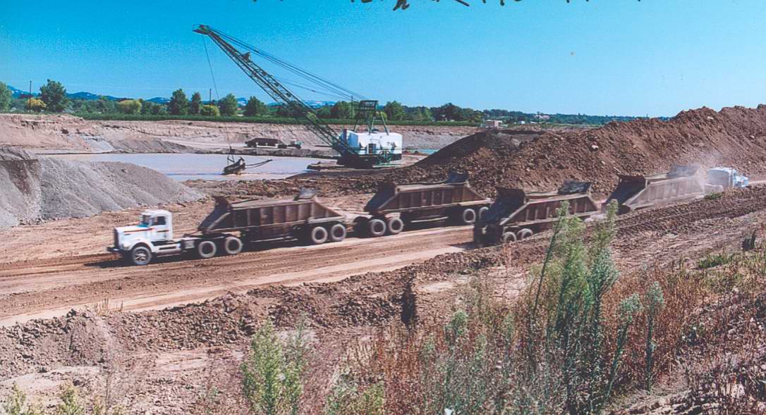 Click on image to enlarge (125K).
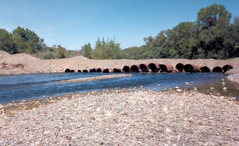 Click on image to enlarge (214K).
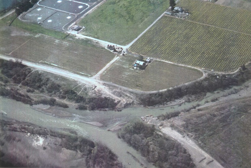 Click on image to enlarge (199K).
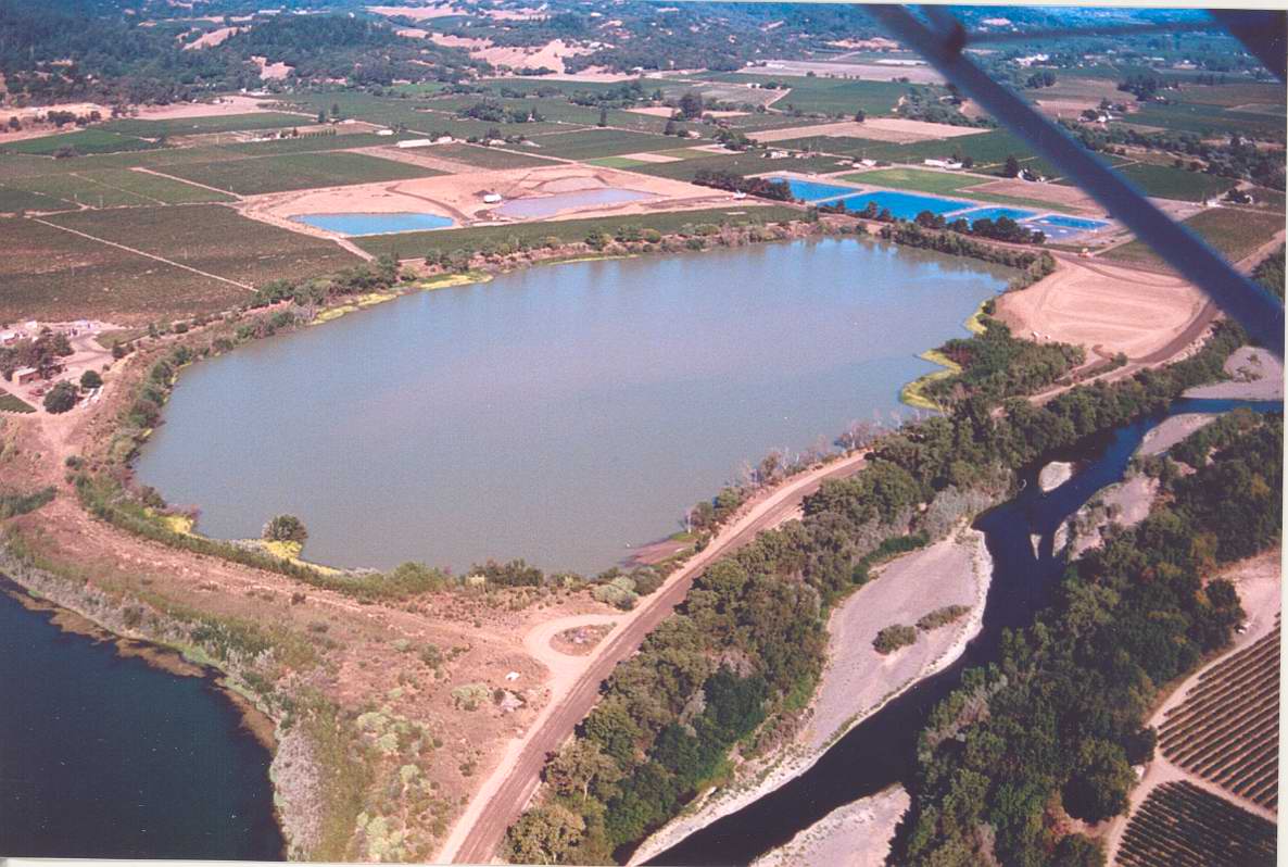 Click on image to enlarge (140K).
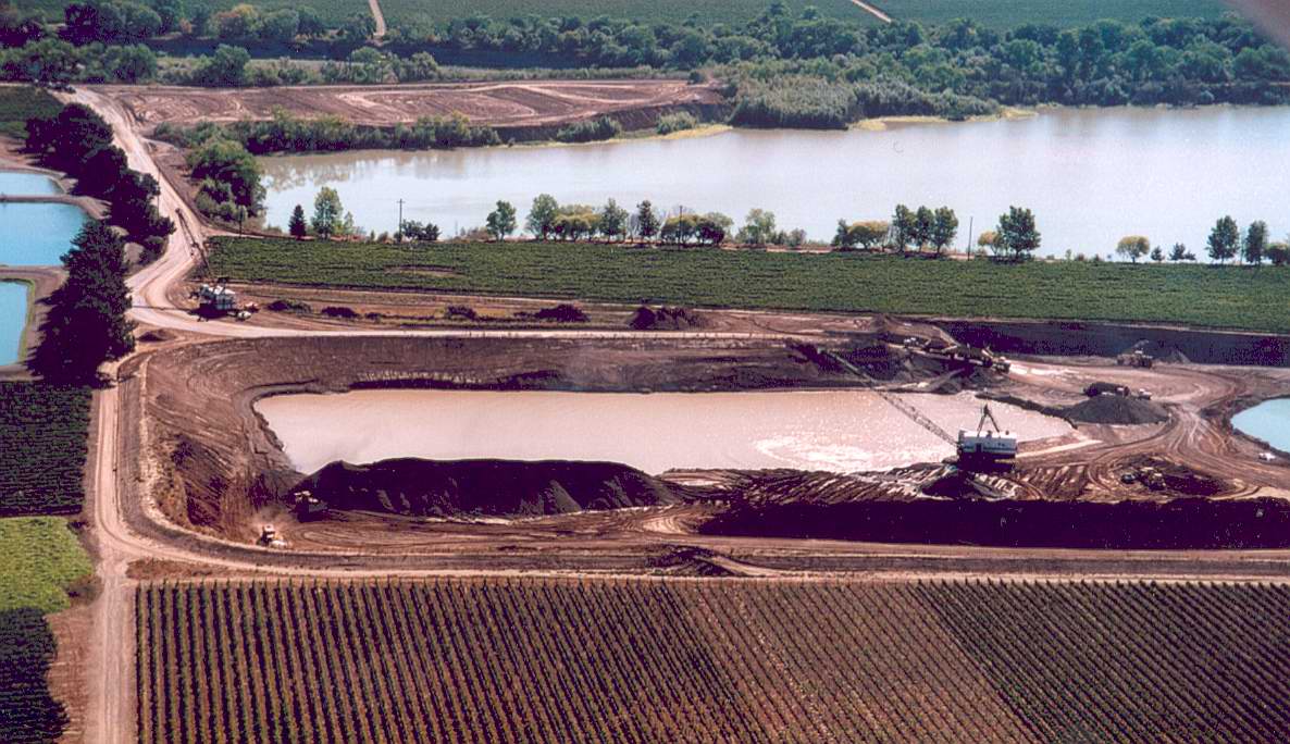 Click on image to enlarge (151K).
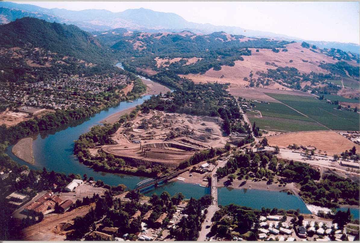 Click on image to enlarge (172K).
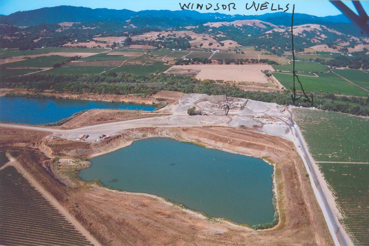 Click on image to enlarge (127K).
To learn more about this topic click Info Links
To view additional information (data source, aquisition date etc.) about this page, click Metadata
| www.krisweb.com |