
| Area | Coyote Valley |
| Topic | Sediment: Road Stream Crossing Density for Coyote Valley Calwaters |
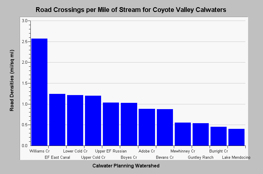
| Caption: The chart above shows a summary of the densities of road crossings per stream mile for Coyote Valley Calwater Planning Watersheds. Stream crossing density varies from 0.40 in Lake Mendocino to 2.57 in Williams Creek. Road and stream data originates from 1:24,000 scale topographic maps and under represent road densities, especially in urban and timber harvest areas. Roads densities are calculated by KRIS IFR staff in Arc Info. See Map for a map layer of basin wide roads. See InfoLinks for more information. | |
 |
To learn more about this topic click Info Links .
To view additional information (data source, aquisition date etc.) about this page, click Metadata .
To view the table with the chart's data, click Chart Table web page.
To download the table with the chart's data, click roads_russian_coyotevalley_24k.dbf (size 3,298 bytes) .
To view the table with the chart's source data, click Source Table web page.
To download the table with the chart's source data, click roads_russian_calwaters_24k.dbf (size 27,124 bytes)
| www.krisweb.com |