
| Area | Coyote Valley |
| Topic | Flow: EF Russian R nr Capella, CA - Daily Ave 1955-1967 |
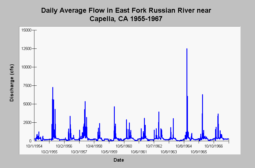
| Caption: This chart displays daily average flows (cfs) in the East Fork Russian River near Capella, CA (US Geological Survey gauging station #11461500) for the water years 1955 through 1967. The gage is located approximately 1.5 miles upstream of Lake Mendocino. The East Fork Russian River stream flow has been under the influence of the Potter Valley Project diversion since 1908. See InfoLinks for more information. | |
 |
To learn more about this topic click Info Links .
To view additional information (data source, aquisition date etc.) about this page, click Metadata .
To view the table with the chart's data, click Chart Table web page.
To download the table with the chart's data, click flow_daily_usgs11461500_efrus_nr_cal_1955_1967.dbf (size 171,090 bytes) .
To view the table with the chart's source data, click Source Table web page.
To download the table with the chart's source data, click flow_daily_usgs11461500_efrus_nr_cal_1942_2001.dbf (size 789,102 bytes)
| www.krisweb.com |