|
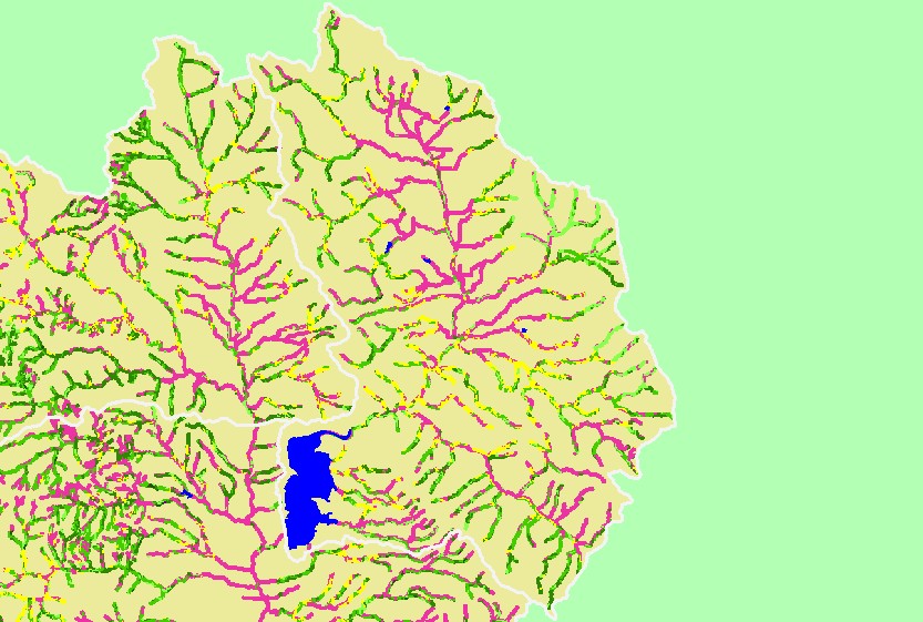
This is a map of 1994 USFS Landsat vegetation size data within 90-meter riparian buffer zones in the Coyote Valley sub-basin. Data provided by the U.S. Forest
Service Spatial Analysis Lab in Sacramento, CA. The vegetation classification is accurate at a one-hectare scale and is suitable for stand classification. Click the check
box next to a layer to toggle it on/off. Other available themes include Vegetation Size, Topographic Maps, Calwater Planning Watersheds and 1:24,000 streams. Scale = 1:176,053 .
|
|