
|
Area/Topic | Bibliography | Background | Hypotheses | Home |
|
Map Page.
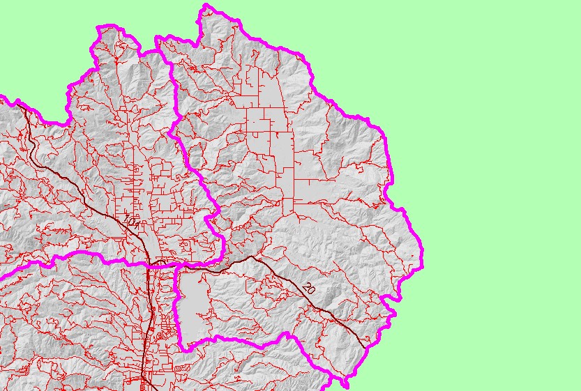
You selected the area Coyote Valley and the topic Map: 1F. Roads, Coyote Valley Sub-basin |
| This is a map of 1:24,000 scale roads in the Coyote Valley sub-basin, displayed with sub-basins and a grayscale hillshade. The actual number of roads is under-represented in this map because the roads layer is based primarily on 1:24,000 scale topographic maps, which may be out-dated and tend to underestimate forest and ranch roads. Highway 20 runs across the lower half of the sub-basin. Data were provided by Legacy - The Landscape Connection. | |||
|
|
||
| www.krisweb.com |