
|
Area/Topic | Bibliography | Background | Hypotheses | Home |
|
Map Page.
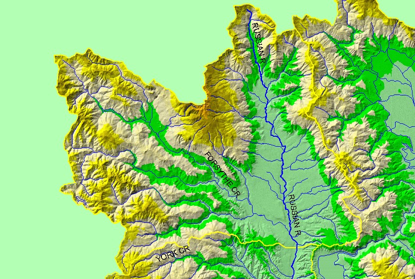
You selected the area Forsythe Creek and the topic Map: 1B. Elevation and Hydrography, Forsythe Creek Sub-basin |
| This is a map of the 1:100,000 scale U.S. Geologic Survey hydrography in the Forsythe Creek sub-basin, displayed with a Digital Elevation Model (DEM) showing the topography of the landscape. The valley at the east side of the sub-basin is Redwood Valley. Most of the west side of the sub-basin is steep terrain, with elevations up to 1100 meters. Data were contributed by the U.S. Geological Survey and the California Department of Forestry. | |||
|
|
||
| www.krisweb.com |