
|
Area/Topic | Bibliography | Background | Hypotheses | Home |
|
Map Page.
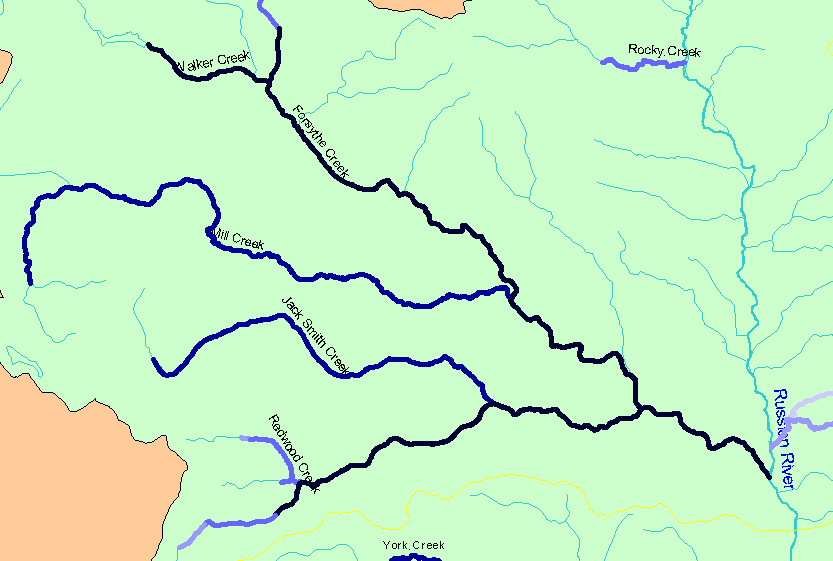
You selected the area Forsythe Creek and the topic Habitat: Survey Reach Length in Forsythe Cr and Tributaries 1999 |
| The map shows the Strahler stream orders for stream reaches surveyed during the California Department of Fish and Game habitat typing surveys in Forsythe Creek and its tributaries. Strahler stream orders were determined by IFR-KRIS using the California Department of Forestry's 1:24,000 scale GIS layer. | |||
|
|
||
| www.krisweb.com |