|
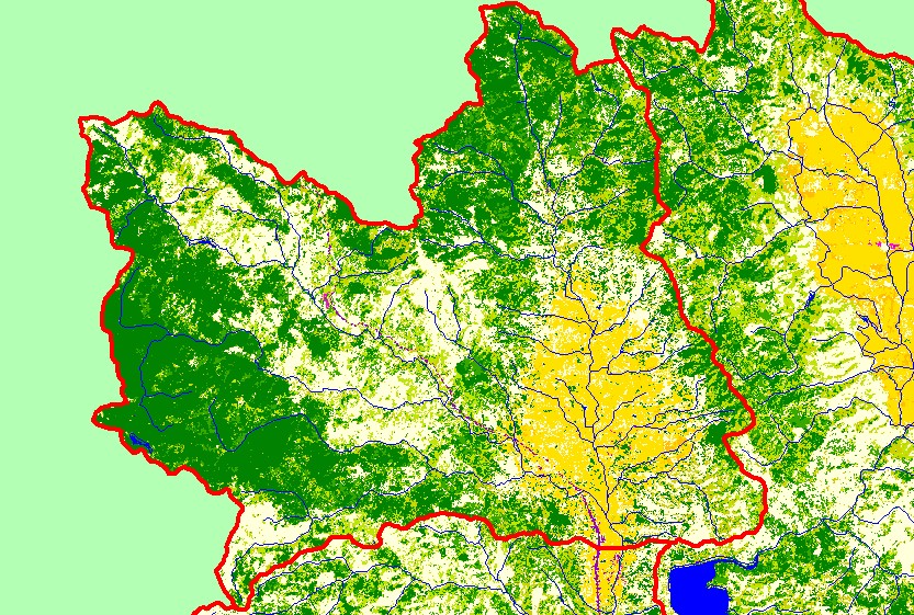
This is a map of EPA Landcover/Landuse in the Forsythe Creek sub-basin, based on a 1992 Landsat TM satellite image. Redwood Valley is mostly covered in
orchards, vineyards, and other agricultural lands. Since 1992, there has been significant residential construction in the valley. The far western and northern portions of
the sub-basin are dominated by conifers. The remainder of the sub-basin is a mix of conifers, hardwoods, grasslands, and herbaceous vegetation. Data were provided
by the U.S. Environmental Protection Agency.
|
|