
| Area | Forsythe Creek |
| Topic | Tour: West Fork Russian #3 Rocky Creek to Calpella |
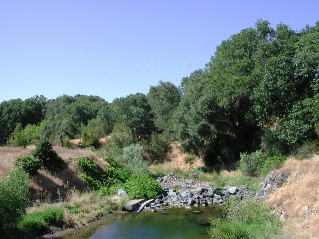
rr_jul_13_15_2003__105.jpg This picture of the West Fork Russian River was taken off the Eastside Road Bridge looking upstream. Old bridge abutments and new rip rap cause scour of the pool which retains surface water in the photo, but the WF lacks surface flow downstream (see Picture #6). It is likely that the rip rap was placed to prevent head cutting in the channel. This pool has sufficient depth to provide rearing habitat for salmonids but temperatures were too warm to support them at the time the photo was taken. Photo by Patrick Higgins. July 13, 2003.
This photo was taken looking downstream at the dry bed of the West Fork Russian River off the Eastside Road Bridge. The riparian vegetation lining both banks and extending back on the terrace on the right is a result of a bioengineering project by Evan Engber. Photo by Patrick Higgins. July 13, 2003.
The West Fork Russian River is shown here looking upstream off School Road in Redwood Valley. The stream has regained surface flows and appears to have good canopy. Photo by Patrick Higgins. July 13, 2003.
The West Fork Russian River is shown here looking downstream off School Road in Redwood Valley. The channel is well shaded from the afternoon sun. Photo by Patrick Higgins. July 13, 2003.
This photo of the West Fork Russian River off East Side-Calpella Road below Highway 20 shows a closeup of a shallow riffle. Boulders lining the right hand bank appear as if they may be related to a past bank stabilization project . Photo by Patrick Higgins. July 13, 2003.
This photo of the West Fork Russian River off East Side-Calpella Road below Highway 20 shows a coarse gravel bar and relatively open riparian conditions. This reach flows by a large lumber mill and log deck that extends back from the top of the far bank. Photo by Patrick Higgins. July 13, 2003.
This photo of the West Fork was taken off Lake Mendocino Drive looking downstream not far above the convergence with the mainstem Russian River. The extensive exposure of clay bedrock substrate along the banks may be indicative of past down-cutting, which is a recognized problem in this reach. Picture taken by Patrick Higgins. July 15, 2003.
This photo of the West Fork was taken off Lake Mendocino Drive looking upstream not far above the convergence with the mainstem Russian River. Riparian growth looks fairly healthy here. Picture taken by Patrick Higgins. July 15, 2003.
 Click on image to enlarge (148K).
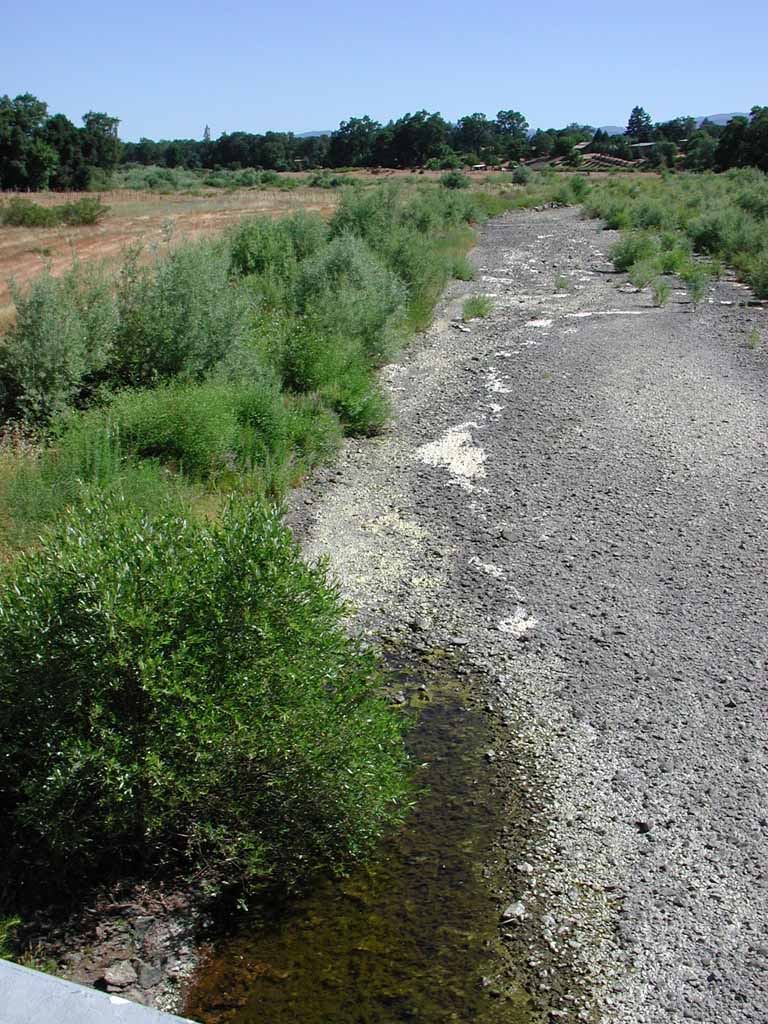 Click on image to enlarge (172K).
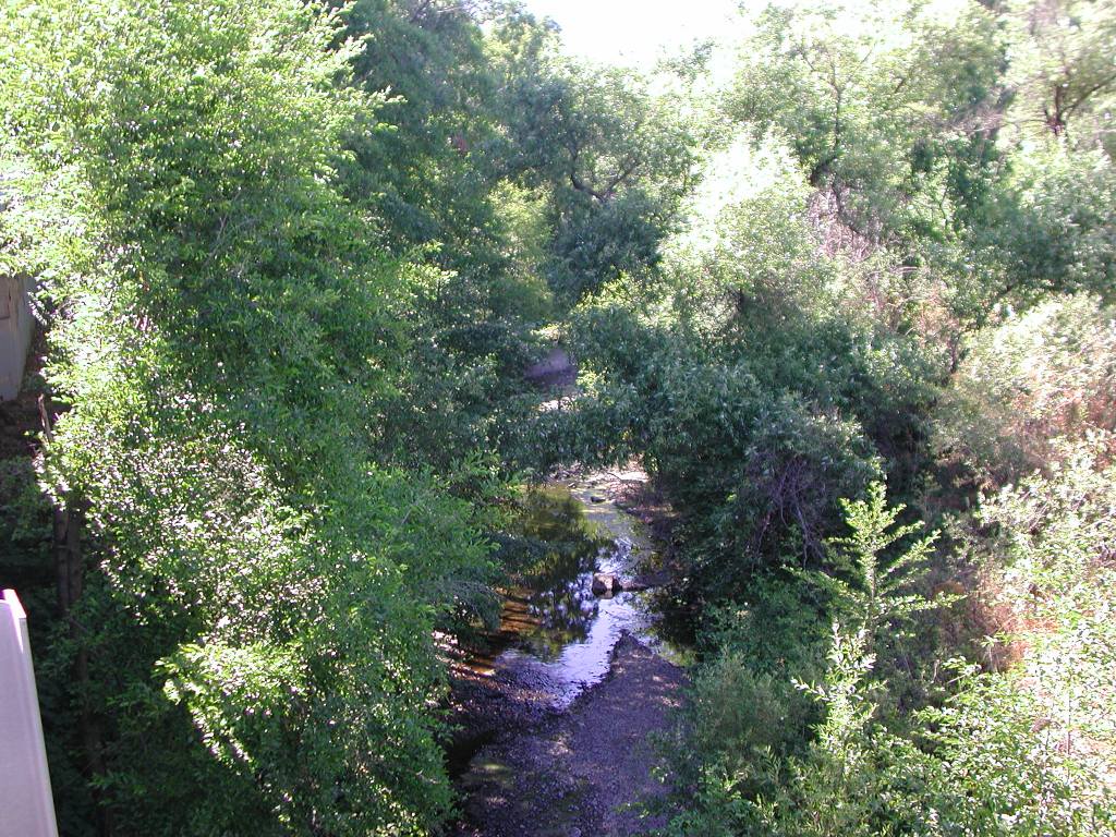 Click on image to enlarge (243K).
 Click on image to enlarge (172K).
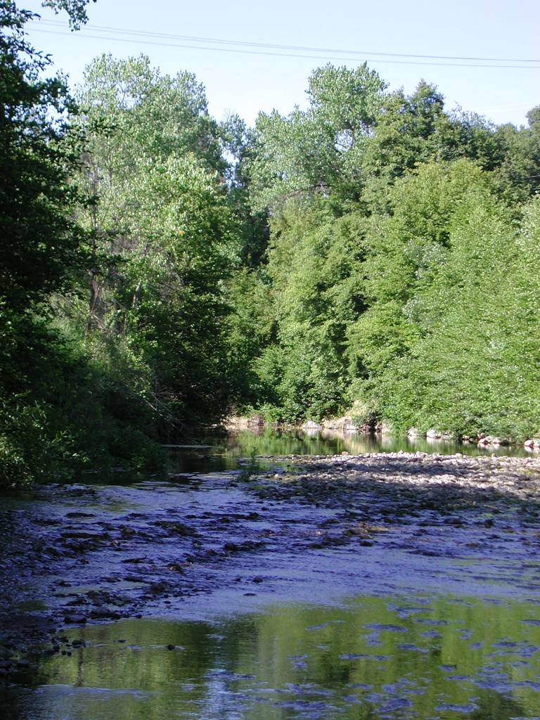 Click on image to enlarge (189K).
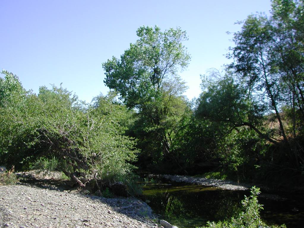 Click on image to enlarge (172K).
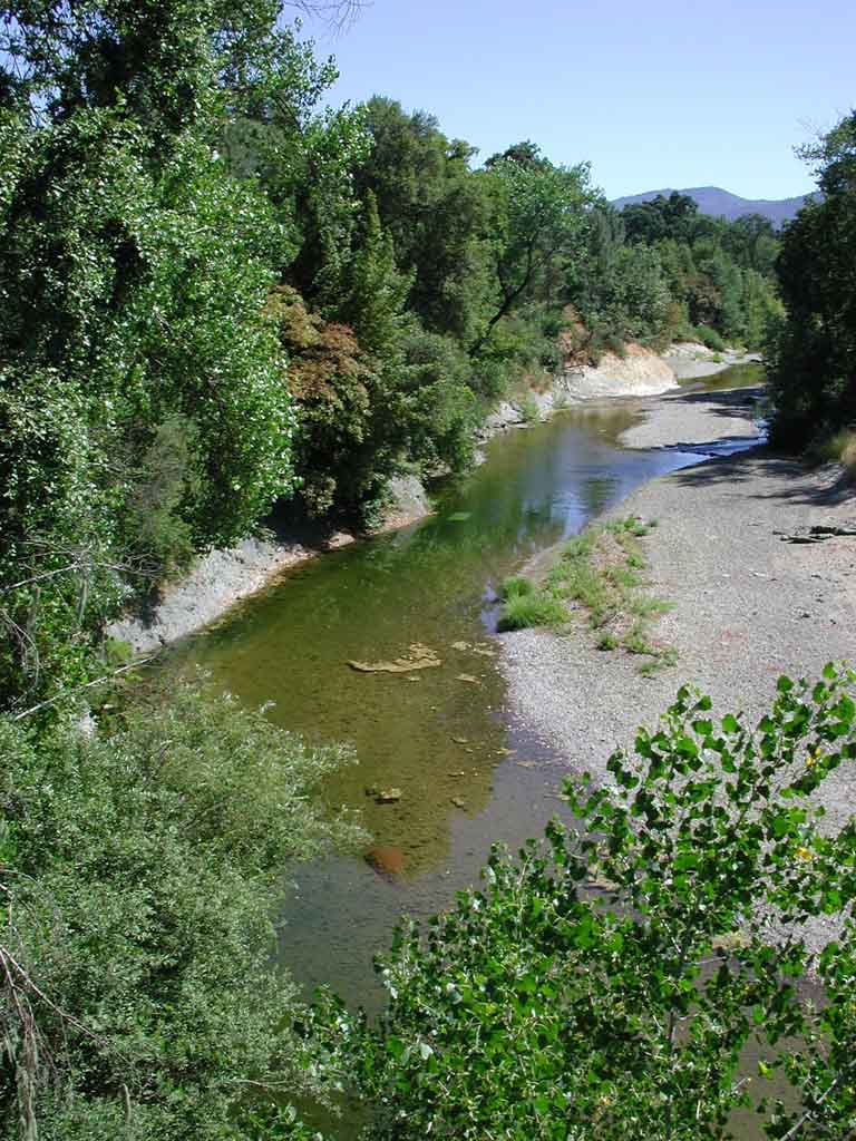 Click on image to enlarge (136K).
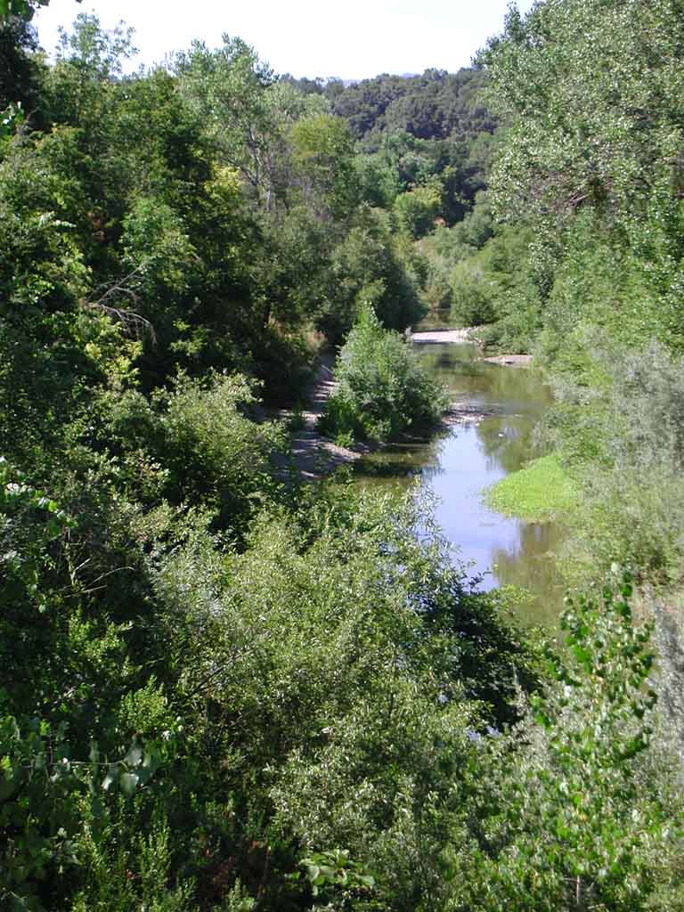 Click on image to enlarge (136K).
To learn more about this topic click Info Links
To view additional information (data source, aquisition date etc.) about this page, click Metadata
| www.krisweb.com |