
| Area | Guerneville |
| Topic | WQ: Estuary Temp, Salinity and DO Grab Sta #1 8/21/97 During Breach |
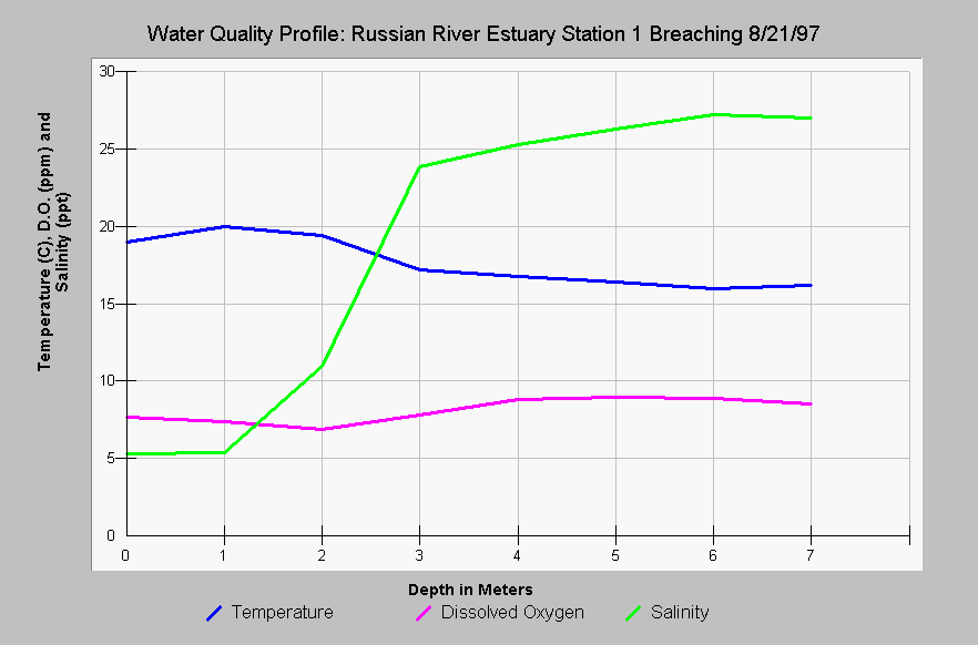
| Caption: This chart shows the Russian River estuary temperature in Celsius, dissolved oxygen (DO) in parts per million (ppm) and salinity in parts per thousand (ppt) at Station #1 versus the depth in meters during an estuary breaching on August 21, 1997. Dissolved oxygen is much improved from pre-breaching conditions (see previous Topic) with dissolved oxygen well above stressful levels at all depths. Salinity of the water increased during the breaching as sea water intruded. This station is immediately upstream of the mouth of the Russian River (see Picture tab for map). Data provided by Merritt-Smith Consulting (1998) from a study performed for Sonoma County. See InfoLinks for more information on study methods and results. | |
 |
To learn more about this topic click Info Links .
To view additional information (data source, aquisition date etc.) about this page, click Metadata .
To view the table with the chart's data, click Chart Table web page.
To download the table with the chart's data, click wq_grab_sta1_82197.dbf (size 578 bytes) .
To view the table with the chart's source data, click Source Table web page.
To download the table with the chart's source data, click wq_profiles_1997_mega_source.dbf (size 57,960 bytes)
| www.krisweb.com |