
| Area | Guerneville |
| Topic | Fish: Estuary Beach Seine Sample Totals 1998 |
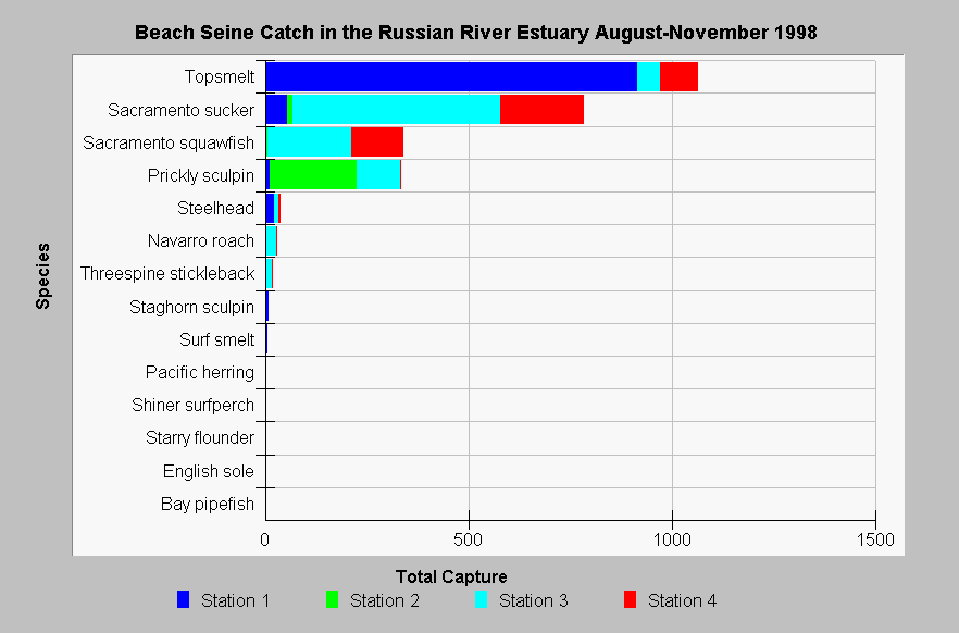
| Caption: The Chart Table fish_est_seine_sum_1998.dbf is the summary results by station of all seine net samples from the Russian River estuary at four stations from August through November 1998. Sampling at Station #2 was impaired on many dates by very steep banks at high water levels and large wood deposited by floods that snagged the nets and made sampling ineffective or completely infeasible at low water. Station 1 is closest to the ocean while #4 is furthest upstream (see Picture tab). Data from Merritt Smith Consulting and Sonoma County. See InfoLinks for more information. | |
 |
To learn more about this topic click Info Links .
To view additional information (data source, aquisition date etc.) about this page, click Metadata .
To view the table with the chart's data, click Chart Table web page.
To download the table with the chart's data, click fish_est_seine_sum_1998.dbf (size 1,336 bytes) .
To view the table with the chart's source data, click Source Table web page.
To download the table with the chart's source data, click fish_est_seine_source_1998.dbf (size 14,042 bytes)
| www.krisweb.com |