
| Area | Guerneville |
| Topic | Climate: Rainfall - Guerneville - Monthly Min, Ave, Max 1904-2000 |
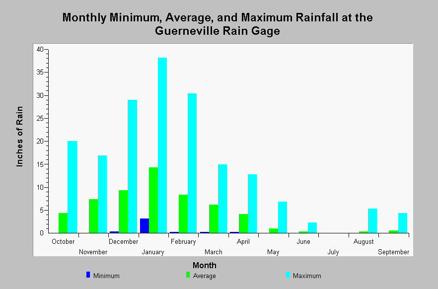
| Caption: This chart shows the monthly minimum, average, and maximum rainfall totals recorded at the Guerneville rain gage (DWR # F90 3684 00) between 1952 and 1973. Rainfall is highly seasonal, accumulating the most rainfall between October through April. On average, January is the wettest month (14.27 inches) and July is the driest month (0.00 inches). See InfoLinks for more information. | |
 |
To learn more about this topic click Info Links .
To view additional information (data source, aquisition date etc.) about this page, click Metadata .
To view the table with the chart's data, click Chart Table web page.
To download the table with the chart's data, click climate_rainfall_monthlystats_gurneville.dbf (size 606 bytes) .
To view the table with the chart's source data, click Source Table web page.
To download the table with the chart's source data, click climate_rainfall_monthly_gurneville.dbf (size 3,276 bytes)
| www.krisweb.com |