
|
Area/Topic | Bibliography | Background | Hypotheses | Home |
|
Map Page.
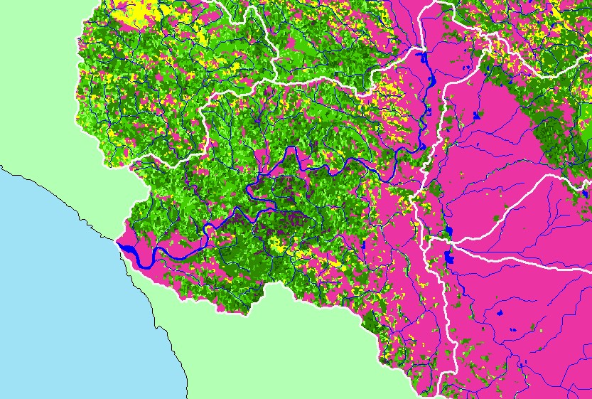
You selected the area Guerneville and the topic Map: 1D. USFS Vegetation Size, Guerneville Sub-basin |
| This is a map of 1994 USFS Landsat-based vegetation size data and 1:100,000 scale streams in the Guerneville sub-basin. The vegetation classification is accurate at a one-hectare scale and is suitable for stand classification. Data were provided by the U.S. Forest Service Spatial Analysis Lab in Sacramento, CA. | |||
|
|
||
| www.krisweb.com |