
|
Area/Topic | Bibliography | Background | Hypotheses | Home |
|
Map Page.
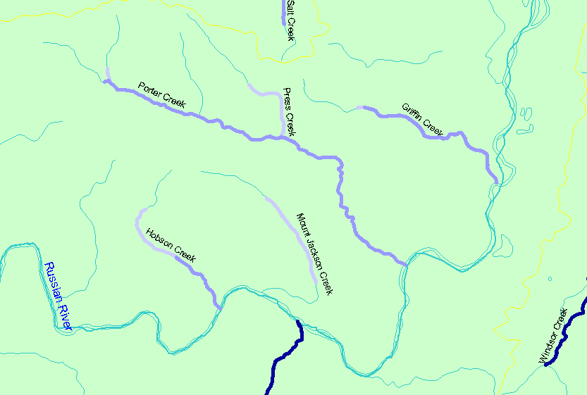
You selected the area Guerneville and the topic Habitat: Survey Reach Length in Northeast Guerneville Tribs 1995-2000 |
| The map shows the Strahler stream orders for stream reaches surveyed during the California Department of Fish and Game habitat typing surveys in the northeast portion of the Guerneville sub-basin. Strahler stream orders were determined by IFR-KRIS using the California Department of Forestry's 1:24,000 scale GIS layer. | |||
|
|
||
| www.krisweb.com |