
|
Area/Topic | Bibliography | Background | Hypotheses | Home |
|
Map Page.
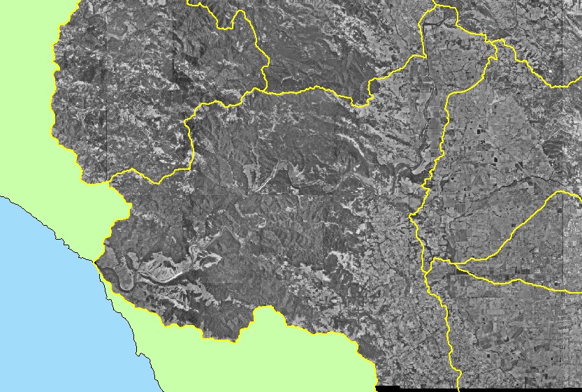
You selected the area Guerneville and the topic Map: 3A. Digital Orthophotos (DOQs), Guerneville Sub-basin |
| This is a map showing digital orthophoto quarter-quadrangles (DOQs) in the Guerneville sub-basin, displayed with sub-basin outlines. DOQs were provided by the U.S. Geologic Survey. Use the Pan (hand icon) and Zoom (magnifying glass icons) tools to move around the map. | |||
|
|
||
| www.krisweb.com |