
| Area | Geyserville |
| Topic | Flow: Big Sulphur Creek - Annual Peaks 1956-1972 |
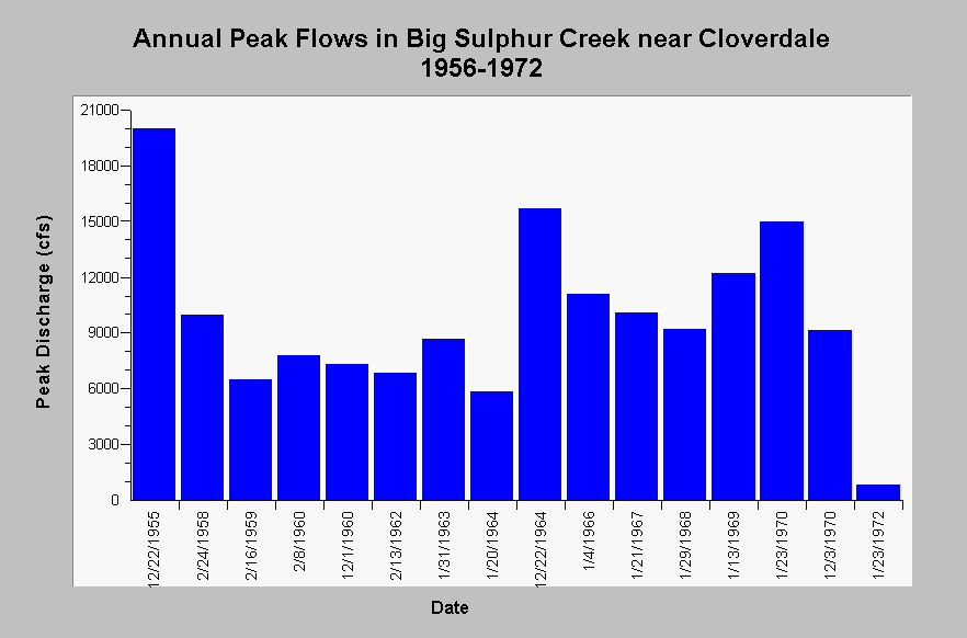
| Caption: This chart displays annual peak discharge in Big Sulphur Creek near Cloverdale, CA (US Geological Survey gauging station #11463200) for the water years 1956 and 1958 through 1972. The maximum observed peak flow was 20000 cfs occurring in December 1955 and the minimum peak flow of 822 cfs was observed in January 1972. See InfoLinks for more Information. | |
 |
To learn more about this topic click Info Links .
To view additional information (data source, aquisition date etc.) about this page, click Metadata .
To view the table with the chart's data, click Chart Table web page.
To download the table with the chart's data, click flow_yrpeak_usgs11463200_bigsulphur_1956_1972.dbf (size 738 bytes) .
| www.krisweb.com |