
| Area | Geyserville |
| Topic | Habitat: Maximum Pool Depths Russian R. in Alexander Valley 1992 |
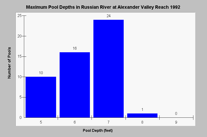
| Caption: This chart shows the maximum depths of 51 pools measured in a July and August 1992 habitat typing survey of the Alexander Valley reach of the Russian River. The Alexander Valley Reach extends from the confluence of Big Sulphur Springs to the intersection of the mainstem and the Alexander Valley Bridge. Data were collected by Circuit Rider Productions. Click Map to see the maximum pool depths along the reach. See InfoLinks for more information. | |
 |
To learn more about this topic click Info Links .
To view additional information (data source, aquisition date etc.) about this page, click Metadata .
To view the table with the chart's data, click Chart Table web page.
To download the table with the chart's data, click hab_rus_crp_1992_pools.dbf (size 355 bytes) .
To view the table with the chart's source data, click Source Table web page.
To download the table with the chart's source data, click hab_rus_crp_1992_source.dbf (size 270,085 bytes)
| www.krisweb.com |