
|
Area/Topic | Bibliography | Background | Hypotheses | Home |
|
Map Page.
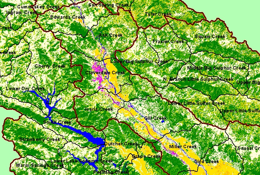
You selected the area Geyserville and the topic Land Cover: EPA Land-Use - Geyserville Sub-basin, Upper 1992 |
| This is a map of EPA Landcover/Landuse in Calwater Planning Watersheds in the upper portion of the Geyserville sub-basin. Data were derived from a 1992 Landsat TM satellite image. Data were provided by the U.S. Environmental Protection Agency. | |||
|
|
||
| www.krisweb.com |