
| Area | Geyserville |
| Topic | Tour: Russian River, Alexander Valley Land Use Photos #2 |
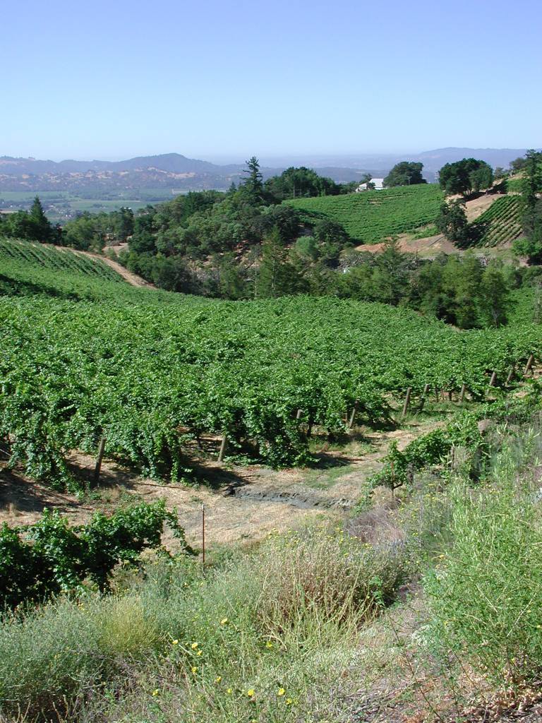
Hillslopes above Alexander Valley are now being turned into vineyards, not just the valley floor. Erosion risk from vineyard development may be higher on steeper ground. Photo by Patrick Higgins. July 15, 2003.
This dirt road leading off the Geysers Road is developing a gully. Rural roads may be significant contributors of sediment to streams and cumulatively may change runoff patterns and hydrology. Photo by Patrick Higgins. July 15, 2003.
This is one of many storage ponds that store diverted water or water pumped from the ground to water grapes on the floor of Alexander Valley, which stretches to the south. Photo by Patrick Higgins. July 15, 2003.
This photo was taken looking south east and shows vineyard development at the top of the Miller Creek watershed. Mt St Helena shows in the background. Miller Creek has vineyards now from its headwaters to its convergence with the Russian; although quite a bit of wildlands remain in the drainage. Patrick Higgins. July 15, 2003.
High fences to prevent access of deer to vineyards may be disrupting wildlife ranges. Photo taken looking south. Photo by Patrick Higgins. July 15, 2003.
The hillslopes of Miller Creek are being increasingly developed as vineyards. Geyserville lies just down and to the left of center in the photo. Photo taken looking west. Photo by Patrick Higgins. July 15, 2003.
This hillslope in the Gird Creek watershed above Alexander Valley off Geysers Road shows oak woodlands and grasslands. The slumps in the grasslands are signs of geologic instability. Photo by Patrick Higgins. July 15, 2003.
This closeup of the hillslope at the same location as Picture #079 shows that there are stock trails cutting across the hillslopes. Grazing may have triggered or exacerbated slumping here. There is no indication that these land movements are contributing to water quality problems in the area shown by this photo. Photo by Patrick Higgins. July 15, 2003.
 Click on image to enlarge (197K).
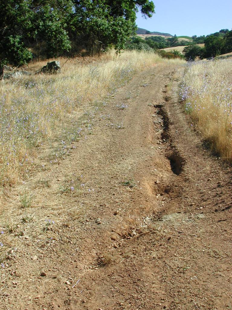 Click on image to enlarge (241K).
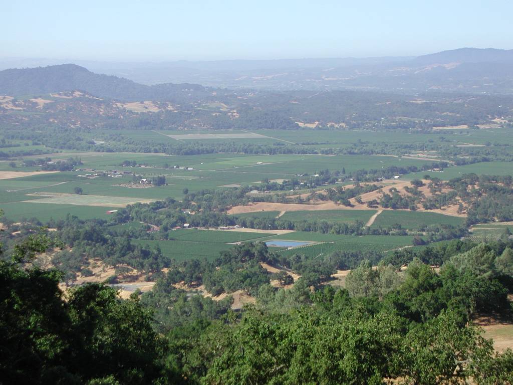 Click on image to enlarge (114K).
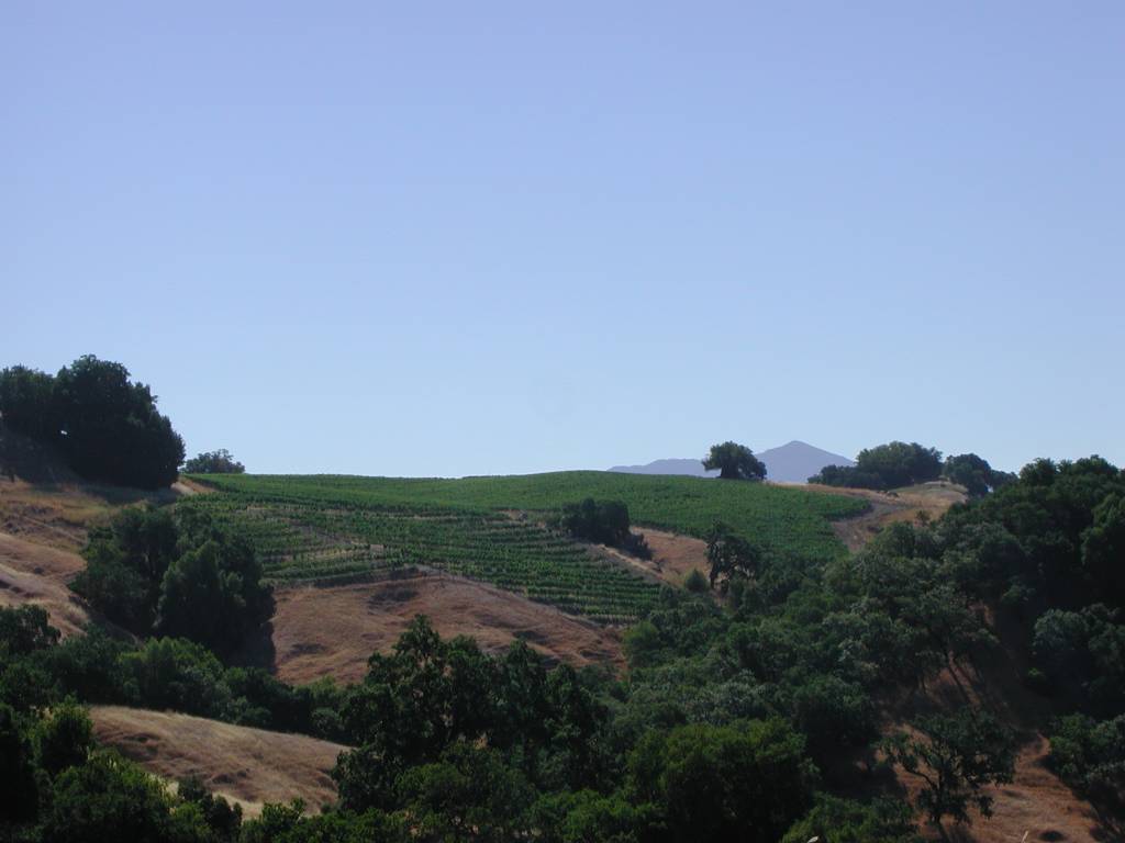 Click on image to enlarge (58K).
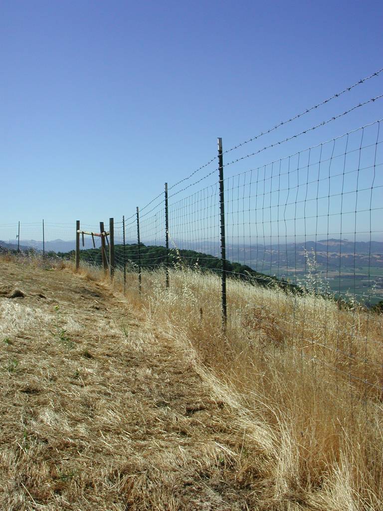 Click on image to enlarge (141K).
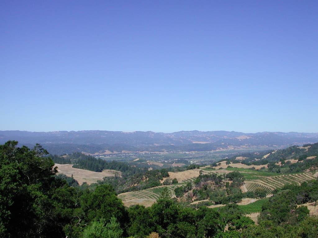 Click on image to enlarge (81K).
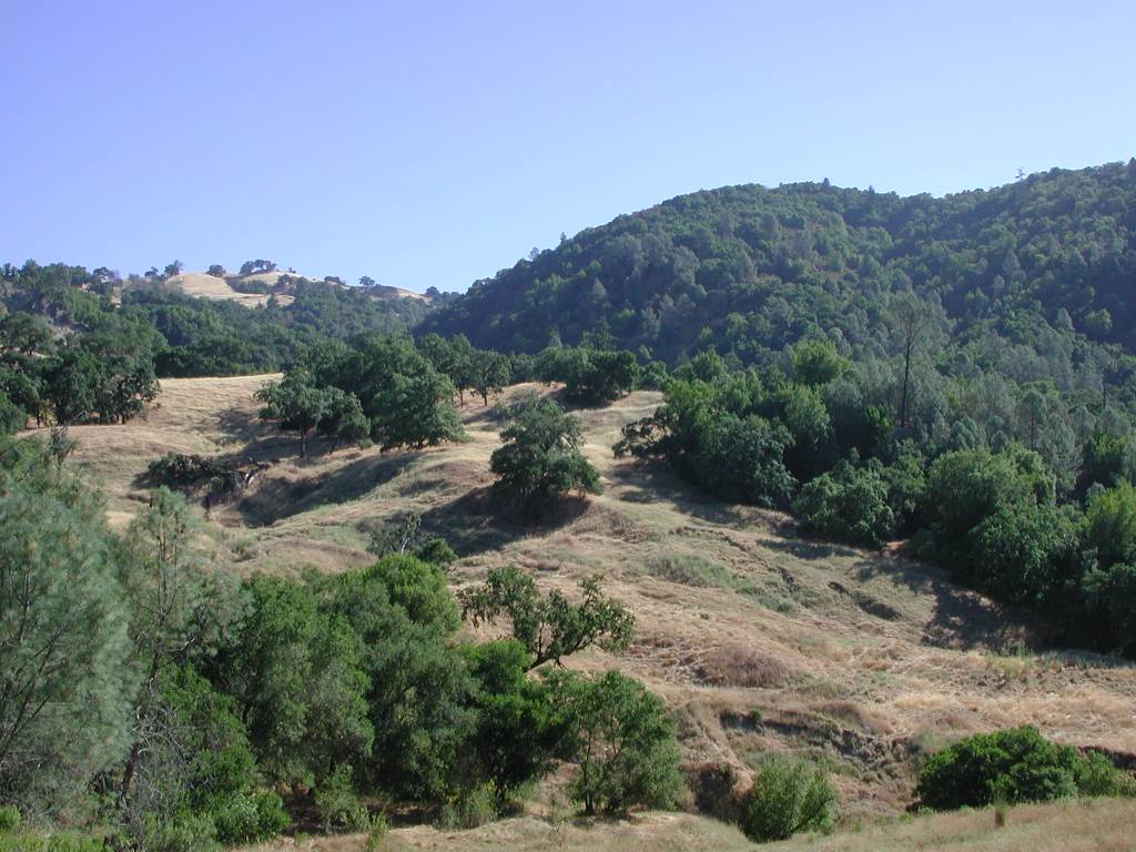 Click on image to enlarge (124K).
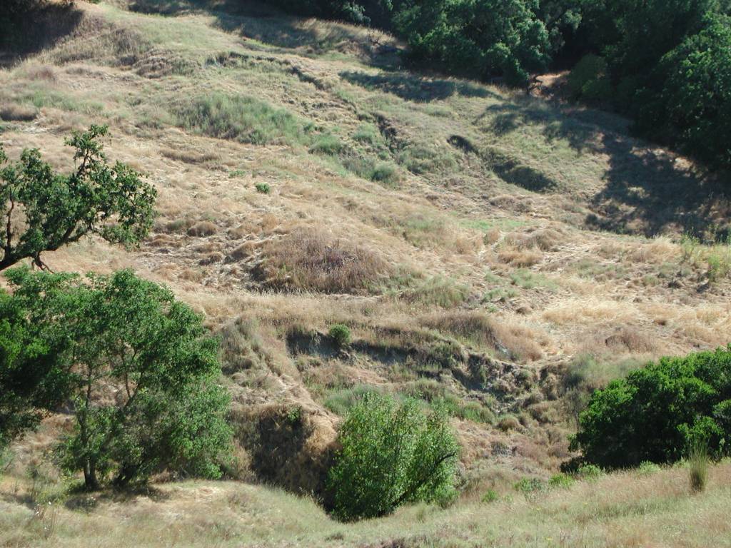 Click on image to enlarge (163K).
To learn more about this topic click Info Links
To view additional information (data source, aquisition date etc.) about this page, click Metadata
| www.krisweb.com |