
| Area | Geyserville |
| Topic | Fish: Mainstem Fish Community Healdsburg Reach Russian River 2002 |
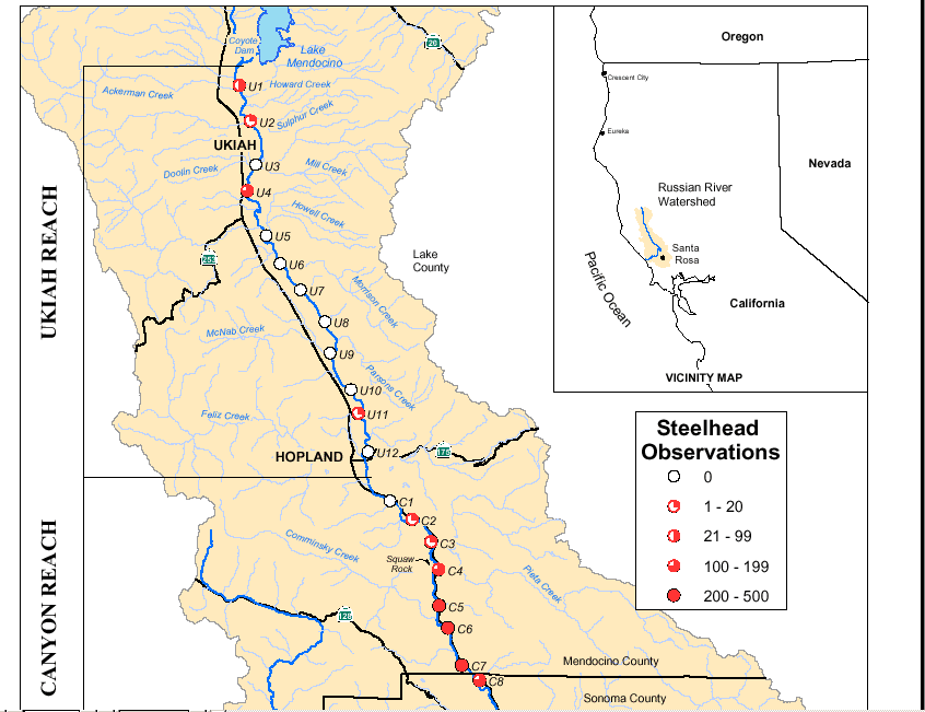
This map image shows the upper Russian River mainstem reaches surveyed by the Sonoma County Water Agency from July-September 2002 with the number of steelhead observations per mile (upper half of Figure 1 from SCWA, 2003). Alexander Valley and the Healdsburg reaches are depicted in Picture #2. See InfoLinks to learn more about study methods and results.
This map image shows the lower half of Figure 1 from SCWA (2003) with the Russian River mainstem reaches from Hopland to below Healdsburg with the number of steelhead observations per mile. The Russian River in the Alexander Valley and Healdsburg reaches had very few steelhead observations. See InfoLinks to learn more about study methods and results.
Caption and photo from Figure 39 in the Upper Russian River Steelhead Distribution Study (SCWA, 2003): "Healdsburg Reach, Segment H2. This segment contained mostly flatwater (94%) habitat with adjacent broad gravel bars, and occasional riffle (4%) and deep pool (2%) habitats. No steelhead were observed."
Caption and photo from Figure 43 in the Upper Russian River Steelhead Distribution Study (SCWA, 2003): "Healdsburg Reach, Segment H6. This segment contained 3% riffle, 94% flatwater, and 3% deep pool habitats. One steelhead was observed in a small riffle"
Caption and photo from Figure 44 in the Upper Russian River Steelhead Distribution Study (SCWA, 2003): "Healdsburg Reach, Segment H7. This segment was not dive surveyed but contained a large deep pool and flatwater habitats."
Caption and photo from Figure 45 in the Upper Russian River Steelhead Distribution Study (SCWA, 2003): "Healdsburg Reach, Segment H8. This segment contained primarily flatwater habitat. No steelhead were observed."
Caption and photo from Figure 46 in the Upper Russian River Steelhead Distribution Study (SCWA, 2003): "Healdsburg Reach, Segment H9. This segment was not surveyed but contained deep pool and flatwater habitats. Water conditions are influenced by the Healdsburg Dam located approximately 4 km downstream. No steelhead were observed."
Caption and photo from Figure 47 in the Upper Russian River Steelhead Distribution Study (SCWA, 2003): "Healdsburg Reach, Segment H10, Healdsburg Dam. This segment is located at and below the Healdsburg Dam and contained 3% deep pool, 78% flatwater, 12% riffle, and 7% cascade habitats. The photographs show a fast-moving deep riffle (top) and an artificial cascade below the dam (bottom). A total of 16 steelhead were observed in the riffle and cascade habitats."
 Click on image to enlarge (43K).
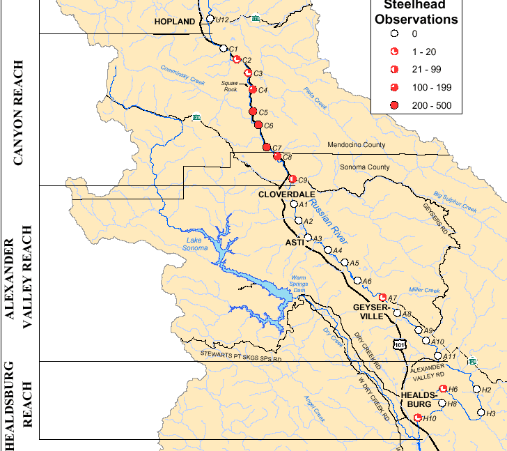 Click on image to enlarge (44K).
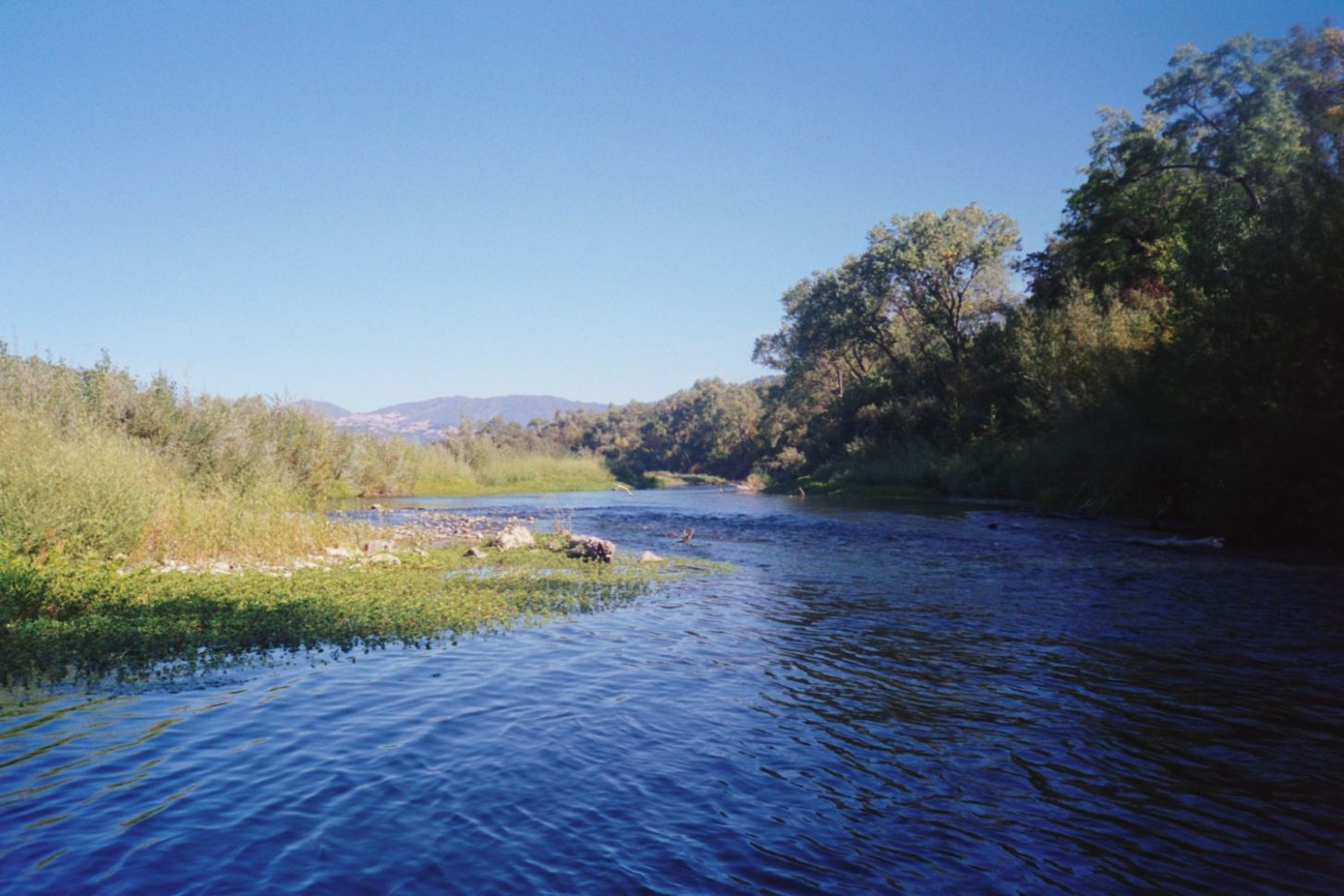 Click on image to enlarge (178K).
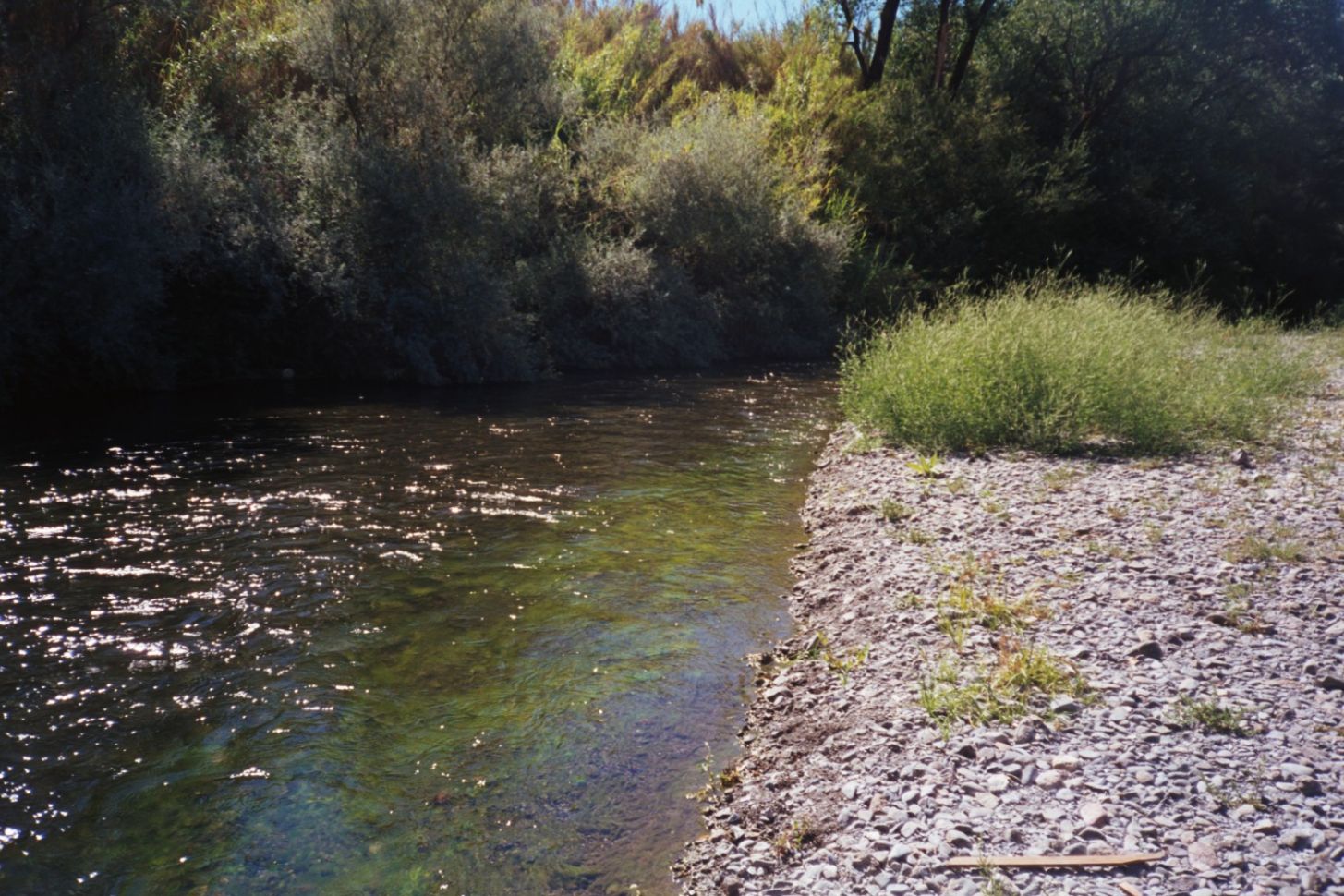 Click on image to enlarge (280K).
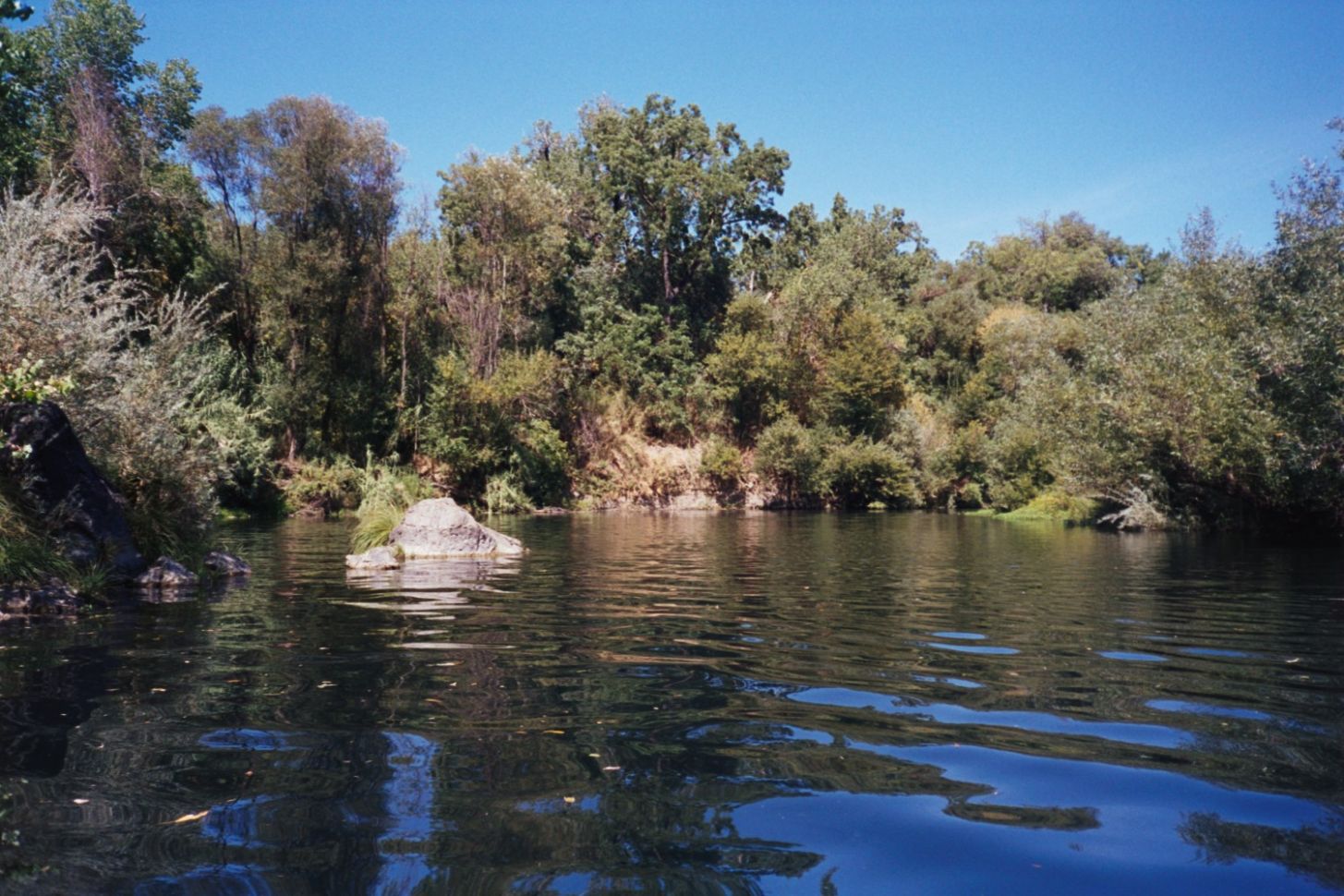 Click on image to enlarge (254K).
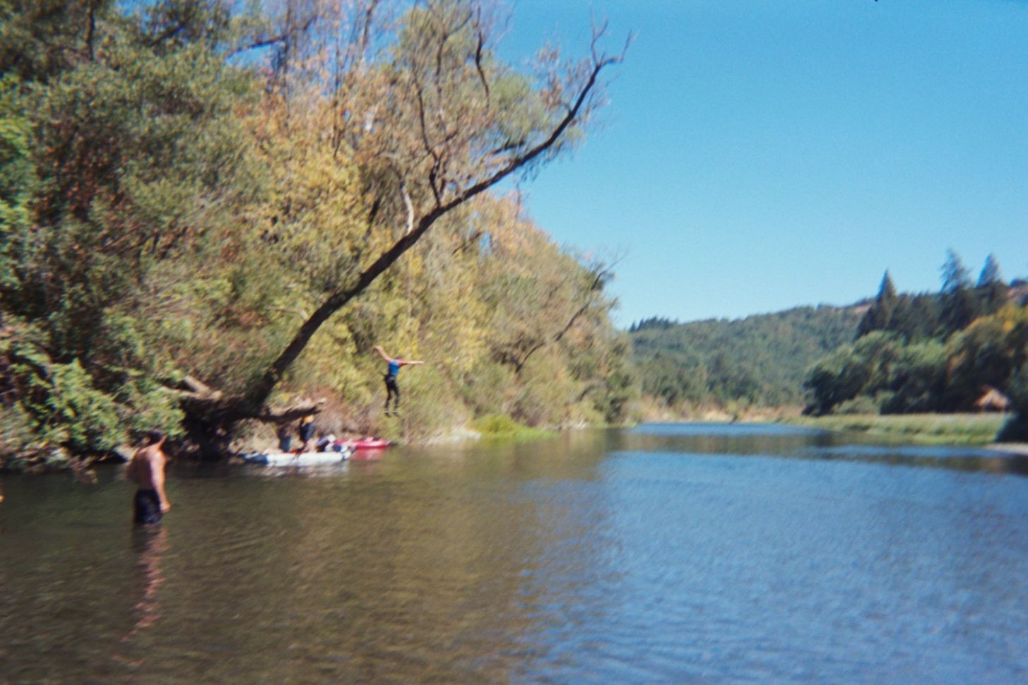 Click on image to enlarge (182K).
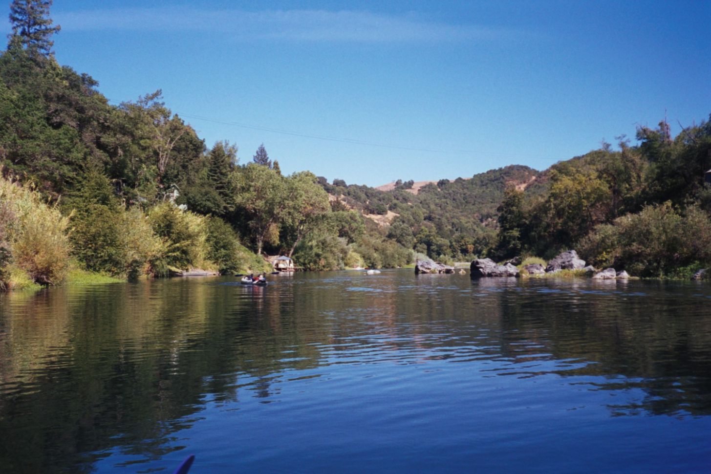 Click on image to enlarge (196K).
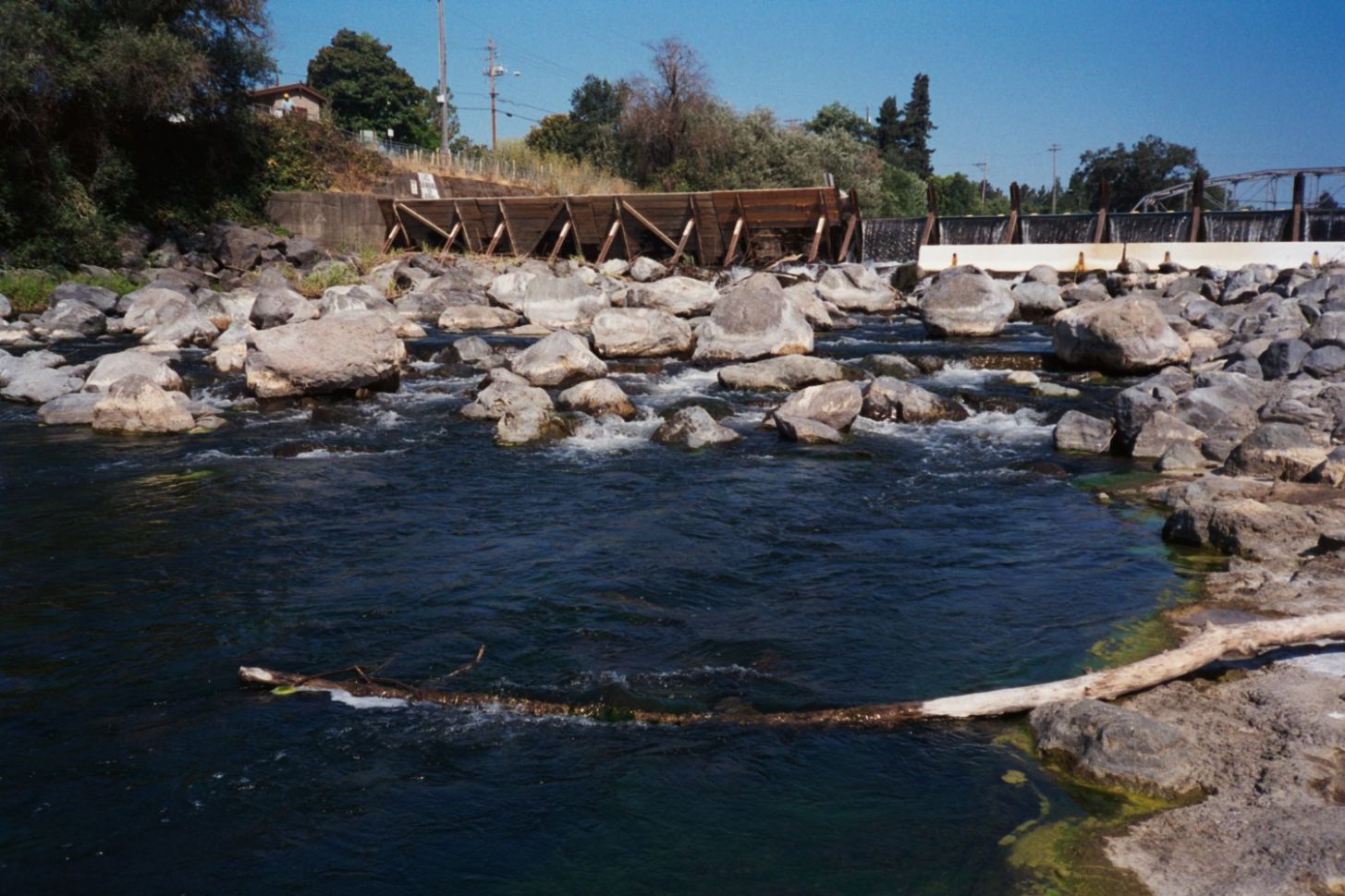 Click on image to enlarge (224K).
To learn more about this topic click Info Links
To view additional information (data source, aquisition date etc.) about this page, click Metadata
| www.krisweb.com |