
| Area | Geyserville |
| Topic | Tour: Alexander Valley Aerial Photos Past/Present |
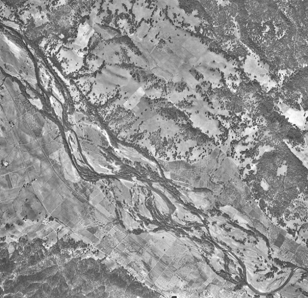
This is a 1947 aerial photo of Alexander Valley near Gill Creek, river mile 52.5 to 54.5. The river channel had a wide active area characterized by sinuous meandering with point bars and alternate bars. The riparian corridor was wide; most of the vegetation concentrated in relic channel meanders, the vegetation is sparse on gravel bars and along the floodplains. Terraces and floodplains are primarily used for agriculture and vineyards.
This image is from the 1965 US Army Corps of Engineers Russian River Channel Improvement Operation and Maintenance Manual and show the proposed channel improvements to a reach of the Russian River near Gill Creek, river mile 52.6 to 54.7. The design clears and straightens the stream channel and adds bank stabilization measures.
This is a 1993 aerial photo of Alexander Valley near Gill Creek, river mile 52.5 to 54.5. Stabilization projects, gravel mining, and the encroachment of agriculture has reduced the width of the active channel and riparian corridor. The Russian River is less sinuous and is braided in areas, a sign of a destabilized riverbed. Riparian vegetation is thinner and in some areas, there is not a riparian buffer between agriculture lands and the channel. There is also an increase in water storage ponds in the upland areas.
This is a 2000 aerial photograph of the Russian River at approximately river mile 54.5. The channel is braided, a sign of a destabilized riverbed. Riparian vegetation is reestablishing on the gravel bars; however, a thin riparian buffer is seen between agriculture lands and the channel.
This is a 2000 aerial photograph of the Russian River at approximately river mile 54. The channel shows braiding, a sign of a destabilized riverbed. Agriculture land use has encroached on the riparian corridor.
This is a 2000 aerial photograph of the Russian River at approximately river mile 53.5. A large sediment deposit is located at the confluence of Gill Creek (located an the top center of the photo). Gill Creek was also dry during the time of this photo.
This is a 2000 aerial photograph of the Russian River at approximately river mile 53. Riparian vegetation is reestablishing on the point bar; however, agriculture land use has encroaching on the riparian corridor.
This is a 2000 aerial photograph of the Russian River at approximately river mile 52.5. The channel shows some signs of braiding. Riparian vegetation is reestablishing on the gravel bars; however, agriculture land use has encroaching on the riparian corridor.
 Click on image to enlarge (327K).
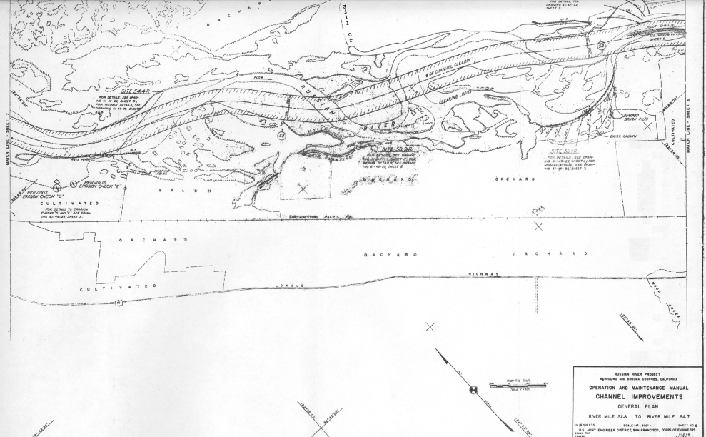 Click on image to enlarge (346K).
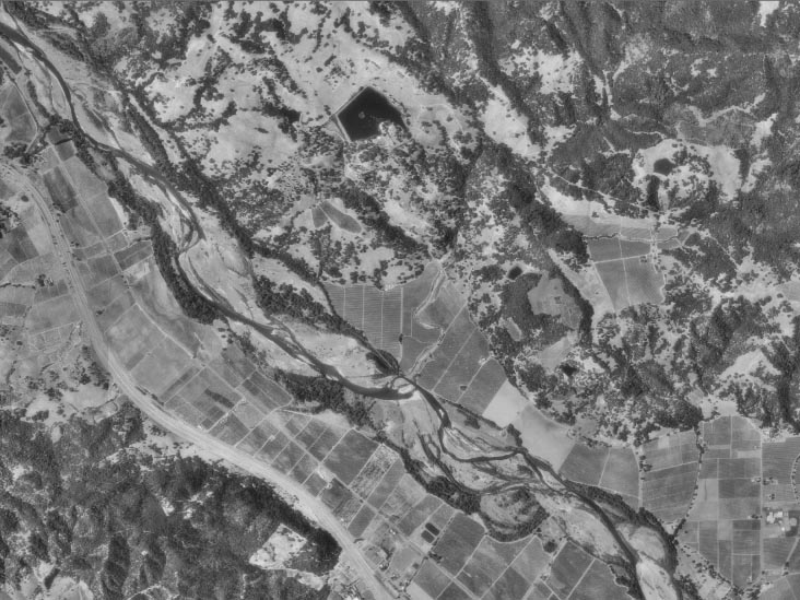 Click on image to enlarge (118K).
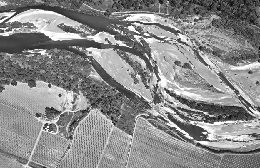 Click on image to enlarge (166K).
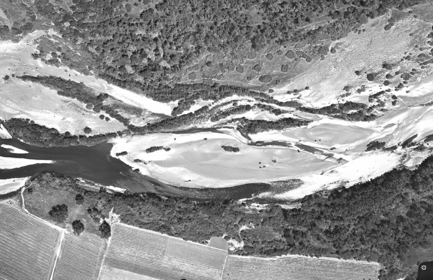 Click on image to enlarge (162K).
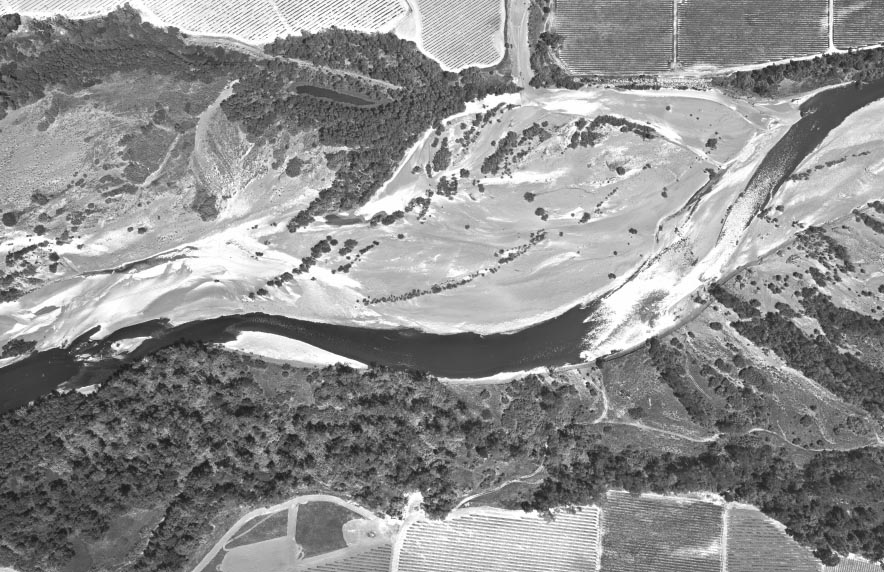 Click on image to enlarge (151K).
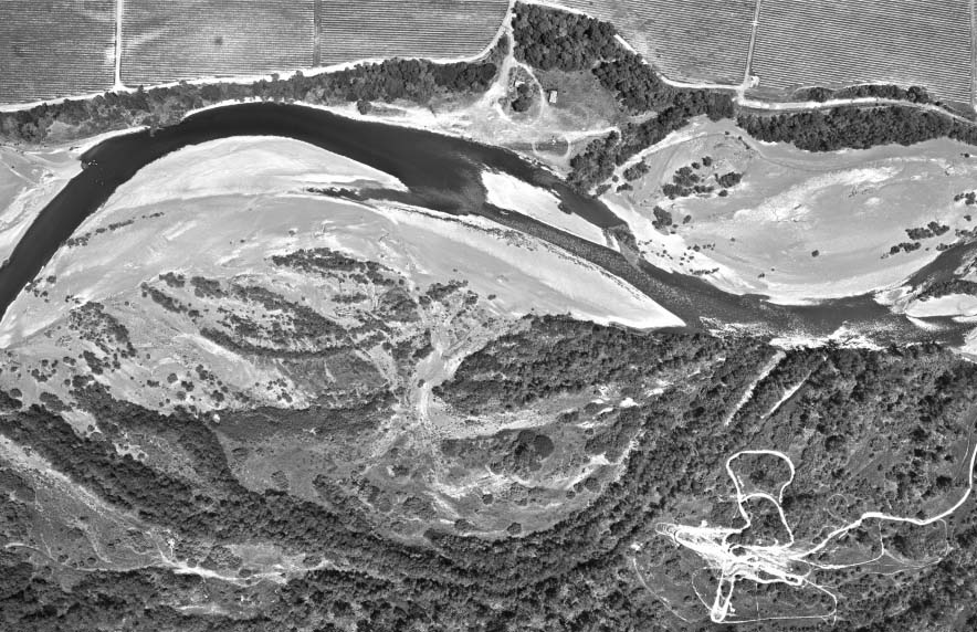 Click on image to enlarge (139K).
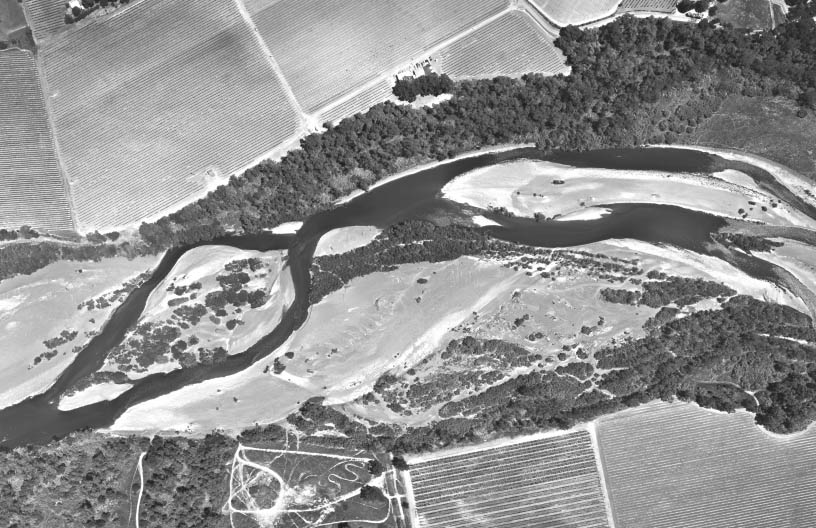 Click on image to enlarge (117K).
To learn more about this topic click Info Links
To view additional information (data source, aquisition date etc.) about this page, click Metadata
| www.krisweb.com |