|
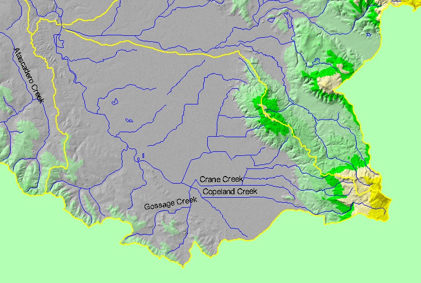
This is a map of the 1:100,000 scale U.S. Geologic Survey hydrography in the Laguna sub-basin, displayed with a Digital Elevation Model (DEM) showing the
topography of the landscape. The Santa Rosa Plain is a flat area that covers much of the sub-basin, and many streams there have been channelized for flood control and
development. With elevations up to 800 meters, there is more relief in the headwaters of Crane and Copeland Creeks at the southeast corner of the sub-basin, but only
a small fraction is steep terrain. Data were contributed by the U.S. Geological Survey and the California Department of Forestry.
|
|