
| Area | Laguna |
| Topic | Tour: 1940 Aerials - Cotati to Sebastopol |
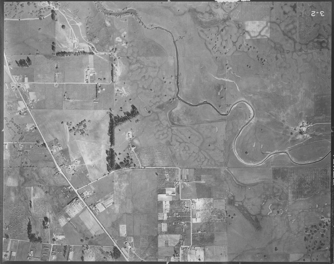
This photo shows the Laguna sub-basin near the southern Gravenstein Hwy. The Laguna channel is denuded of riparian and appears to be excavated. Note the extensive vernal pools and meandering flood channels. Photo taken by the U.S. Army Corp of Engineers in March 1940 and provided in digital form by Phillip Williams and Associates. Flood contours were drawn on originals.
This photo shows the Laguna sub-basin around the intersection of Gravenstein Hwy and Llano Road. Note the extensive vernal pools and meandering flood channels to the north and east. Photo taken by the U.S. Army Corp of Engineers in March 1940 and provided in digital form by Phillip Williams and Associates. Flood contours were drawn on originals.
This photo shows the Laguna sub-basin around the intersection of Gravenstein Hwy and Todd Road. Note the extensive vernal pools and meandering flood channels to the north and east. Photo taken by the U.S. Army Corp of Engineers in March 1940 and provided in digital form by Phillip Williams and Associates. Flood contours were drawn on originals.
This photo shows the Laguna in the proximity of Todd Road. Blucher Creek enters at left. Photo taken by the U.S. Army Corp of Engineers in March 1940 and provided in digital form by Phillip Williams and Associates. Flood contours were drawn on originals.
This photo shows the Laguna to the north of the Gravenstein Hwy. Photo taken by the U.S. Army Corp of Engineers in March 1940 and provided in digital form by Phillip Williams and Associates. Flood contours were drawn on originals.
This photo shows the Laguna to the east of Sebastopol. Photo taken by the U.S. Army Corp of Engineers in March 1940 and provided in digital form by Phillip Williams and Associates. Flood contours were drawn on originals.
This photo shows the Laguna to the east of Sebastopol. Photo taken by the U.S. Army Corp of Engineers in March 1940 and provided in digital form by Phillip Williams and Associates. Flood contours were drawn on originals.
This photo shows the Laguna to the northeast of Sebastopol. Photo taken by the U.S. Army Corp of Engineers in March 1940 and provided in digital form by Phillip Williams and Associates. Flood contours were drawn on originals.
 Click on image to enlarge (148K).
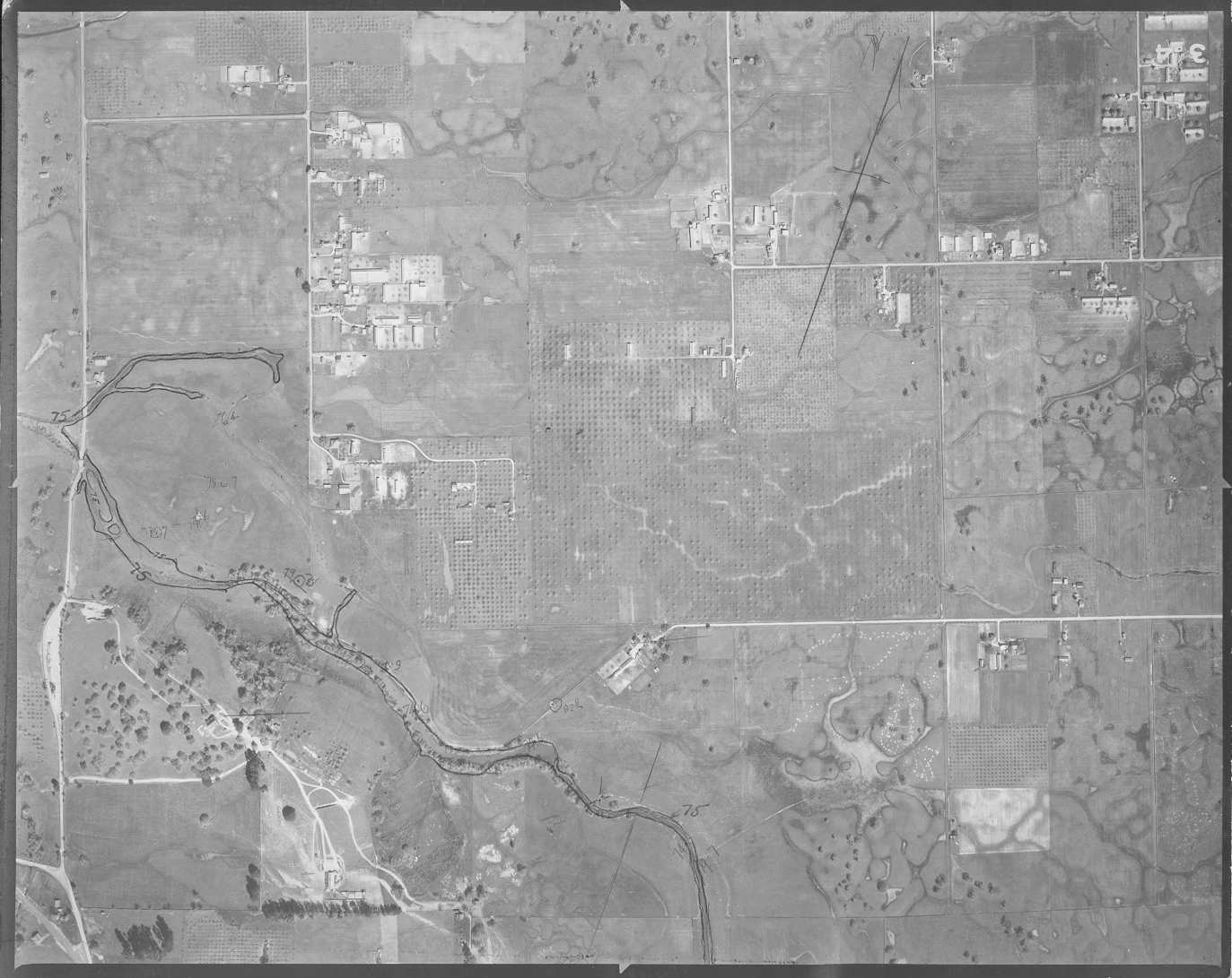 Click on image to enlarge (142K).
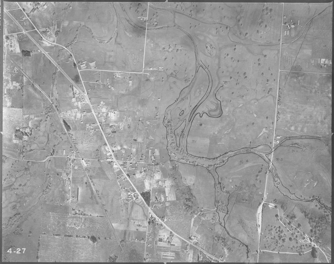 Click on image to enlarge (149K).
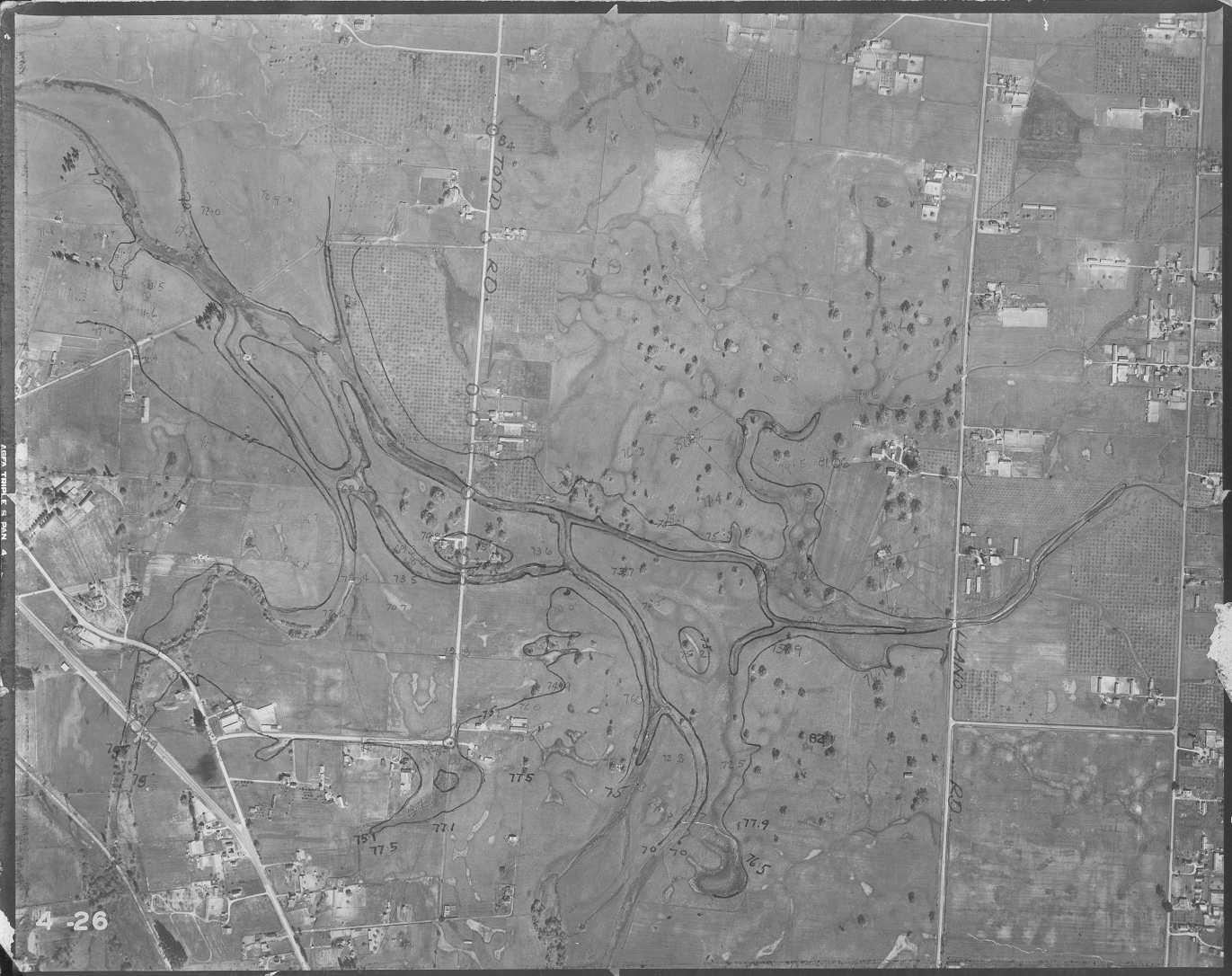 Click on image to enlarge (155K).
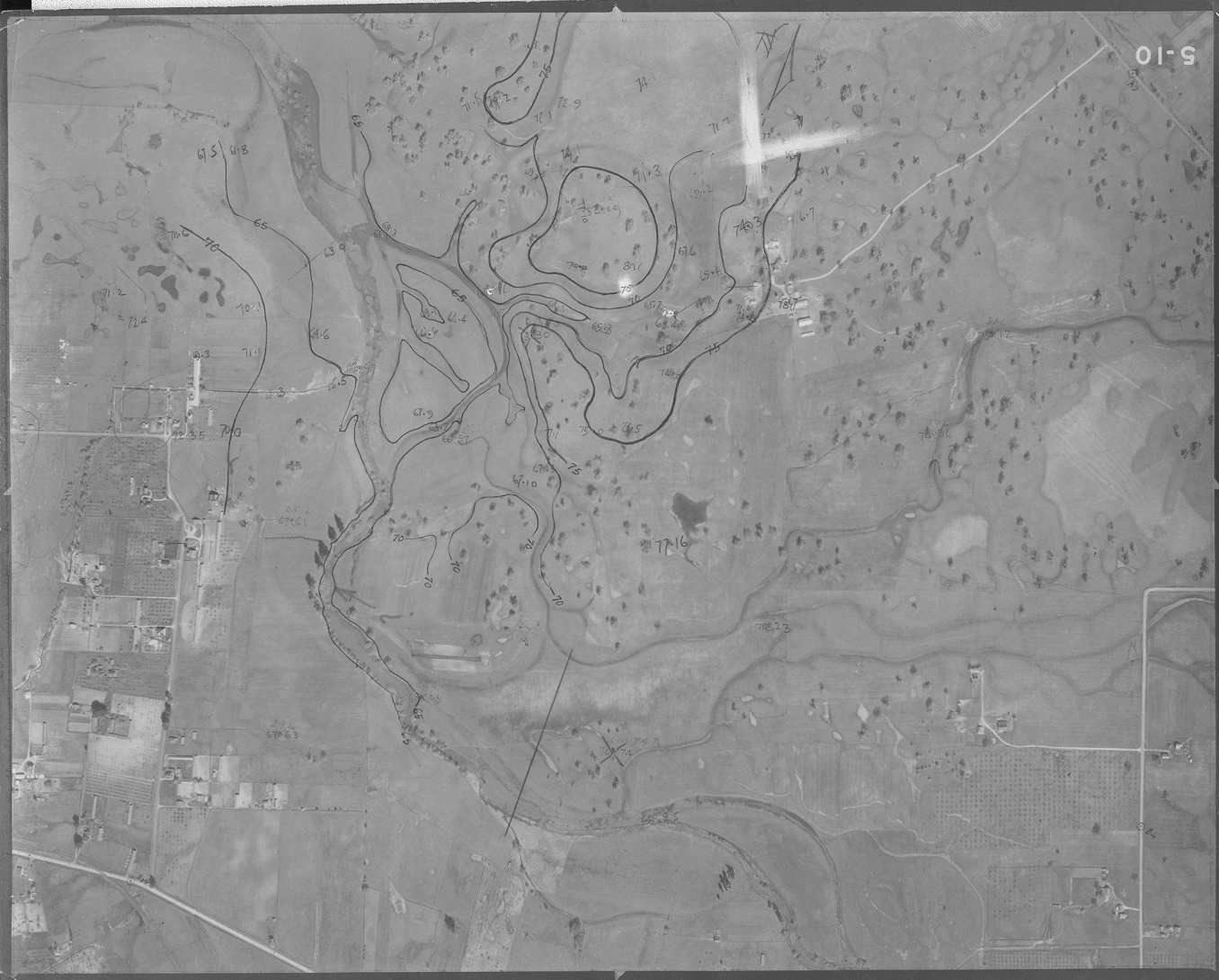 Click on image to enlarge (102K).
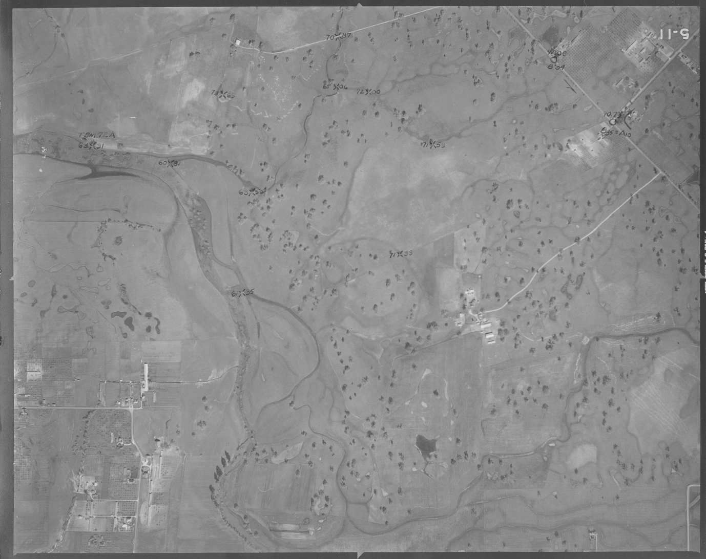 Click on image to enlarge (91K).
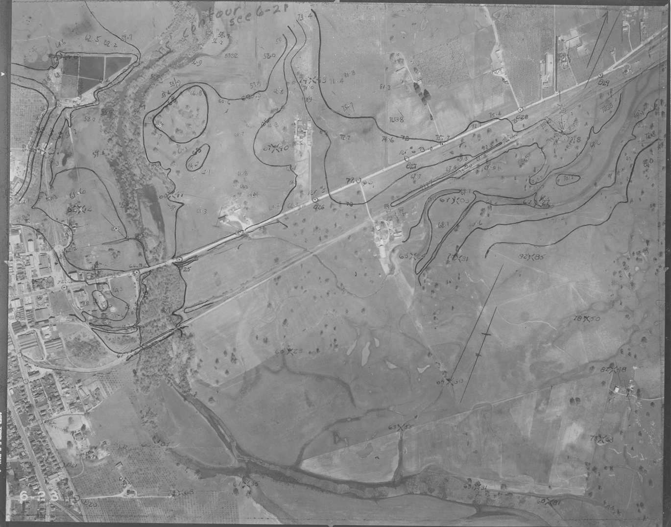 Click on image to enlarge (131K).
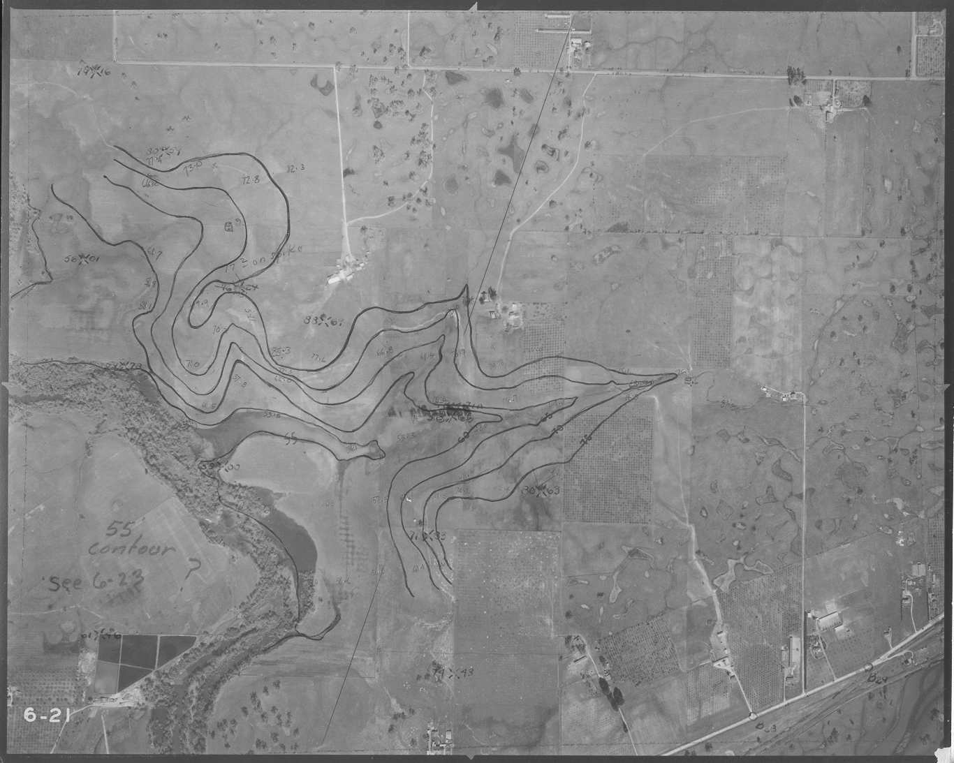 Click on image to enlarge (119K).
To learn more about this topic click Info Links
To view additional information (data source, aquisition date etc.) about this page, click Metadata
| www.krisweb.com |