
|
Area/Topic | Bibliography | Background | Hypotheses | Home |
|
Map Page.
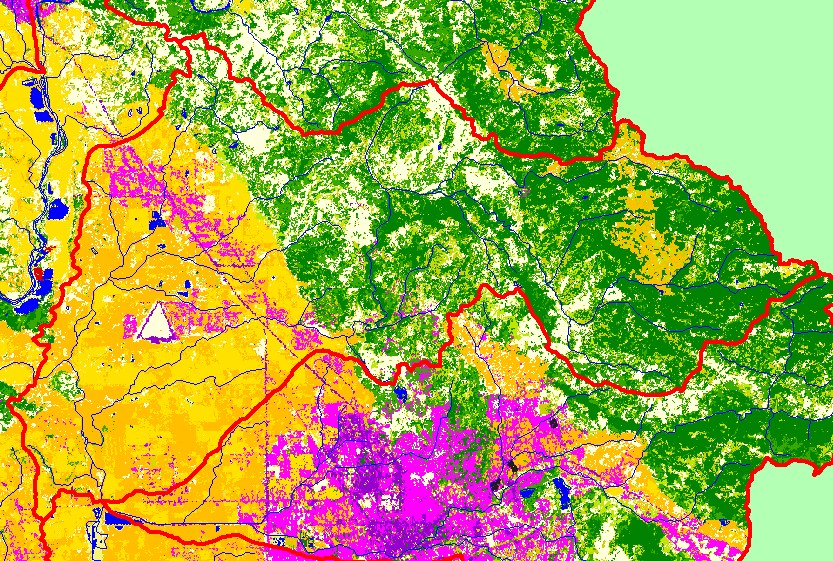
You selected the area Mark West and the topic Map: 1C. EPA Landcover/Landuse, Mark West Sub-basin |
| This is a map of EPA Landcover/Landuse in the Mark West sub-basin, based on a 1992 Landsat TM satellite image. Most of the western third of the project area is covered in vineyards and other agriculture. The residential (pink) and industrial (purple) in the northwestern portion of the sub-basin is Windsor. The eastern half of sub-basin contains a mix of conifers, hardwoods, grasslands, agriculture, and herbaceous vegetation. Data were provided by the U.S. Environmental Protection Agency. | |||
|
|
||
| www.krisweb.com |