
| Area | Mark West |
| Topic | Tour: 1940 Aerials - Windsor and Mark West Creek |
This photo shows the confluence of Windsor Creek with the Laguna. Photo taken by the U.S. Army Corp of Engineers in March 1940 and provided in digital form by Phillip Williams and Associates. Flood contours were drawn on originals.
This photo shows the confluence of Mark West Creek with the Laguna. Photo taken by the U.S. Army Corp of Engineers in March 1940 and provided in digital form by Phillip Williams and Associates. Flood contours were drawn on originals.
This photo shows Mark West Creek in the vicinity of Olivet School. Photo taken by the U.S. Army Corp of Engineers in March 1940 and provided in digital form by Phillip Williams and Associates. Flood contours were drawn on originals.
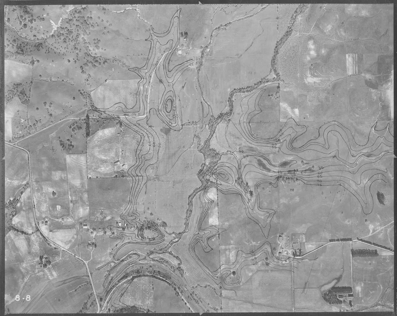
This photo shows a valley reach of Mark West Creek. Photo taken by the U.S. Army Corp of Engineers in March 1940 and provided in digital form by Phillip Williams and Associates. Flood contours were drawn on originals.
This photo shows Mark West Creek flowing onto the valley floor. Photo taken by the U.S. Army Corp of Engineers in March 1940 and provided in digital form by Phillip Williams and Associates. Flood contours were drawn on originals.
This photo shows Mark West Creek downstream of Mark West Springs. Photo taken by the U.S. Army Corp of Engineers in March 1940 and provided in digital form by Phillip Williams and Associates. Flood contours were drawn on originals.
This photo shows Mark West Creek downstream of Mark West Springs. Photo taken by the U.S. Army Corp of Engineers in March 1940 and provided in digital form by Phillip Williams and Associates. Flood contours were drawn on originals.
This photo shows Mark West Creek in the vicinity of Mark West Springs. Photo taken by the U.S. Army Corp of Engineers in March 1940 and provided in digital form by Phillip Williams and Associates. Flood contours were drawn on originals.
 Click on image to enlarge (167K).
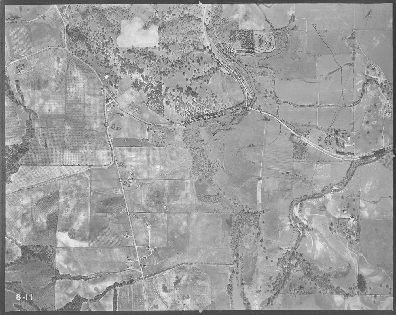 Click on image to enlarge (180K).
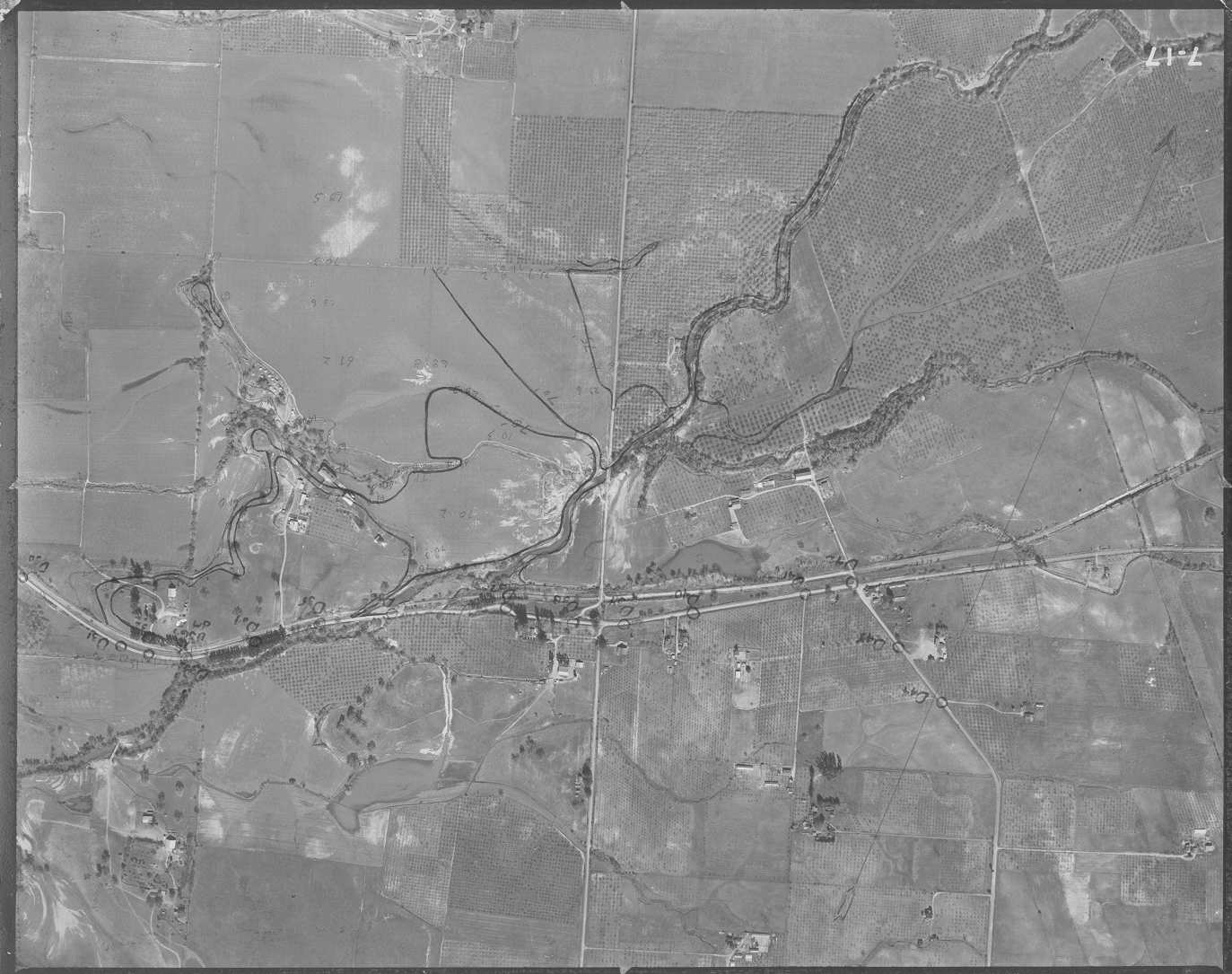 Click on image to enlarge (149K).
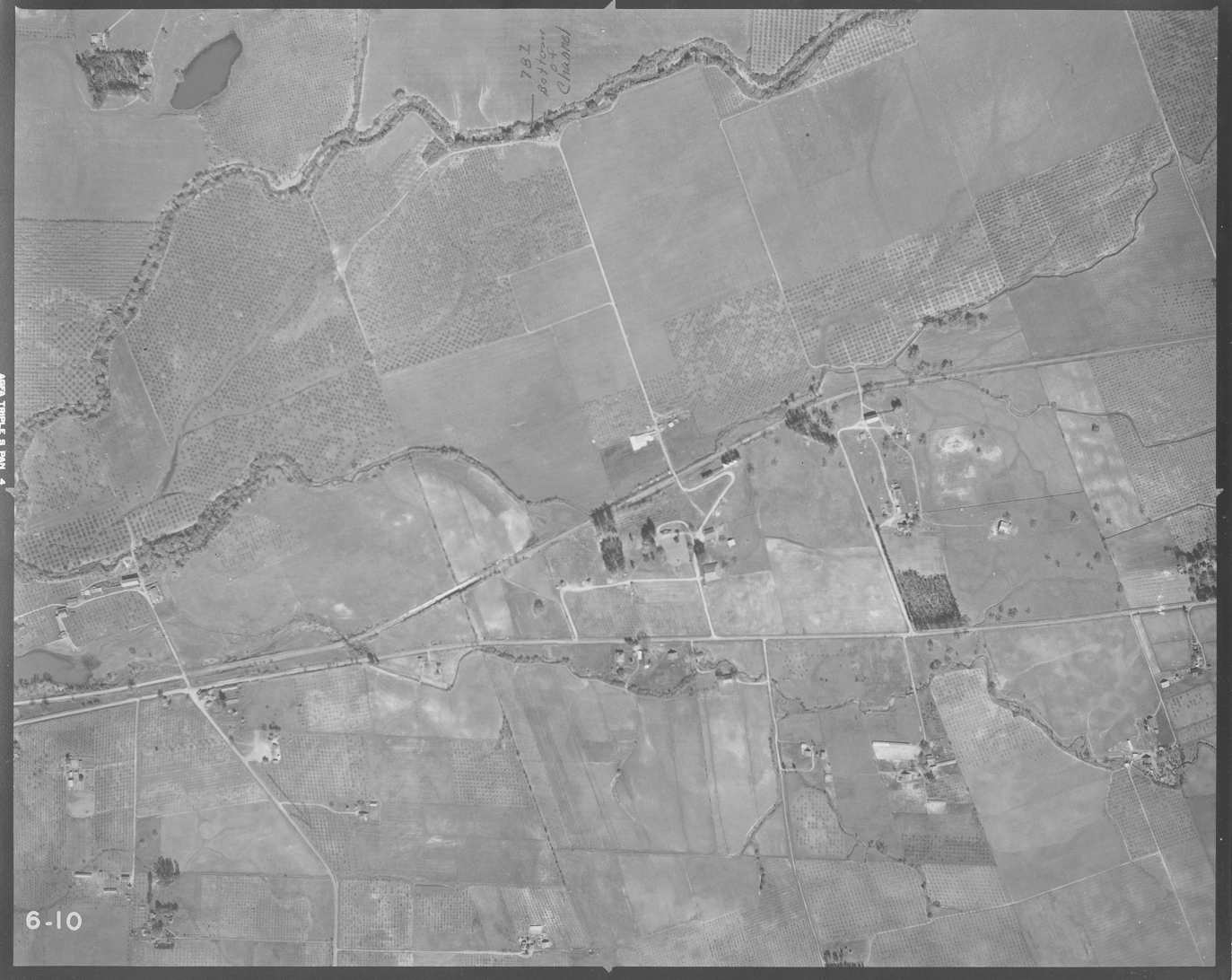 Click on image to enlarge (119K).
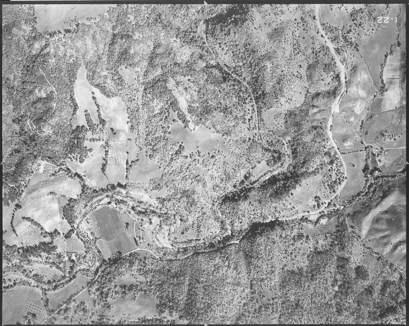 Click on image to enlarge (315K).
 Click on image to enlarge (330K).
 Click on image to enlarge (303K).
 Click on image to enlarge (285K).
To learn more about this topic click Info Links
To view additional information (data source, aquisition date etc.) about this page, click Metadata
| www.krisweb.com |