|
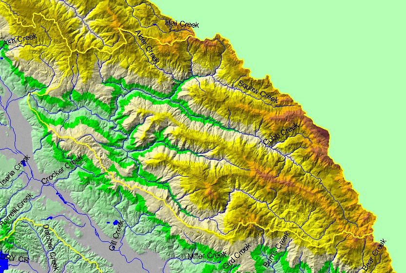
This is a map of the 1:100,000 scale U.S. Geologic Survey hydrography in the Sulphur Creek sub-basin, displayed with a Digital Elevation Model (DEM) showing the
topography of the landscape. The sub-basin is quite steep terrain, with elevations up to 1400 meters. Big Sulphur Creek was once considered for a major dam and
reservoir, but the effort was abandoned in the late 1960's due to concerns about geologic instability and high sediment loads. Data were contributed by the U.S.
Geological Survey and the California Department of Forestry.
|
|