
| Area | Sulphur Creek |
| Topic | Tour: Little Sulphur Creek (including North Branch) Land Use Photos |
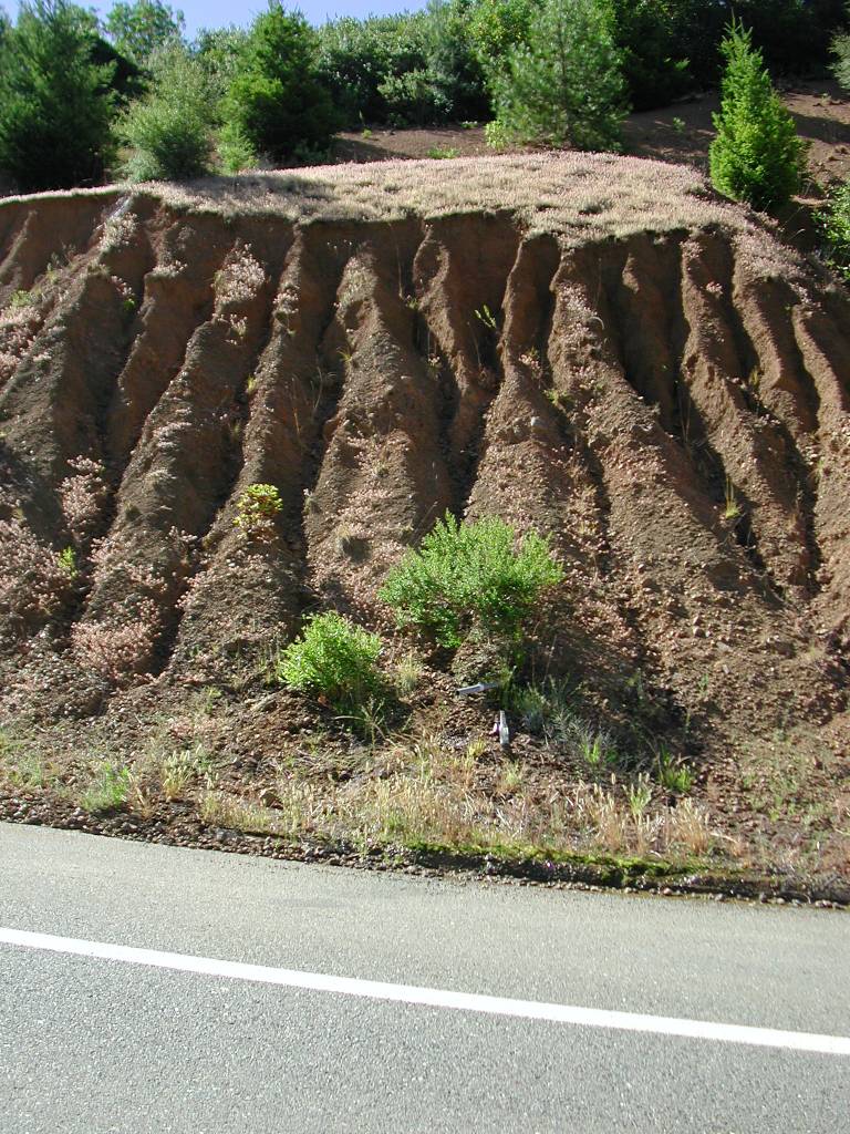
Gullies form in the road cut above the Geysers Road. See the next photo for a solution to this potential source of water pollution. Photo by Patrick Higgins taken on July 15, 2003.
Large boulders have been placed along the shoulder of the Geysers Road to prevent gullying of road cuts or mat least to prevent delivery of sediment to the road and down slope to Little Sulphur Creek. Photo by Patrick Higgins taken on July 15, 2003.
The Geysers Road has failed due to a large earthflow at this location in the Little Sulphur Creek watershed, where the road turns east. Roads may change drainage on slides and may in some cases help trigger or re-initiate movement. Photo by Patrick Higgins taken on July 15, 2003.
This photo was taken off Geysers Road looking west just before the road leaves the Little Sulphur Creek drainage. The Geysers Road can be seen at left and the large earthflow in Picture #3 is clearly visible. Photo by Patrick Higgins taken on July 15, 2003.
This closeup of the North Branch Little Sulphur Creek watershed shows an abandoned mine just below the old town site of Mercuryville. It is likely this was a mercury mine. Photo taken by Patrick Higgins on July 15, 2003.
This sign off the Geysers Road is a reminder of the past when mercury was mined here. Photo taken by Patrick Higgins on July 15, 2003. Photo by Patrick Higgins taken on July 15, 2003.
This closeup of a hillslope in the upper North Branch Little Sulphur Creek, which shows hummocky ground indicative of earthflow movement. Movement just above the road is so active that bare, blue-gray soil is exposed. Photo taken by Patrick Higgins on July 15, 2003. Photo by Patrick Higgins taken on July 15, 2003.
This zoom in on the Geysers Road in upper North Branch Little Sulphur Creek shows gully erosion at culvert outlets. Photo taken by Patrick Higgins on July 15, 2003.
 Click on image to enlarge (207K).
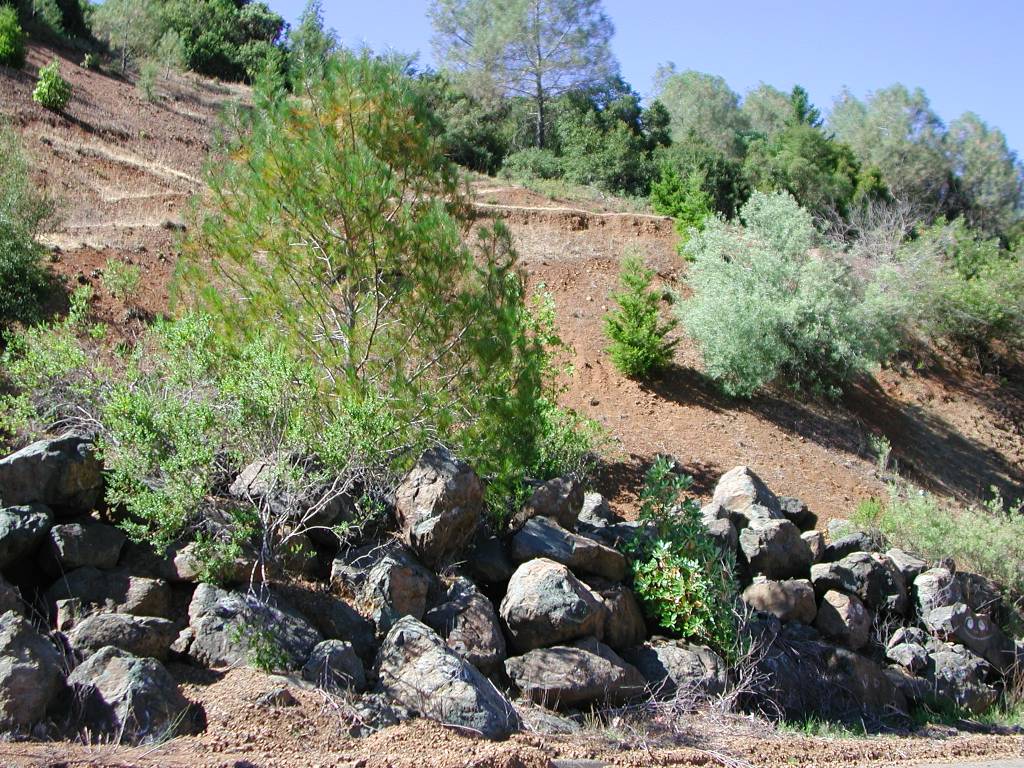 Click on image to enlarge (217K).
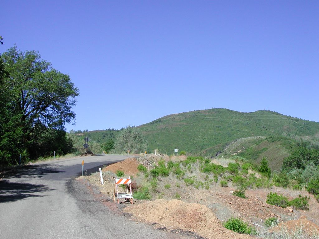 Click on image to enlarge (137K).
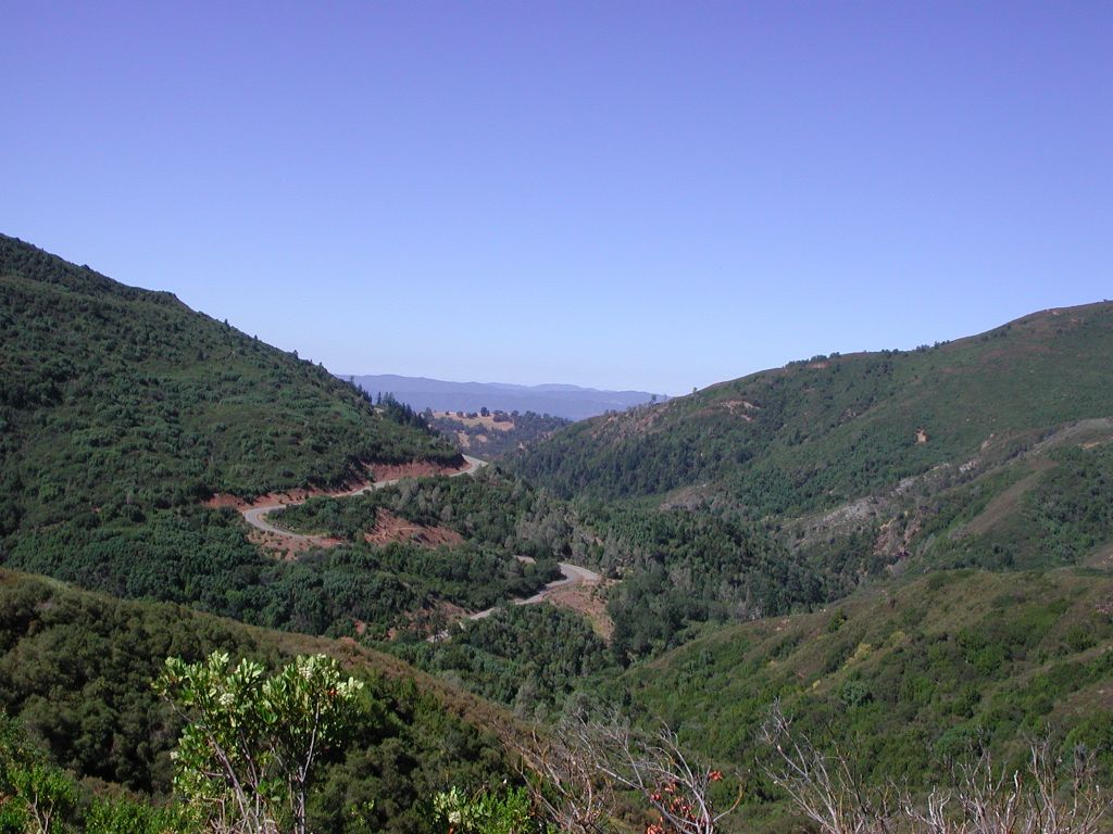 Click on image to enlarge (138K).
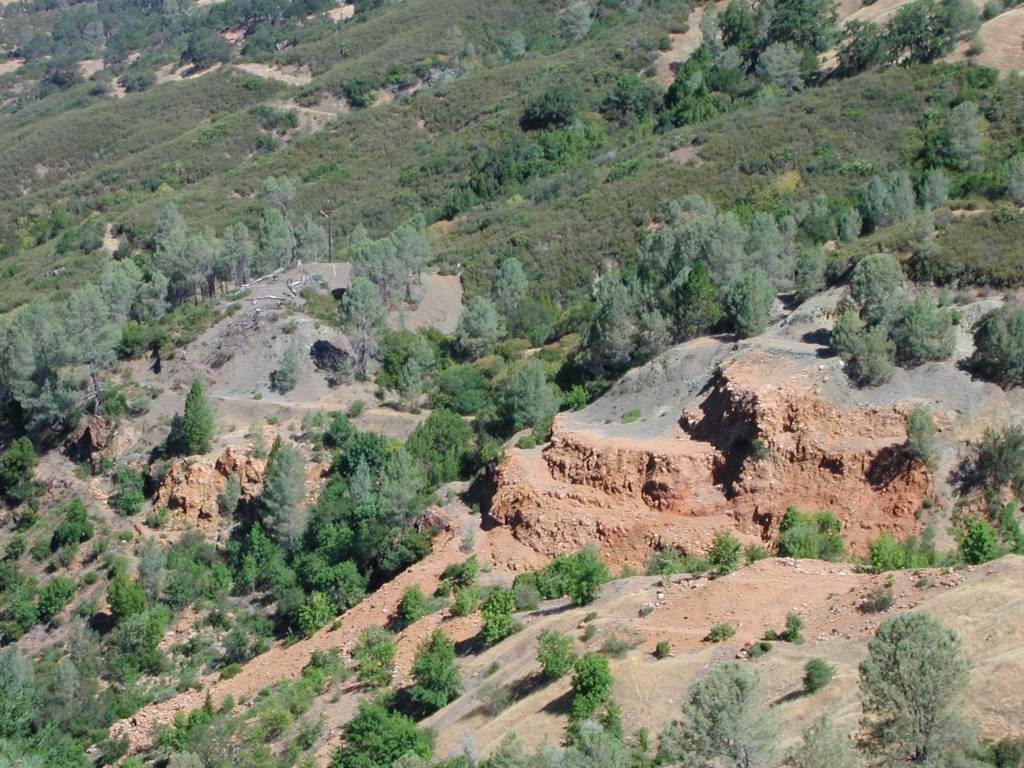 Click on image to enlarge (161K).
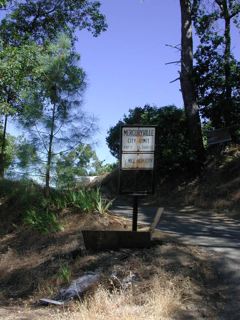 Click on image to enlarge (172K).
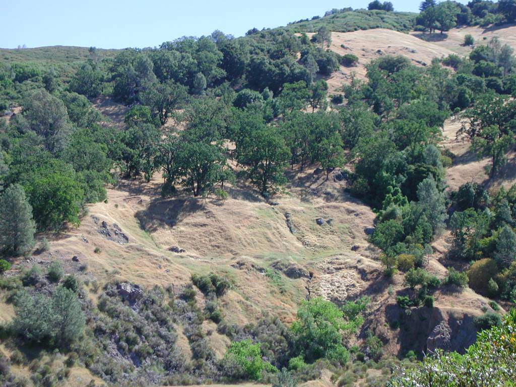 Click on image to enlarge (169K).
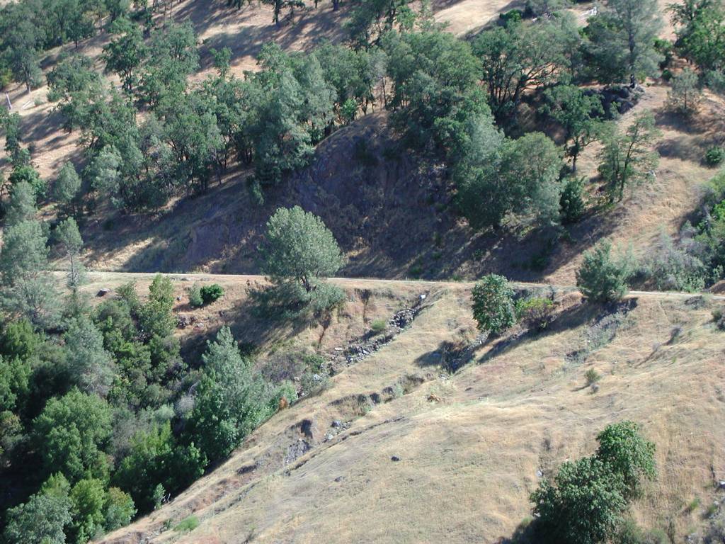 Click on image to enlarge (173K).
To learn more about this topic click Info Links
To view additional information (data source, aquisition date etc.) about this page, click Metadata
| www.krisweb.com |