|
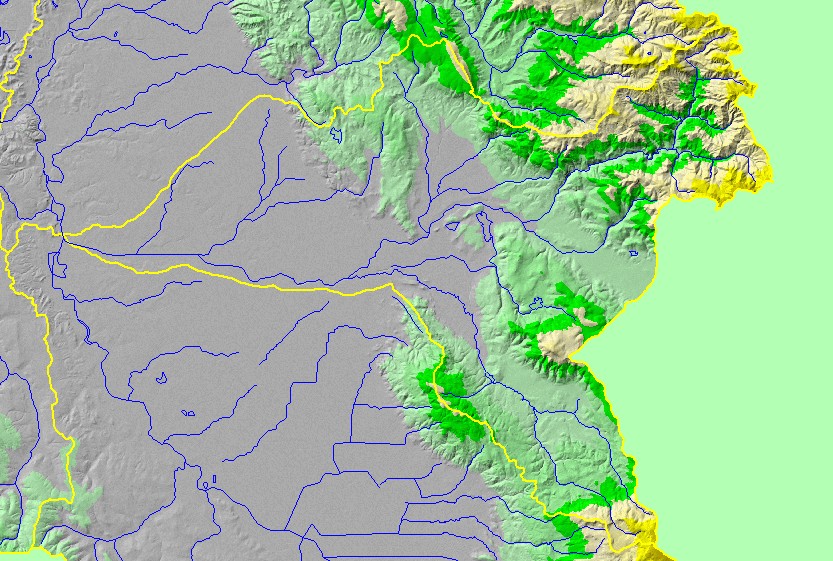
This is a map of the 1:100,000 scale U.S. Geologic Survey hydrography in the Santa Rosa sub-basin, displayed with a Digital Elevation Model (DEM) showing the
topography of the landscape. The flat area in the western half of the sub-basin is the Santa Rosa Plain, where many streams have been channelized for flood control
and development. In the headwaters of Santa Rosa Creek at the northeast corner of the sub-basin contains some steep terrain, with elevations up to 800 meters. The
tributary extending the southeast corner of the sub-basin is Matanzas Creek. Data were contributed by the U.S. Geological Survey and the California Department of
Forestry.
|
|