|
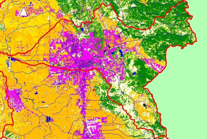
This is a map of EPA Landcover/Landuse in the Santa Rosa sub-basin, based on a 1992 Landsat TM satellite image. There is extensive residential (pink) and industrial
(purple) development in center of the sub-basin, which is the city of Santa Rosa and the surrounding areas. Most of the flat areas excluding the development around
Santa Rosa are covered in vineyards and other agriculture. The eastern half of sub-basin contains a mix of conifers, hardwoods, grasslands, agriculture, and herbaceous
vegetation. Data were provided by the U.S. Environmental Protection Agency.
|
|