
| Area | Santa Rosa |
| Topic | Tour: 1940 Aerials - Santa Rosa Creek |
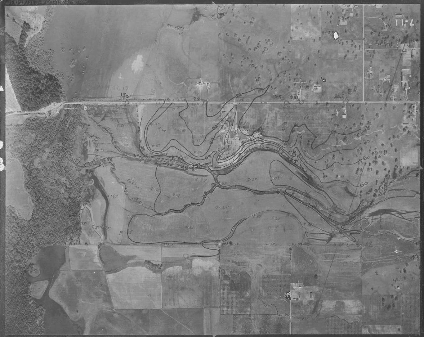
This photo shows the confluence of Santa Rosa Creek with the Laguna. Photo taken by the U.S. Army Corp of Engineers in March 1940 and provided in digital form by Phillip Williams and Associates. Flood contours were drawn on originals.
This photo shows Santa Rosa Creek in the vicinity of Guerneville and Willowside Roads. Note the wide floodplain corridor and braided channel. Photo taken by the U.S. Army Corp of Engineers in March 1940 and provided in digital form by Phillip Williams and Associates. Flood contours were drawn on originals.
This photo shows Santa Rosa Creek immediately west of Santa Rosa. Note the wide floodplain corridor and braided channel. Photo taken by the U.S. Army Corp of Engineers in March 1940 and provided in digital form by Phillip Williams and Associates. Flood contours were drawn on originals.
This photo shows Santa Rosa Creek as it flows through western Santa Rosa. Photo taken by the U.S. Army Corp of Engineers in March 1940 and provided in digital form by Phillip Williams and Associates. Flood contours were drawn on originals.
 Click on image to enlarge (226K).
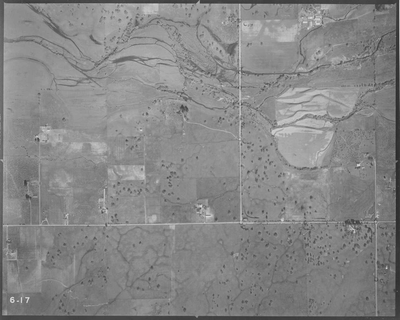 Click on image to enlarge (112K).
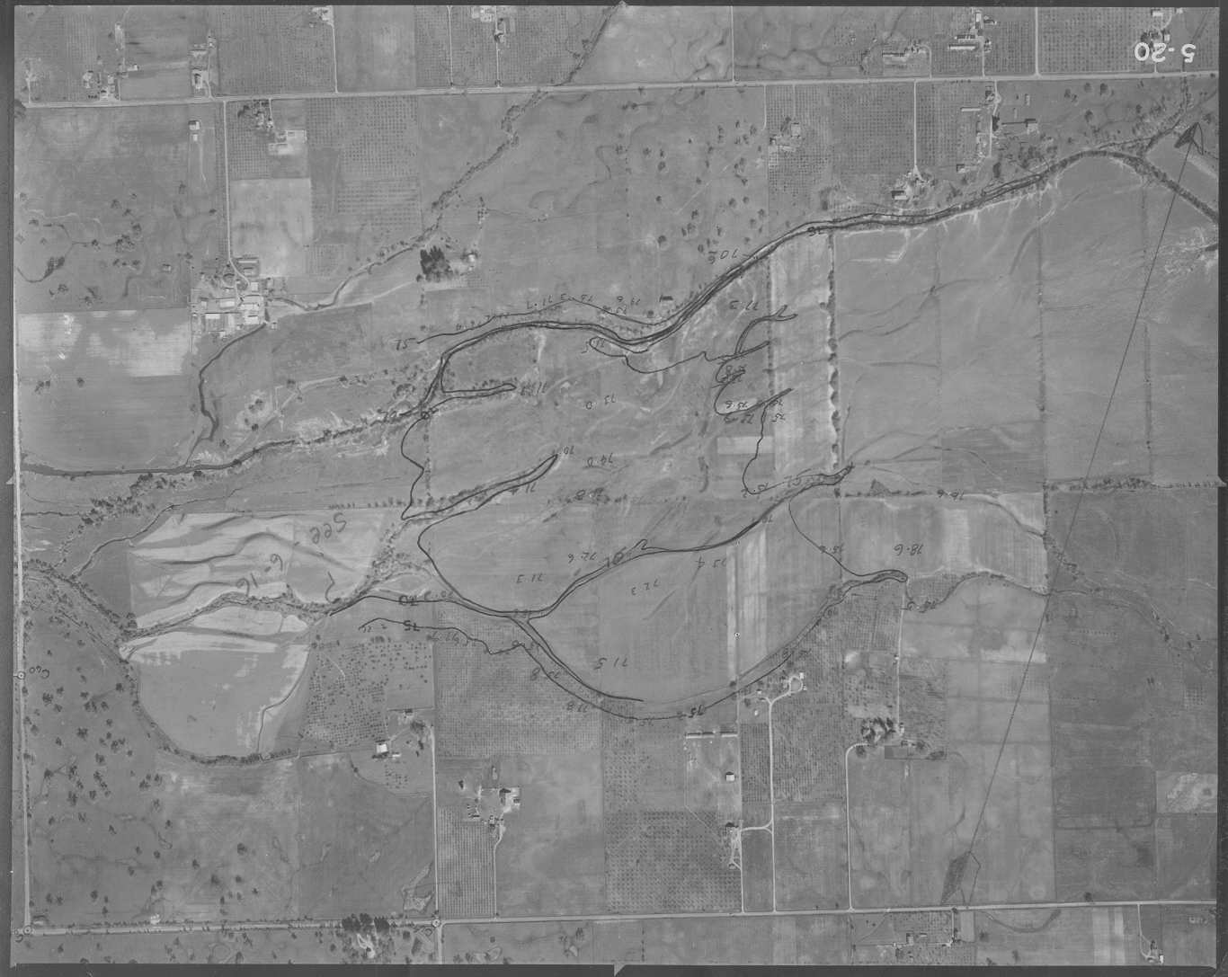 Click on image to enlarge (118K).
 Click on image to enlarge (293K).
To learn more about this topic click Info Links
To view additional information (data source, aquisition date etc.) about this page, click Metadata
| www.krisweb.com |