
| Area | Ukiah |
| Topic | Sediment: Coleman Creek Fines <0.85mm 1982 |
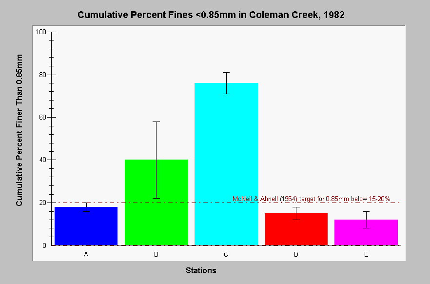
| Caption: The chart above shows summary results from wet-sieved McNeil samples taken from Coleman Creek in 1982. Mean values of cumulative percent fines less than 0.85mm are displayed. Whiskers represent standard error. Effects of road construction downstream of Station A are visible in the large pulses of fine sediment at Stations B and C. Data provided by California Department of Fish and Game. See InfoLinks for more information. | |
 |
To learn more about this topic click Info Links .
To view additional information (data source, aquisition date etc.) about this page, click Metadata .
To view the table with the chart's data, click Chart Table web page.
To download the table with the chart's data, click coleman_dfg82_mcneil_all_cross.db (size 4,096 bytes) .
To view the table with the chart's source data, click Source Table web page.
To download the table with the chart's source data, click coleman_dfg82_mcneil_all.dbf (size 3,019 bytes)
| www.krisweb.com |