
| Area | Warm Springs |
| Topic | Stream Channel: Thalweg Profile - Dry Creek 1964-1978 |
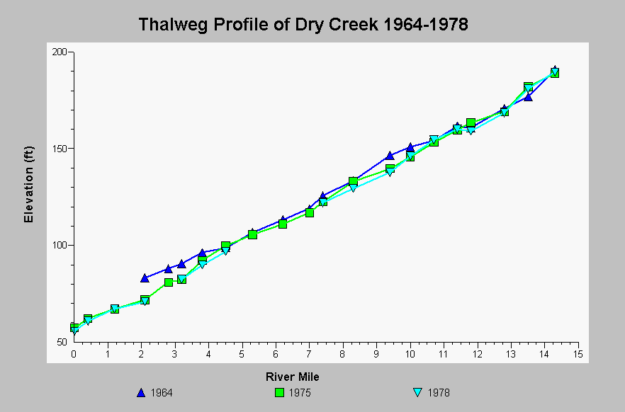
| Caption: This chart shows the thalweg profile of Dry Creek for the years 1964, 1975, and 1998. The Dry Creek channel bottom has downgraded over time. Base level lowering associated with the construction of Coyote and Healdsburg dams and gravel mining in the Russian River at and below the Dry Creek confluence is thought contribute to the extensive degradation of Dry Creek (EIP Associates, 1994).. The thalweg data come from Sonoma County Planning Department Aggregate Resources Management Plan (1981) and originates from US Army Corps of Engineer surveys. See InfoLinks for more information. | |
 |
To learn more about this topic click Info Links .
To view additional information (data source, aquisition date etc.) about this page, click Metadata .
To view the table with the chart's data, click Chart Table web page.
To download the table with the chart's data, click streamchannel_drycreek_thalweg_1964_1978.dbf (size 939 bytes) .
| www.krisweb.com |