|
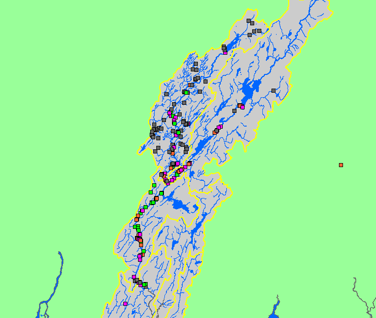
This is a map of inventoried non-point source pollution sites in the Sheepscot watershed. Data for Mainstem Sheepscot sites are current only through May 16, 2003 and
West Branch sites are current through approximately November 2002. Scale = 1:271,155 .
|
|
|
 |
 |
To view metadata about a map layer, click on a link in the table below.
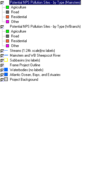
| Name of Layer in Map Legend | Metadata File Name |
|---|
| Potential NPS Pollution Sites - by Type (Mainstem) |
npsmain.shp.txt
|
| Potential NPS Pollution Sites - by Type (WBranch) |
westbr.shp.txt
|
| Streams (1:24k scale)(no labels) | Unavailable |
| Mainstem and WB Sheepscot River |
shpscotriv24.shp.txt
|
| Subbasins (no labels) |
subbasins.shp.txt
|
| Frame Project Outline | Unavailable |
| Waterbodies (no labels) |
sheeppnd.shp.txt
|
| Atlantic Ocean, Bays, and Estuaries | Unavailable |
| Project Background | Unavailable |