|
Area/Topic | Bibliography | Background | Hypotheses | Home |
Photo Pages: Meta Information
This page contains detailed information from the KRIS Photodatabase table about photos from sub-basin Below Head Tide and series Tour- Lower Sheepscot R. near Dock Rd. Br. 2004.
| Agency | Institute for Fisheries Resources |
| Basin | Sheepscot |
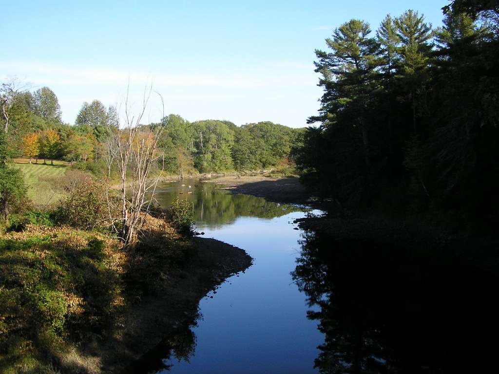
| Caption | This photograph shows the Sheepscot River, looking upstream from the Dock Road bridge at Alna (1-2 miles below Head Tide Dam). This area is tidally-influenced. This site is located in the Below Head Tide sub-basin. Photograph was taken by Eli Asarian on 10/8/2004. |
| CaptionTemplate | [description] This site is located in the [SubBasin] sub-basin. Photograph was taken by [photographer] on [photodate]. |
| Category | Watershed Tour |
| Description | This photograph shows the Sheepscot River, looking upstream from the Dock Road bridge at Alna (1-2 miles below Head Tide Dam). This area is tidally-influenced. |
| Filename | sheep_2004-10-08_11-53-20.jpg |
| Filesize | 158245 |
| Path | sheep_ifr_04\sheep_2004-10-08_11-53-20.jpg |
| Photodate | 10/8/2004 |
| Photographer | Eli Asarian |
| Restriction | None |
| Series | Tour- Lower Sheepscot R. near Dock Rd. Br. 2004 |
| SubBasin | Below Head Tide |
| UpdateDate | 10/20/2004 |
| UpdateName | JEA |
| Agency | Institute for Fisheries Resources |
| Basin | Sheepscot |
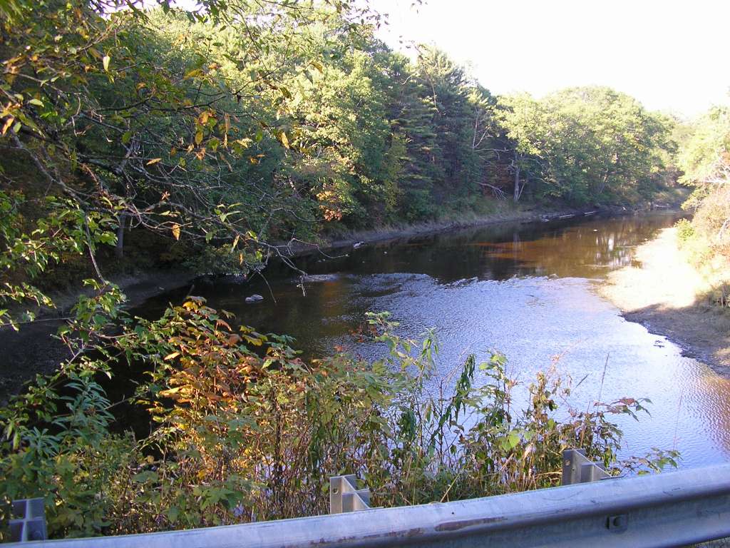
| Caption | This photograph shows the Sheepscot River, looking downstream from the Dock Road bridge at Alna (1-2 miles below Head Tide Dam). This area is tidally-influenced. This site is located in the Below Head Tide sub-basin. Photograph was taken by Eli Asarian on 10/8/2004. |
| CaptionTemplate | [description] This site is located in the [SubBasin] sub-basin. Photograph was taken by [photographer] on [photodate]. |
| Category | Watershed Tour |
| Description | This photograph shows the Sheepscot River, looking downstream from the Dock Road bridge at Alna (1-2 miles below Head Tide Dam). This area is tidally-influenced. |
| Filename | sheep_2004-10-08_11-53-48.jpg |
| Filesize | 90433 |
| Path | sheep_ifr_04\sheep_2004-10-08_11-53-48.jpg |
| Photodate | 10/8/2004 |
| Photographer | Eli Asarian |
| Restriction | None |
| Series | Tour- Lower Sheepscot R. near Dock Rd. Br. 2004 |
| SubBasin | Below Head Tide |
| UpdateDate | 10/20/2004 |
| UpdateName | JEA |
| Agency | Institute for Fisheries Resources |
| Basin | Sheepscot |
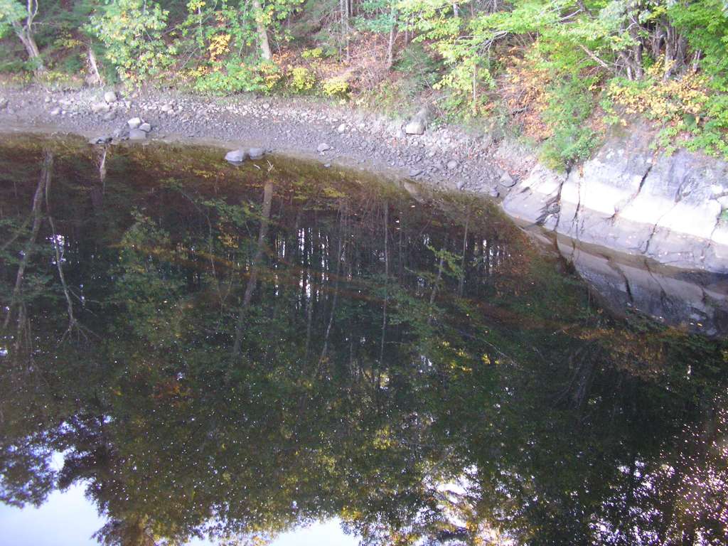
| Caption | This photograph shows the Sheepscot River, looking downstream into the pool underneath the Dock Road bridge at Alna (1-2 miles below Head Tide Dam). This area is tidally-influenced, as indicated by the bands on the riverbank. A submerged tree lies horizontally in the darkly-colored water. This site is located in the Below Head Tide sub-basin. Photograph was taken by Eli Asarian on 10/8/2004. |
| CaptionTemplate | [description] This site is located in the [SubBasin] sub-basin. Photograph was taken by [photographer] on [photodate]. |
| Category | Watershed Tour |
| Description | This photograph shows the Sheepscot River, looking downstream into the pool underneath the Dock Road bridge at Alna (1-2 miles below Head Tide Dam). This area is tidally-influenced, as indicated by the bands on the riverbank. A submerged tree lies horizontally in the darkly-colored water. |
| Filename | sheep_2004-10-08_11-54-18.jpg |
| Filesize | 139341 |
| Path | sheep_ifr_04\sheep_2004-10-08_11-54-18.jpg |
| Photodate | 10/8/2004 |
| Photographer | Eli Asarian |
| Restriction | None |
| Series | Tour- Lower Sheepscot R. near Dock Rd. Br. 2004 |
| SubBasin | Below Head Tide |
| UpdateDate | 10/20/2004 |
| UpdateName | JEA |
| www.krisweb.com |