|
Area/Topic | Bibliography | Background | Hypotheses | Home |
Photo Pages: Meta Information
This page contains detailed information from the KRIS Photodatabase table about photos from sub-basin Dyer River and series Tour- Forest Clearing in Dyer River Sub-basin 2004.
| Agency | Institute for Fisheries Resources |
| Basin | Sheepscot |
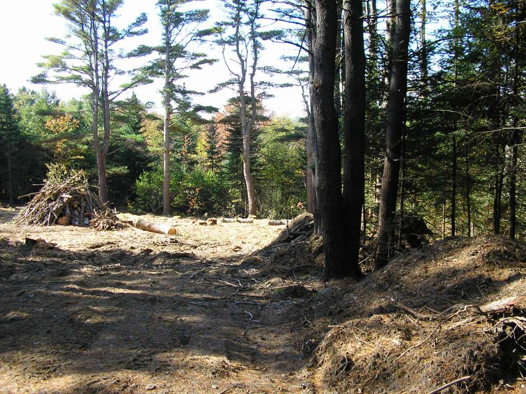
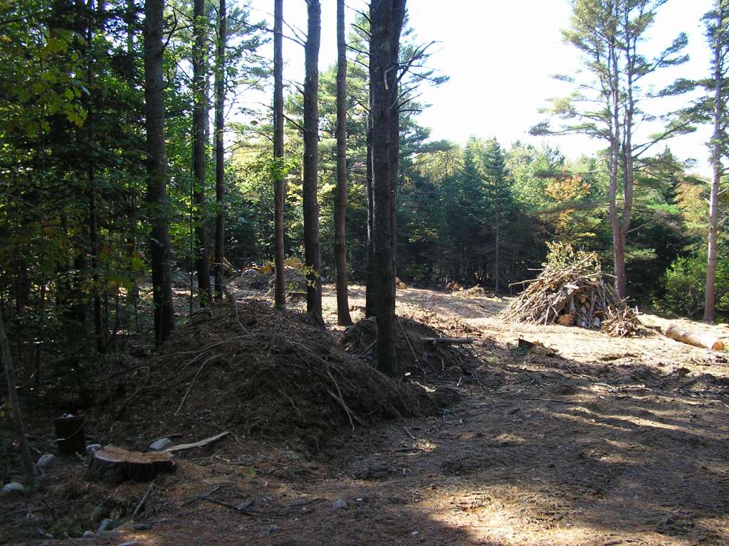
| Caption | This photograph shows a recently-cleared plot of forest, presumably being converted to a lot for a residential new home. Photograph was taken from North Newcastle Road. This site is located in the Dyer River sub-basin. Photograph was taken by Eli Asarian on 10/8/2004. |
| CaptionTemplate | [description] This site is located in the [SubBasin] sub-basin. Photograph was taken by [photographer] on [photodate]. |
| Category | Watershed Tour |
| Description | This photograph shows a recently-cleared plot of forest, presumably being converted to a lot for a residential new home. Photograph was taken from North Newcastle Road. |
| Filename | sheep_2004-10-08_10-54-41.jpg |
| Filesize | 155622 |
| Path | sheep_ifr_04\sheep_2004-10-08_10-54-41.jpg |
| Photodate | 10/8/2004 |
| Photographer | Eli Asarian |
| Restriction | None |
| Series | Tour- Forest Clearing in Dyer River Sub-basin 2004 |
| SubBasin | Dyer River |
| UpdateDate | 10/20/2004 |
| UpdateName | JEA |
| Agency | Institute for Fisheries Resources |
| Basin | Sheepscot |
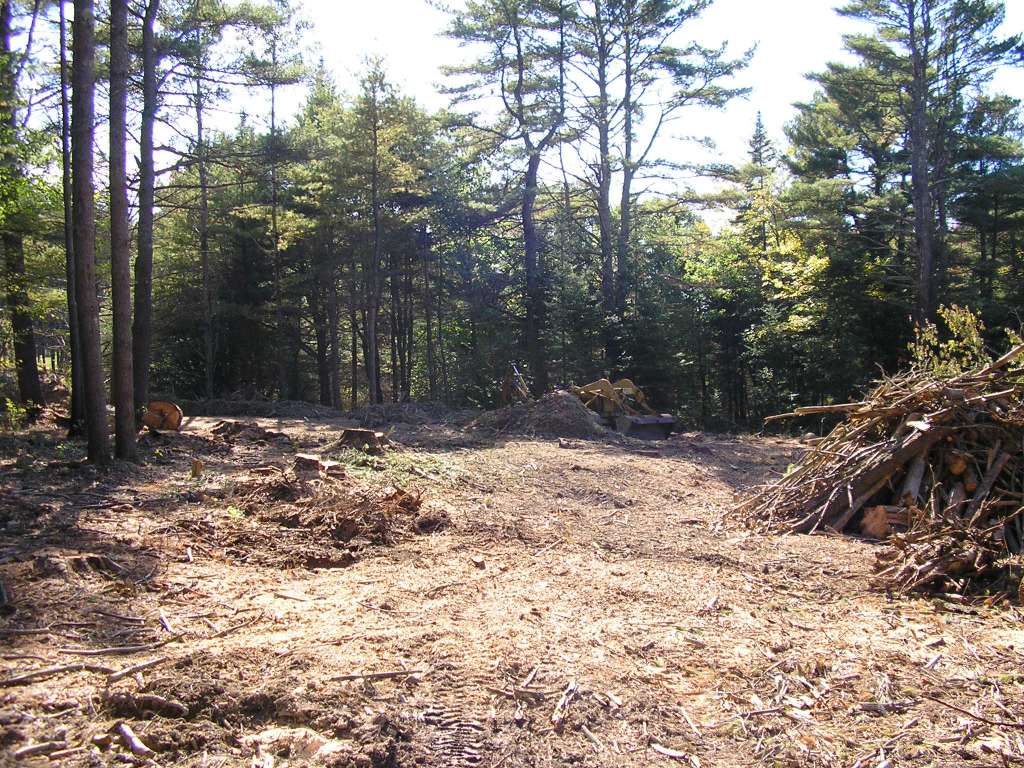
| Caption | This photograph shows a recently-cleared plot of forest, presumably being converted to a lot for a residential new home. Photograph was taken from North Newcastle Road. This site is located in the Dyer River sub-basin. Photograph was taken by Eli Asarian on 10/8/2004. |
| CaptionTemplate | [description] This site is located in the [SubBasin] sub-basin. Photograph was taken by [photographer] on [photodate]. |
| Category | Watershed Tour |
| Description | This photograph shows a recently-cleared plot of forest, presumably being converted to a lot for a residential new home. Photograph was taken from North Newcastle Road. |
| Filename | sheep_2004-10-08_10-54-47.jpg |
| Filesize | 190368 |
| Path | sheep_ifr_04\sheep_2004-10-08_10-54-47.jpg |
| Photodate | 10/8/2004 |
| Photographer | Eli Asarian |
| Restriction | None |
| Series | Tour- Forest Clearing in Dyer River Sub-basin 2004 |
| SubBasin | Dyer River |
| UpdateDate | 10/20/2004 |
| UpdateName | JEA |
| Agency | Institute for Fisheries Resources |
| Basin | Sheepscot |
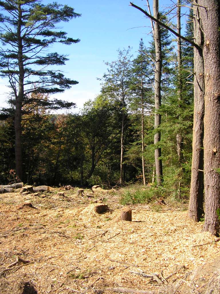
| Caption | This photograph shows a recently-cleared plot of forest, presumably being converted to a lot for a residential new home. Photograph was taken from North Newcastle Road. This site is located in the Dyer River sub-basin. Photograph was taken by Eli Asarian on 10/8/2004. |
| CaptionTemplate | [description] This site is located in the [SubBasin] sub-basin. Photograph was taken by [photographer] on [photodate]. |
| Category | Watershed Tour |
| Description | This photograph shows a recently-cleared plot of forest, presumably being converted to a lot for a residential new home. Photograph was taken from North Newcastle Road. |
| Filename | sheep_2004-10-08_10-55-09.jpg |
| Filesize | 207145 |
| Path | sheep_ifr_04\sheep_2004-10-08_10-55-09.jpg |
| Photodate | 10/8/2004 |
| Photographer | Eli Asarian |
| Restriction | None |
| Series | Tour- Forest Clearing in Dyer River Sub-basin 2004 |
| SubBasin | Dyer River |
| UpdateDate | 10/20/2004 |
| UpdateName | JEA |
| Agency | Institute for Fisheries Resources |
| Basin | Sheepscot |
| Caption | This photograph shows a recently-cleared plot of forest, presumably being converted to a lot for a residential new home. Photograph was taken from North Newcastle Road. This site is located in the Dyer River sub-basin. Photograph was taken by Eli Asarian on 10/8/2004. |
| CaptionTemplate | [description] This site is located in the [SubBasin] sub-basin. Photograph was taken by [photographer] on [photodate]. |
| Category | Watershed Tour |
| Description | This photograph shows a recently-cleared plot of forest, presumably being converted to a lot for a residential new home. Photograph was taken from North Newcastle Road. |
| Filename | sheep_2004-10-08_10-55-34.jpg |
| Filesize | 210478 |
| Path | sheep_ifr_04\sheep_2004-10-08_10-55-34.jpg |
| Photodate | 10/8/2004 |
| Photographer | Eli Asarian |
| Restriction | None |
| Series | Tour- Forest Clearing in Dyer River Sub-basin 2004 |
| SubBasin | Dyer River |
| UpdateDate | 10/20/2004 |
| UpdateName | JEA |
| Agency | Institute for Fisheries Resources |
| Basin | Sheepscot |
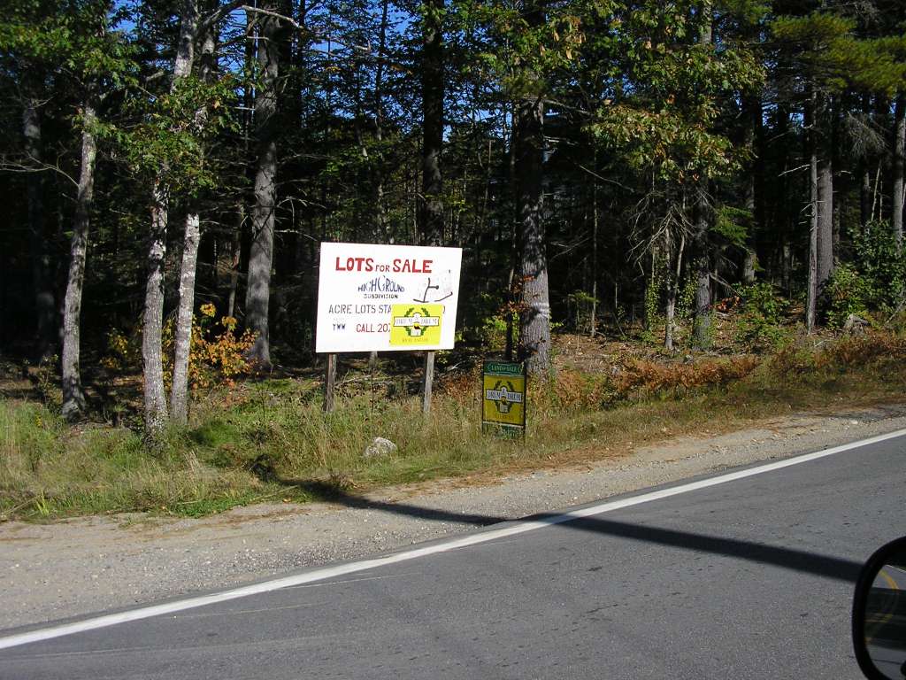
| Caption | This photograph shows a new residential subdivision where forest is being cleared and new homes are being built. Photograph was taken from Highway 194, near where the Dyer River crosses under the highway. This site is located in the Dyer River sub-basin. Photograph was taken by Eli Asarian on 10/8/2004. |
| CaptionTemplate | [description] This site is located in the [SubBasin] sub-basin. Photograph was taken by [photographer] on [photodate]. |
| Category | Watershed Tour |
| Description | This photograph shows a new residential subdivision where forest is being cleared and new homes are being built. Photograph was taken from Highway 194, near where the Dyer River crosses under the highway. |
| Filename | sheep_2004-10-08_11-29-06.jpg |
| Filesize | 149202 |
| Path | sheep_ifr_04\sheep_2004-10-08_11-29-06.jpg |
| Photodate | 10/8/2004 |
| Photographer | Eli Asarian |
| Restriction | None |
| Series | Tour- Forest Clearing in Dyer River Sub-basin 2004 |
| SubBasin | Dyer River |
| UpdateDate | 10/20/2004 |
| UpdateName | JEA |
| www.krisweb.com |