|
Area/Topic | Bibliography | Background | Hypotheses | Home |
Photo Pages: Meta Information
This page contains detailed information from the KRIS Photodatabase table about photos from sub-basin Mainstem Sheepscot and series Historical Photos- 1950 Clary Lk (Pleasant Pond) Outlet.
| Basin | Sheepscot |
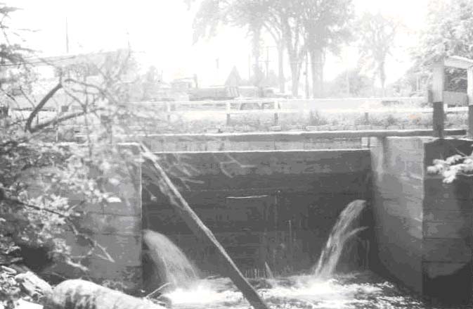
| Caption | Cleary Brook (Tributary to Sheepscot River). Flood control outlet of lower Chase's Mill Pond looking upstream. June 20, 1950. |
| CaptionTemplate | [Description] |
| Category | Historical Photos |
| Description | Cleary Brook (Tributary to Sheepscot River). Flood control outlet of lower Chase's Mill Pond looking upstream. June 20, 1950. |
| Filename | clary_lake_dam.jpg |
| Filesize | 51893 |
| Meta_Id | Photo_Historic |
| Notefile | sheepscot.htm#Pics_Historic1 |
| Path | ms/clary_lake_dam.jpg |
| Series | Historical Photos- 1950 Clary Lk (Pleasant Pond) Outlet |
| SubBasin | Mainstem Sheepscot |
| Basin | Sheepscot |
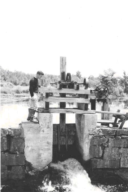
| Caption | Cleary Stream, Tributary to Sheepscot R. Control gate between upper and lower ponds at Chases mill, 1/4 mile above mouth. June 20, 1950. |
| CaptionTemplate | [Description] |
| Category | Historical Photos |
| Description | Cleary Stream, Tributary to Sheepscot R. Control gate between upper and lower ponds at Chases mill, 1/4 mile above mouth. June 20, 1950. |
| Filename | clary_lake_gate.jpg |
| Filesize | 52131 |
| Meta_Id | Photo_Historic |
| Notefile | sheepscot.htm#Pics_Historic1 |
| Path | ms/clary_lake_gate.jpg |
| Series | Historical Photos- 1950 Clary Lk (Pleasant Pond) Outlet |
| SubBasin | Mainstem Sheepscot |
| Basin | Sheepscot |
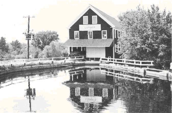
| Caption | Cleary Brook, tributary to Sheepscot River at 11.5 miles above Alna Bridge. Chase Lumber Mill and lower mill pond from road bridge. Power inlet under mill; flood spillway at right. Impassable barrier. Dam approximately l/4 mile above Cleary Brook mouth. Sill operates on a 23'6" drop head. June 20, 1950. |
| CaptionTemplate | [Description] |
| Category | Historical Photos |
| Description | Cleary Brook, tributary to Sheepscot River at 11.5 miles above Alna Bridge. Chase Lumber Mill and lower mill pond from road bridge. Power inlet under mill; flood spillway at right. Impassable barrier. Dam approximately l/4 mile above Cleary Brook mouth. Sill operates on a 23'6" drop head. June 20, 1950. |
| Filename | clary_lake_mill_pond.jpg |
| Filesize | 72887 |
| Meta_Id | Photo_Historic |
| Notefile | sheepscot.htm#Pics_Historic1 |
| Path | ms/clary_lake_mill_pond.jpg |
| Series | Historical Photos- 1950 Clary Lk (Pleasant Pond) Outlet |
| SubBasin | Mainstem Sheepscot |
| www.krisweb.com |