| Agency |
Institute for Fisheries Resources |
| Basin |
Sheepscot |
| Caption |
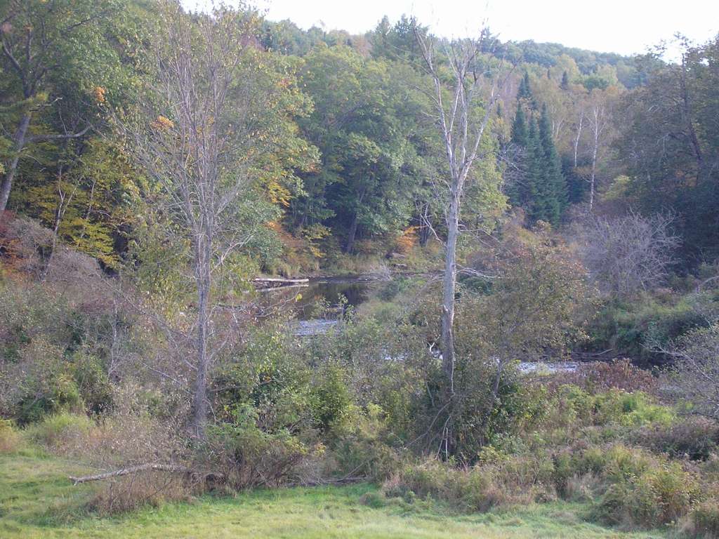
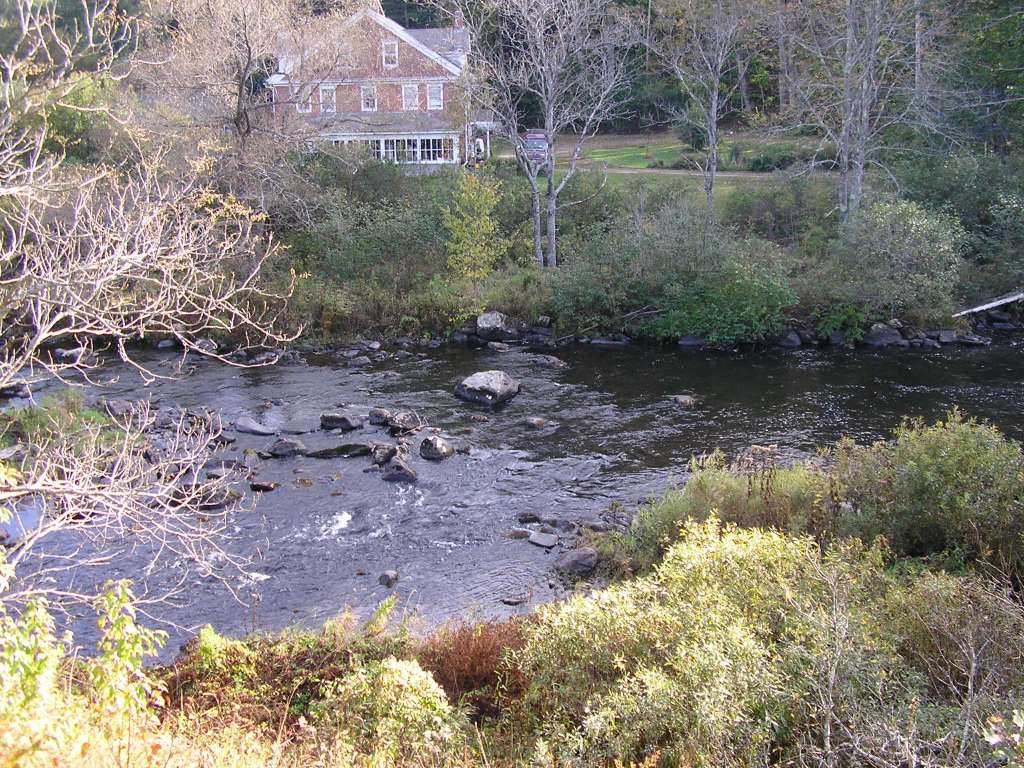
This photograph shows the riparian zone of the Sheepscot River, looking downstream, somewhere downstream of King's Mills (Whitefield). This site is located in the Mainstem Sheepscot sub-basin. Photograph was taken by Eli Asarian on 10/8/2004. |
| CaptionTemplate |
[description] This site is located in the [SubBasin] sub-basin. Photograph was taken by [photographer] on [photodate]. |
| Category |
Watershed Tour |
| Description |
This photograph shows the riparian zone of the Sheepscot River, looking downstream, somewhere downstream of King's Mills (Whitefield). |
| Filename |
sheep_2004-10-08_12-40-50.jpg |
| Filesize |
144504 |
| Path |
sheep_ifr_04\sheep_2004-10-08_12-40-50.jpg |
| Photodate |
10/8/2004 |
| Photographer |
Eli Asarian |
| Restriction |
None |
| Series |
Tour- Sheepscot River near King's Mills 2004 |
| SubBasin |
Mainstem Sheepscot |
| UpdateDate |
10/20/2004 |
| UpdateName |
JEA |

| Agency |
Institute for Fisheries Resources |
| Basin |
Sheepscot |
| Caption |
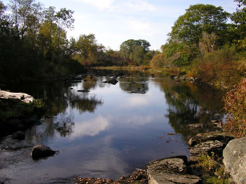
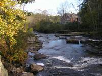
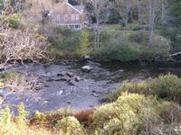
This photograph shows the Sheepscot River, looking upstream near King's Mills (Whitefield). This site is located in the Mainstem Sheepscot sub-basin. Photograph was taken by Eli Asarian on 10/8/2004. |
| CaptionTemplate |
[description] This site is located in the [SubBasin] sub-basin. Photograph was taken by [photographer] on [photodate]. |
| Category |
Watershed Tour |
| Description |
This photograph shows the Sheepscot River, looking upstream near King's Mills (Whitefield). |
| Filename |
sheep_2004-10-08_12-45-46.jpg |
| Filesize |
114745 |
| Path |
sheep_ifr_04\sheep_2004-10-08_12-45-46.jpg |
| Photodate |
10/8/2004 |
| Photographer |
Eli Asarian |
| Restriction |
None |
| Series |
Tour- Sheepscot River near King's Mills 2004 |
| SubBasin |
Mainstem Sheepscot |
| UpdateDate |
10/20/2004 |
| UpdateName |
JEA |
| Agency |
Institute for Fisheries Resources |
| Basin |
Sheepscot |
| Caption |
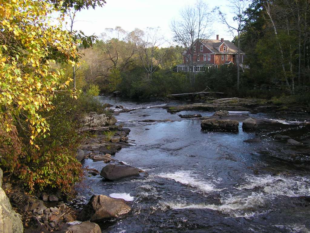
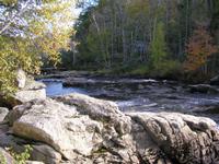
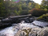
This photograph shows the Sheepscot River, looking downstream, at the former site of King's Mills Dam (Whitefield). This site is located in the Mainstem Sheepscot sub-basin. Photograph was taken by Eli Asarian on 10/8/2004. |
| CaptionTemplate |
[description] This site is located in the [SubBasin] sub-basin. Photograph was taken by [photographer] on [photodate]. |
| Category |
Watershed Tour |
| Description |
This photograph shows the Sheepscot River, looking downstream, at the former site of King's Mills Dam (Whitefield). |
| Filename |
sheep_2004-10-08_12-45-54.jpg |
| Filesize |
184174 |
| Path |
sheep_ifr_04\sheep_2004-10-08_12-45-54.jpg |
| Photodate |
10/8/2004 |
| Photographer |
Eli Asarian |
| Restriction |
None |
| Series |
Tour- Sheepscot River near King's Mills 2004 |
| SubBasin |
Mainstem Sheepscot |
| UpdateDate |
10/20/2004 |
| UpdateName |
JEA |
| Agency |
Institute for Fisheries Resources |
| Basin |
Sheepscot |
| Caption |
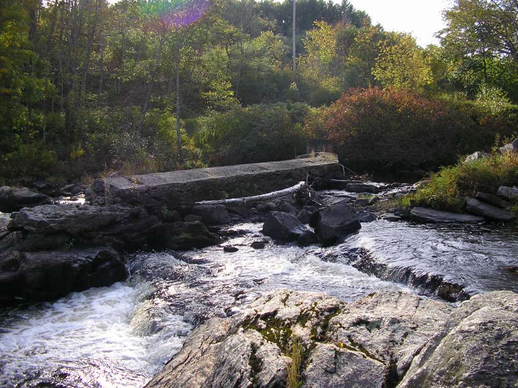
This photograph shows the Sheepscot River, looking downstream from the former site of King's Mills Dam (Whitefield). This site is located in the Mainstem Sheepscot sub-basin. Photograph was taken by Eli Asarian on 10/8/2004. |
| CaptionTemplate |
[description] This site is located in the [SubBasin] sub-basin. Photograph was taken by [photographer] on [photodate]. |
| Category |
Watershed Tour |
| Description |
This photograph shows the Sheepscot River, looking downstream from the former site of King's Mills Dam (Whitefield). |
| Filename |
sheep_2004-10-08_12-46-15.jpg |
| Filesize |
155106 |
| Path |
sheep_ifr_04\sheep_2004-10-08_12-46-15.jpg |
| Photodate |
10/8/2004 |
| Photographer |
Eli Asarian |
| Restriction |
None |
| Series |
Tour- Sheepscot River near King's Mills 2004 |
| SubBasin |
Mainstem Sheepscot |
| UpdateDate |
10/20/2004 |
| UpdateName |
JEA |
| Agency |
Institute for Fisheries Resources |
| Basin |
Sheepscot |
| Caption |
This photograph shows the Sheepscot River at the former site of King's Mills Dam (Whitefield), looking west. This site is located in the Mainstem Sheepscot sub-basin. Photograph was taken by Eli Asarian on 10/8/2004. |
| CaptionTemplate |
[description] This site is located in the [SubBasin] sub-basin. Photograph was taken by [photographer] on [photodate]. |
| Category |
Watershed Tour |
| Description |
This photograph shows the Sheepscot River at the former site of King's Mills Dam (Whitefield), looking west. |
| Filename |
sheep_2004-10-08_12-46-30.jpg |
| Filesize |
160141 |
| Path |
sheep_ifr_04\sheep_2004-10-08_12-46-30.jpg |
| Photodate |
10/8/2004 |
| Photographer |
Eli Asarian |
| Restriction |
None |
| Series |
Tour- Sheepscot River near King's Mills 2004 |
| SubBasin |
Mainstem Sheepscot |
| UpdateDate |
10/20/2004 |
| UpdateName |
JEA |
| Agency |
Institute for Fisheries Resources |
| Basin |
Sheepscot |
| Caption |
This photograph shows the Sheepscot River, shortly downstream from the former site of King's Mills Dam (Whitefield). This site is located in the Mainstem Sheepscot sub-basin. Photograph was taken by Eli Asarian on 10/8/2004. |
| CaptionTemplate |
[description] This site is located in the [SubBasin] sub-basin. Photograph was taken by [photographer] on [photodate]. |
| Category |
Watershed Tour |
| Description |
This photograph shows the Sheepscot River, shortly downstream from the former site of King's Mills Dam (Whitefield). |
| Filename |
sheep_2004-10-08_12-47-41.jpg |
| Filesize |
195341 |
| Path |
sheep_ifr_04\sheep_2004-10-08_12-47-41.jpg |
| Photodate |
10/8/2004 |
| Photographer |
Eli Asarian |
| Restriction |
None |
| Series |
Tour- Sheepscot River near King's Mills 2004 |
| SubBasin |
Mainstem Sheepscot |
| UpdateDate |
10/20/2004 |
| UpdateName |
JEA |
| Agency |
Institute for Fisheries Resources |
| Basin |
Sheepscot |
| Caption |
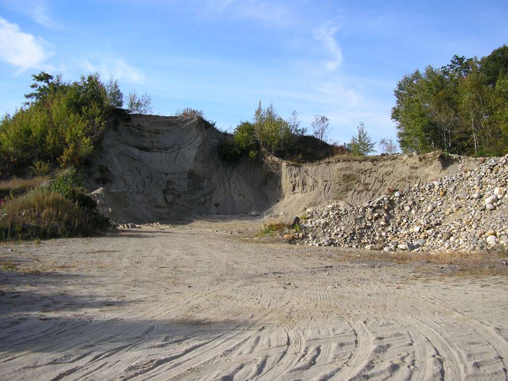
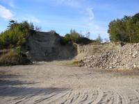
This photograph shows the a gravel pit along highway 194 near the former site of King's Mills Dam (Whitefield). This site is located in the Mainstem Sheepscot sub-basin. Photograph was taken by Eli Asarian on 10/8/2004. |
| CaptionTemplate |
[description] This site is located in the [SubBasin] sub-basin. Photograph was taken by [photographer] on [photodate]. |
| Category |
Watershed Tour |
| Description |
This photograph shows the a gravel pit along highway 194 near the former site of King's Mills Dam (Whitefield). |
| Filename |
sheep_2004-10-08_12-48-11.jpg |
| Filesize |
115407 |
| Path |
sheep_ifr_04\sheep_2004-10-08_12-48-11.jpg |
| Photodate |
10/8/2004 |
| Photographer |
Eli Asarian |
| Restriction |
None |
| Series |
Tour- Sheepscot River near King's Mills 2004 |
| SubBasin |
Mainstem Sheepscot |
| UpdateDate |
10/20/2004 |
| UpdateName |
JEA |